Route 128 | ||||
---|---|---|---|---|
Route information | ||||
Length | 3.1 mi [1] (5.0 km) | |||
Major junctions | ||||
South end | ||||
North end | ||||
Location | ||||
Counties | Providence | |||
Highway system | ||||
|
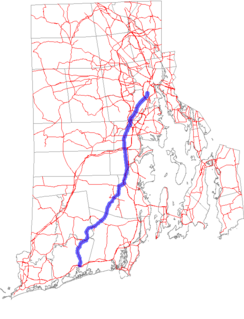
Route 128 is a 3.1 miles (5.0 km) state highway in the U.S. state of Rhode Island. The highway links U.S. Route 6A (US 6A), US 6 and US 44.
A state highway, state road, or state route is usually a road that is either numbered or maintained by a sub-national state or province. A road numbered by a state or province falls below numbered national highways in the hierarchy. Roads maintained by a state or province include both nationally numbered highways and un-numbered state highways. Depending on the state, "state highway" may be used for one meaning and "state road" or "state route" for the other.
Rhode Island, officially the State of Rhode Island and Providence Plantations, is a state in the New England region of the United States. It is the smallest state in area, the seventh least populous, the second most densely populated, and it has the longest official name of any state. Rhode Island is bordered by Connecticut to the west, Massachusetts to the north and east, and the Atlantic Ocean to the south via Rhode Island Sound and Block Island Sound. It also shares a small maritime border with New York. Providence is the state capital and most populous city in Rhode Island.
U.S. Route 6 (US 6) is a major east–west road in the U.S. state of Rhode Island. Nationally, the route continues west to Bishop, California and east to Provincetown, Massachusetts. In western Rhode Island, it forms part of one of several routes between Hartford, Connecticut and Providence, Rhode Island, and was planned to be replaced by Interstate 895. The part of I-895 that was built, from Interstate 895 to Olneyville, is now part of US 6. At Olneyville, US 6 joins Route 10 and heads east towards downtown Providence, where it turns south on Interstate 95 and east on Interstate 195. US 6 splits from I-195 in East Providence, crossing into Massachusetts on Warren Avenue. The whole route of US 6 is a state highway maintained by the Rhode Island Department of Transportation.
Route 128 begins at a signalized intersection with Hartford Avenue (US 6A) and Killingly Street. The highway follows Killingly north towards a partial cloverleaf interchange with US 6 before continuing north through residential neighborhoods. At an T-intersection with Greenville Avenue, Route 128 turns northwest before terminating at the Putnam Pike (US 44). [1]
The entire route is in Providence County.
Location | mi [1] | km | Destinations | Notes | |
---|---|---|---|---|---|
Providence | 0.0 | 0.0 | Southern terminus, Killingly Street continues south | ||
0.2 | 0.32 | Interchange | |||
Johnston | 3.1 | 5.0 | Northern terminus | ||
1.000 mi = 1.609 km; 1.000 km = 0.621 mi |
U.S. Route 44 (US 44) is an east–west United States highway that runs for 237 miles (381 km) through four states in the Northeastern region of the United States. The western terminus is at U.S. Route 209 and New York State Route 55 in Kerhonkson, a hamlet in the Hudson Valley region of New York. The eastern terminus is at Massachusetts Route 3A in Plymouth, Massachusetts.
Route 2 is a state highway in the U.S. state of Rhode Island. It runs approximately 36 miles (58 km) from US 1 in Charlestown to US 1 in Providence.
Route 7 is a numbered state highway in Rhode Island, United States. It runs approximately 16 miles (26 km) from Route 246 in Providence to Joslin Road in Burrillville.
Route 14 is a numbered state highway in the U.S. state of Rhode Island. It runs approximately 23 miles (37 km) from Connecticut routes 14 and 14A at the border with Sterling, CT to Route 6 in Providence.
Route 33 is a state highway in the U.S. state of Rhode Island. It runs approximately 6.5 miles (10.5 km) from Route 3 in Coventry to Route 2 in Cranston.
Route 51 is a state highway in the U.S. state of Rhode Island. It runs approximately 5.4 miles (8.7 km) from Route 115 in West Warwick to Route 12 in Cranston.
Route 101 is a numbered state highway running 9.7 miles (15.6 km) in Rhode Island. It begins at the Connecticut state line in the town of Foster and ends at U.S. Route 6 in the town of Scituate.
Route 102 is a numbered state highway running 44.4 miles (71.5 km) in Rhode Island. Route 102 serves as a non-freeway beltway around the Providence metro area. It begins in the village of Wickford and travels through less developed areas of western Rhode Island. The route ends in the village of Slatersville.
Route 104 is a numbered State Highway running 13.4 miles (21.6 km) in Rhode Island. It runs from US 44 in North Providence to Worrall Street in Downtown Woonsocket. The route connects the cities of Providence and Woonsocket via the town center of Smithfield.
Route 114A is an alternate state route to Rhode Island Route 114, located along the Massachusetts – Rhode Island border in East Providence, RI and Seekonk, MA. The road begins and ends within East Providence in Rhode Island at Route 114. Most of the road, however, is located within Seekonk in Massachusetts.
Route 117 is a state route in the U.S. state of Rhode Island.
Route 123 is a state highway running 7.7 miles (12.4 km) in the U.S. state of Rhode Island.
Route 126 is a state highway running for 14.3 miles (23.0 km) in the U.S. state of Rhode Island. Route 126 is a heavily traveled route in Pawtucket.
Route 138 is a numbered State Highway running 48.3 miles (77.7 km) in Rhode Island. Route 138 begins in Exeter at the Connecticut state line in the west and runs to the Massachusetts state line in Tiverton in the east, and is the only state-numbered route to completely cross Rhode Island. Route 138 also keeps the same route number on the other side of both state lines.
Route 214 is a numbered state highway running 2.2 miles (3.5 km) in Rhode Island.
Route 216 is a numbered state highway running 8.1 miles (13.0 km) in Rhode Island.
Massachusetts Route 152 is a state highway in the U.S. state of Massachusetts. The highway begins at the Rhode Island state line, where the road continues into East Providence as Rhode Island Route 152 to U.S. Route 1A and Rhode Island Route 114. Route 152 runs 14.8821 miles (23.9504 km) through Seekonk, Attleboro, and North Attleboro to US 1 in Plainville.
Route 177 is an 8.4 miles (13.5 km) long alignment of state highways in Rhode Island and Massachusetts. The western terminus is at an intersection with Route 77 in Tiverton, Rhode Island and the eastern terminus is at an intersection with US 6 in Westport, Massachusetts.
Route map: Google
KML file (edit • help) |