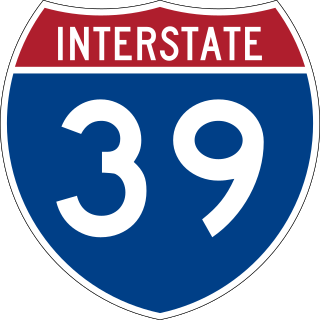
Interstate 39 (I-39) is a highway in the Midwestern United States. I-39 runs from Normal, Illinois, at I-55 to State Trunk Highway 29 (WIS 29) in the town of Rib Mountain, Wisconsin, which is approximately six miles (9.7 km) south of Wausau. I-39 was designed to replace U.S. Route 51 (US 51), which, in the early 1980s, was one of the busiest two-lane highways in the United States. I-39 was built in the 1980s and 1990s.

Taylor County is a county in the U.S. state of Wisconsin. As of the 2020 census, the population was 19,913. Its county seat is Medford.

Marathon County is a county located in the U.S. state of Wisconsin. As of the 2020 census, the population was 138,013. Marathon County's seat is Wausau. It was founded in 1850, created from a portion of Portage County. At that time the county stretched to the northern border with the upper Michigan peninsula. It is named after the battlefield at Marathon, Greece.

Rib Mountain is a census-designated place (CDP) in the town of Rib Mountain in Marathon County, Wisconsin, United States. The population was 6,061 at the 2020 census.
Rib Mountain is a village located in Marathon County, Wisconsin, United States. The population was 7,313 at the 2020 census. A suburb of Wausau, it is part of the Wausau Metropolitan Statistical Area. The census-designated place of Rib Mountain is located in the village.
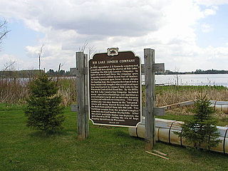
Rib Lake is a village in Taylor County, Wisconsin, United States located at the junction of Wisconsin Highway 102 and Taylor County Highway D. The population was 910 at the 2010 census. The village is completely surrounded by the Town of Rib Lake.

Wausau is a city in and the county seat of Marathon County, Wisconsin, United States. The Wisconsin River divides the city into east and west. The city's suburbs include Schofield, Weston, Mosinee, Maine, Rib Mountain, Kronenwetter, and Rothschild.

Rib Mountain, also known as Rib Hill, is a glacially-eroded monadnock in central Wisconsin, located in the Town of Rib Mountain in Marathon County. Composed of quartzite covered with a softer syenite sheath, it was intruded about 1.5 billion years ago.

Timms Hill or Timm's Hill is the highest natural point in the U.S. state of Wisconsin and is located in north-central Wisconsin in Timms Hill County Park in the Town of Hill in Price County. After being surveyed by Quentin Stevens of Ogema Telephone Co in 1962, Timms Hill was discovered to have an elevation of 1,951.5 ft (595 m). It is less than 1 mile (1.6 km) south of Highway 86, about midway between Ogema and Spirit and about 23 miles (37 km) west of Tomahawk.

The Northern Highland is a geographical region in the north central United States covering much of the northern territory of the state of Wisconsin.

The Wausau School District is a public school district serving the Wausau metropolitan area, including the City of Wausau and the Towns of Rib Mountain, Wausau, Stettin, and Texas. It contains two high schools, two middle schools, 13 elementary schools, and one alternative high school.
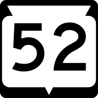
State Trunk Highway 52 is a state highway in the U.S. state of Wisconsin. It runs east–west in central and northeastern Wisconsin from Wabeno to Wausau. It is one of four state highways that also serve Antigo.
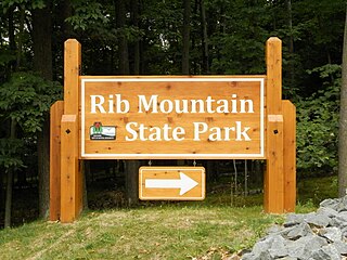
Rib Mountain State Park is a 1,528-acre (618 ha) Wisconsin state park near the city of Wausau. The park includes a ski resort, Granite Peak Ski Area, concession stand, picnic areas, a reservable amphitheater, a former quarry, observation tower, and 15.1 miles of trails. The park is ten miles (16 km) north-northwest of Central Wisconsin Airport.

Samoset Council is a Boy Scout council headquartered in Weston, Wisconsin that serves north central Wisconsin. Founded in 1920, the council gets its name from an early Boy Scout camp in the Town of Harrison named Camp Sam-O-Set. The council is served by Tom Kita Chara Lodge of the Order of the Arrow.

The Big Rib River is a river in central Wisconsin. It originates in northeastern Taylor County at Rib Lake, and flows into Marathon County where it joins the Wisconsin River. "Rib River" is a translation of the Native American name.
Rib Falls is an unincorporated community located in the town of Rib Falls, Marathon County, Wisconsin, United States. Rib Falls is located on the Big Rib River at the junction of County Highways S and U, 4.5 miles (7.2 km) northwest of Marathon City. The community was named for the river, which takes its name from the English translation of the original Ojibwa name O-pik-wun-a Se-be.

Dells of the Eau Claire County Park is in the north-central Wisconsin Town of Plover, east of the city of Wausau. It is divided in two by the Eau Claire River. The river flows through a rocky gorge to form cascades and waterfalls as it passes over and around weathered boulders, outcrops, and other formations. The depth of the river can vary depending on the time of the year. The park also has areas designated for camping, swimming, hiking, and picnicking.