Related Research Articles
Kingston Mines is a village in Peoria County, Illinois, United States. The population was 259 at the 2000 census. It is part of the Peoria, Illinois Metropolitan Statistical Area.

Kingston is a city in Caldwell County, Missouri, and is part of the Kansas City metropolitan area with the United States. The population was 348 at the 2010 census. It is the county seat of Caldwell County.
St. Ann is a suburb of St. Louis in north St. Louis County, Missouri, United States. The population was 13,020 at the 2010 census.

Conway is a city in Horry County, South Carolina, United States. The population was 17,103 at the 2010 census, and estimated at 25,956 in 2019. It is the county seat of Horry County and is part of the Myrtle Beach metropolitan area. It is the home of Coastal Carolina University.
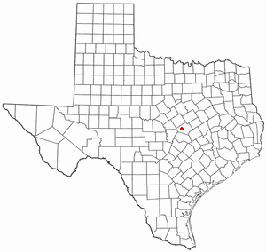
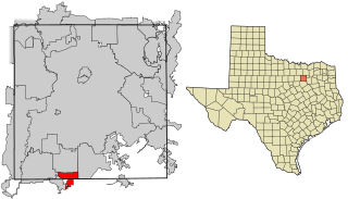
Harker Heights is a city in Bell County, Texas, United States. As of the 2010 census, 26,700 people resided in the city, up from a population of 17,308 in 2000. This makes Harker Heights the third-largest city in Bell County, after Killeen and Temple. Incorporated in 1960, the city derives its name from one of the two original landowners and founder, Harley Kern. Harker Heights is part of the Killeen – Temple – Fort Hood metropolitan area. People usually refer to the town as just "Heights".
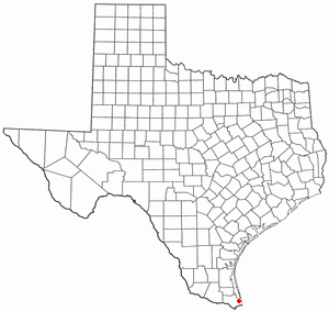
Laguna Heights is a census-designated place (CDP) in Cameron County, Texas, United States. The population was 3,488 at the 2010 census. It is part of the Brownsville–Harlingen Metropolitan Statistical Area.
Glenn Heights is a city in Dallas and Ellis counties in the U.S. state of Texas. The population was 11,278 at the 2010 census.
The Cataraqui River forms the lower portion of the Rideau Canal and drains into Lake Ontario at Kingston, Ontario. The name is taken from the original name for Kingston, Ontario; its exact meaning, however, is undetermined. Early maps showed several name variations including the Great Cataraqui River and Grand River Cataraquay. The river was once called Riviere de Frontenac, or Frontenac River. The alternate spelling "Cadaraqui" also appears in some historic texts.
Fort Henry National Historic Site is located in Kingston, Ontario, Canada on Point Henry, a strategic, elevated point near the mouth of the Cataraqui River where it flows into the St. Lawrence River at the east end of Lake Ontario. The fort and the point on which the fort was built were named after Henry Hamilton, former Lieutenant-Governor of the Province of Quebec.
South Frontenac is a township in Frontenac County in eastern Ontario, Canada. It was amalgamated in 1998 from the former townships of Bedford, Loughborough, Portland, and Storrington.

The Little Cataraqui Creek is a watercourse, much of which is a semi-urban wetland, that empties into Lake Ontario within the municipality of Kingston, Ontario, Canada. Further inland, just north of Highway 401, the creek has been dammed to form a reservoir that is part of the Little Cataraqui Creek Conservation Area.

Leeds—Grenville—Thousand Islands and Rideau Lakes is a federal electoral district in Ontario, Canada, that has been represented in the House of Commons since 1979. Prior to the 2015 election, the riding was known as Leeds—Grenville.

Kingston and the Islands is a federal electoral district in Ontario, Canada, that has been represented in the House of Commons of Canada since 1968.

The Kingston railway station is an inter-city passenger rail station in Cataraqui, Kingston, Ontario, Canada. It is served by Via Rail trains running from Toronto to Ottawa or Montreal, along the Corridor route. It is located on John Counter Boulevard, northeast of Princess Street and north-west of downtown Kingston.

Sighthill is a neighbourhood in the Scottish city of Glasgow. It is situated north of the River Clyde and is part of the wider Springburn district in the north of the city. It is bordered to the north by Cowlairs, to the east by the Springburn Bypass road and the Royston neighbourhood, to the west by the Glasgow to Edinburgh via Falkirk Line and to the south by the Townhead interchange of the M8 Motorway.

Rideau View is a sub-neighbourhood of Carleton Heights in River Ward, in the west-end of Ottawa, Ontario, Canada, located near the Rideau River. It is bordered by Meadowlands Drive to the south, Claymor Avenue to the west and Dynes Road to the north. Debra Avenue is the main road that runs through the neighbourhood and there is some residential housing on Eiffel Avenue. Some of parts of the neighbourhoods are east of Prince of Wales Drive and runs parallel along the Rideau River. The area is also located close to the former city of Nepean. A major feature of the neighbourhood is a low-income housing project designed and built by the Ottawa Housing corporation. There are four high-rise condominiums on Prince of Wales at the corner of Dynes and Meadowlands.
Rideau Ferry is a small community in Eastern Ontario, Canada, along the Rideau Waterway. Rideau Ferry straddles a narrow stretch of water joining the Big Rideau Lake to the Lower Rideau Lake. At Rideau Ferry, the south shore of the Rideau Waterway is located within the Township of Rideau Lakes in Leeds and Grenville County, and the north shore is located within the township of Drummond/North Elmsley in Lanark County.

Inner Harbour is a neighbourhood located in downtown Kingston, Ontario, Canada. The Inner Harbour district is bounded by Joseph Street to the north, Princess Street to the south, Division Street on the west and the Cataraqui River on the east. The area is within the King's Town District. The District is represented on Kingston City Council by Councillor Rob Hutchison for the 2010-14 term of office.
Kingston Mills, located approximately 7 kilometres (4.3 mi) north of downtown Kingston, Ontario, is the southernmost lockstation and one of 24 lockstations of the Rideau Canal system. Kingston Mills is a component of the Rideau Canal National Historic Site, and along with the rest of the Rideau Canal, is a World Heritage Site. The site is managed and operated by Parks Canada.
The Rideau Ferry Yacht Club Conservation Area or Rideau Ferry Conservation Area was established along a 10 acres (4.0 ha) shoreline property on the Lower Rideau Lake. The former Rideau Ferry Yacht Club donated the property in 1976 to provide a public recreation area with access to the lake.
References
- ↑ "Rideau Heights Regeneration - City of Kingston". cityofkingston.ca. Retrieved 2015-08-10.
- ↑ "Welcome to Rideau Heights Regeneration Online | Rideau Heights Regeneration". rideauheights.com. Retrieved 2015-08-10.
- ↑ "Rideau Heights Regeneration - Community Engagement Update & Recommended Design Directions for Shannon Park". City of Kingston. Retrieved 2015-08-10.