Related Research Articles

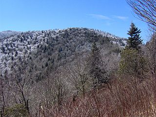
The Appalachian Mountains, often called the Appalachians, are a system of mountains in eastern to northeastern North America. The Appalachians first formed roughly 480 million years ago during the Ordovician Period. They once reached elevations similar to those of the Alps and the Rocky Mountains before experiencing natural erosion. The Appalachian chain is a barrier to east–west travel, as it forms a series of alternating ridgelines and valleys oriented in opposition to most highways and railroads running east–west.
The Appalachian Trail, is a hiking trail in the Eastern United States, extending almost 2,200 miles (3,540 km) between Springer Mountain in Georgia and Mount Katahdin in Maine, and passing through 14 states. The Appalachian Trail Conservancy claims the Appalachian Trail to be the longest hiking-only trail in the world. More than three million people hike segments of the trail each year.

The Tuscarora Trail is a 252-mile (406 km) hiking trail in the eastern United States, following the Appalachian Mountains through portions of Virginia, West Virginia, Maryland, and Pennsylvania. Its route is roughly parallel to, and to the west of, the Appalachian Trail.

Appalachia is a cultural region in the Eastern United States that stretches from the Southern Tier of New York State to northern Alabama and Georgia. While the Appalachian Mountains stretch from Belle Isle in Newfoundland and Labrador, Canada, to Cheaha Mountain in Alabama, Appalachia typically refers only to the cultural region of the central and southern portions of the range, from the Catskill Mountains of New York southwest to the Blue Ridge Mountains which run southwest from southern Pennsylvania to northern Georgia, and the Great Smoky Mountains of Tennessee and North Carolina. In 2019, the region was home to an estimated 25.7 million people, of which roughly 81% are white.

The Ouachita Mountains, simply referred to as the Ouachitas, are a mountain range in western Arkansas and southeastern Oklahoma. They are formed by a thick succession of highly deformed Paleozoic strata constituting the Ouachita Fold and Thrust Belt, one of the important orogenic belts of North America. The Ouachitas continue in the subsurface to the northeast, where they make a poorly understood connection with the Appalachians and to the southwest, where they join with the Marathon uplift area of West Texas. Together with the Ozark Plateaus, the Ouachitas form the U.S. Interior Highlands. The highest natural point is Mount Magazine at 2,753 feet.
The area in United States west of the Appalachian Mountains and extending vaguely to the Mississippi River, spanning the lower Great Lakes to the upper south, is a region known as trans-Appalachia, particularly when referring to frontier times. It included much of Ohio Country and at least the northern and eastern parts of the Old Southwest. It was never an organized territory or other political unit. Most of what was referred to by this name became the states of western Pennsylvania, Ohio, West Virginia, Kentucky, Tennessee and western Virginia. It is still a vague and little used place name today.
The Potomac Heritage Trail, also known as the Potomac Heritage National Scenic Trail or the PHT, is a designated National Scenic Trail corridor spanning parts of the mid-Atlantic region of the United States that will connect various trails and historic sites in Virginia, Maryland, Pennsylvania, and the District of Columbia. The trail network includes 710 miles (1,140 km) of existing and planned sections, tracing the natural, historical, and cultural features of the Potomac River corridor, the upper Ohio River watershed in Pennsylvania and western Maryland, and a portion of the Rappahannock River watershed in Virginia. The trail is managed by the National Park Service.
The Potomac Appalachian Trail Club (PATC) is a volunteer organization that works to maintain hiking trails in the Washington, D.C. area of the United States. PATC was founded in 1927 to protect and develop the local section of the then new Appalachian Trail. It has expanded its mission to oversee over 1,050 miles (1,690 km) of trails, 47 shelters and 39 cabins in Virginia, Maryland, West Virginia, Pennsylvania and Washington, D.C.
The Appalachian National Scenic Trail spans fourteen U.S. states during its roughly 2,200 miles (3,500 km)-long journey: Georgia, North Carolina, Tennessee, Virginia, West Virginia, Maryland, Pennsylvania, New Jersey, New York, Connecticut, Massachusetts, Vermont, New Hampshire, and Maine. The southern end is at Springer Mountain, Georgia, and it follows the ridgeline of the Appalachian Mountains, crossing many of its highest peaks and running almost continuously through wilderness before reaching the northern end at Mount Katahdin, Maine.

The Great Indian Warpath (GIW)—also known as the Great Indian War and Trading Path, or the Seneca Trail—was that part of the network of trails in eastern North America developed and used by Native Americans which ran through the Great Appalachian Valley. The system of footpaths extended from what is now upper New York to deep within Alabama. Various Indians traded and made war along the trails, including the Catawba, numerous Algonquian tribes, the Cherokee, and the Iroquois Confederacy. The British traders' name for the route was derived from combining its name among the northeastern Algonquian tribes, Mishimayagat or "Great Trail", with that of the Shawnee and Delaware, Athawominee or "Path where they go armed".

The Upland South and Upper South are two overlapping cultural and geographic subregions in the inland part of the Southern and lower Midwestern United States. They differ from the Deep South and Atlantic coastal plain by terrain, history, economics, demographics, and settlement patterns.
Old Black is a mountain in the Great Smoky Mountains, located in the Southeastern United States. While often overshadowed by Mount Guyot, its higher neighbor to the south, Old Black is the 5th-highest mountain in Tennessee and the 7th-highest in the Great Smoky Mountains National Park. The Appalachian Trail crosses its western slope, connecting the Cosby-area trail system with the heart of the Eastern Smokies.
In the United States, the Hillbilly Highway is the out-migration of Appalachians from the Appalachian Highlands region to industrial cities in northern, midwestern, and western states, primarily in the years following World War II in search of better-paying industrial jobs and higher standards of living. Many of these migrants were formerly employed in the coal mining industry, which started to decline in 1940s. The word hillbilly refers to a negative stereotype of people from Appalachia. The term hillbilly is considered to be a modern term because it showed up in the early 1900s. The Hillbilly Highway was a parallel to the better-known Great Migration of African-Americans from the south.
The Great Eastern Trail is a network of hiking trails forming a long-distance route in the eastern United States. North of Georgia, the route runs parallel to, and slightly to the west of, the Appalachian Trail. As of 2022, it is still under development and its current length is approximately 1,600 miles (2,600 km). Upon its completion the network is projected to be more than 2,000 miles (3,200 km) in length.

The Appalachian region has always had to allocate much resources and time into transportation due to the region's notable and unique geography. Mountainous terrain and commonly occurring adverse weather effects such as heavy fog and snowfall made roads hazardous and taxing on the traveling vehicles. Initially, European settlers found gaps in the mountains, among them the Cumberland Gap and the Wilderness Road. Another notable challenge of Appalachian travel is the political elements of constructing transportation routes. Most travel systems are funded by municipalities, but since The Appalachian area has several different states it can be difficult for the various governments to agree on how to work on transportation. The most influential forms of travel in the Appalachian region are based on water trading routes, roads and railroads.

The Triple Crown of Hiking informally refers to the three major U.S. long-distance hiking trails:

A quilt trail is a series of painted wood or metal hung or freestanding quilt squares installed along a route emphasizing significant architecture and/or aesthetic landscapes. Currently North America has 46 quilt trails: 43 in the United States and three in Canada.
The Cumberland County Biker/Hiker Trail is a Pennsylvania rail trail at Pine Grove Furnace State Park and is almost entirely on the "Old Railroad Bed Road" between Fuller Lake and Laurel Lake. The trail is a pleasant 2.2 miles within the Pine Grove Furnace State Park located in the Michaux State Forest. The park is home to many species of wildlife and is a common attraction for locals and tourists alike. Walking, hiking, and biking are the opportunities offered by the trail year round. The biker/hiker trail shares roughly half of its trail with the Appalachian Trail and is a very popular route within the State Park.
Feathercamp is a wildland in the George Washington and Jefferson National Forests of western Virginia that has been recognized by the Wilderness Society as a special place worthy of protection from logging and road construction. The Wilderness Society has designated the area as a "Mountain Treasure".
References
- ↑ Glimm, J. Flatlanders and Ridgerunners: Folktales from the Mountains of Northern Pennsylvania . University of Pittsburgh Press.
- ↑ "Ridgerunners and Caretakers".