Pearsall is a city in and the county seat of Frio County, Texas, United States. The population was 9,146 at the 2010 census, up from 7,157 at the 2000 census.

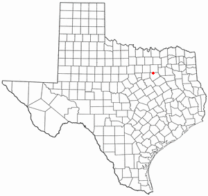
Ovilla is a city in Dallas and Ellis Counties in the U.S. state of Texas. The population was 3,492 at the 2010 census.

Rodenkirchen is a southern city district of Cologne (Köln) in Germany. It has about 100,000 inhabitants and covers an area of 54.56 square kilometres (21.06 mile²). The borough includes the quarters Bayenthal, Godorf, Hahnwald, Immendorf, Marienburg, Meschenich, Raderberg, Raderthal, Rodenkirchen, Sürth, Rondorf, Weiß and Zollstock.

Pax Hill, near Bentley, Hampshire, England, was the family home of Robert Baden-Powell, founder of the Scout movement, and his wife, Olave, for over twenty years during the 20th century. It is located at the end of a half-mile drive, off the main A31 road.

Chugul is a small island located in the centre of the Andreanof Islands of the Aleutian Islands of Alaska. It is one a group of small islands that are situated between Adak Island and Atka Island. Nearby islands include Igitkin and Tagalak. It length is 7.5 kilometres (4.7 mi) and width is 5.7 kilometres (3.5 mi).

Renews–Cappahayden is a small fishing town on the southern shore of Newfoundland, 83 kilometres (52 mi) south of St. John's.

Ravnje is a village in Serbia. It is located in the Sremska Mitrovica municipality, in the Srem District, Vojvodina province. The village has a Serb ethnic majority and its population numbering 1,413 people. Although part of the Srem District, Ravnje is situated in the region of Mačva.

Blue Rock is an unincorporated community in western Blue Rock Township, Muskingum County, Ohio, United States. It is a part of the Franklin Local School District. Blue Rock State Park is located within Blue Rock, Ohio.

The Nazca Province is one of five provinces of the Ica Region of Peru. The capital of the province is the city of Nazca.

Downtown Anchorage is a neighborhood in the U.S. city of Anchorage, Alaska. Considered the central business district of Anchorage, Downtown has many office buildings, cultural points of interest, shopping areas, as well as dining and nightlife attractions. Today's Downtown was the original site of the Anchorage Land Auction in 1915, which gave rise to today's present-day grid street pattern. The actual original townsite was a tent city located off the banks of Ship Creek, at present-day Government Hill.

Kłębanowice is a village in the administrative district of Gmina Radwanice, within Polkowice County, Lower Silesian Voivodeship, in south-western Poland. Prior to 1945 it was in Germany. It lies approximately 3 kilometres (2 mi) south of Radwanice, 10 km (6 mi) north-west of Polkowice, and 90 km (56 mi) north-west of the regional capital Wrocław.
Tour Signal was a proposed skyscraper in La Défense and in Puteaux, France.

Plewnik Drugi is a village in the administrative district of Gmina Wartkowice, within Poddębice County, Łódź Voivodeship, in central Poland. It lies approximately 6 kilometres (4 mi) south-east of Wartkowice, 8 km (5 mi) north-east of Poddębice, and 34 km (21 mi) north-west of the regional capital Łódź.
Cyganka is a village in the administrative district of Gmina Milejów, within Łęczna County, Lublin Voivodeship, in eastern Poland.

Boża Pomoc is a settlement in the administrative district of Gmina Lipno, within Leszno County, Greater Poland Voivodeship, in west-central Poland.

Owśnice is a village in the administrative district of Gmina Kościerzyna, within Kościerzyna County, Pomeranian Voivodeship, in northern Poland. It lies approximately 8 kilometres (5 mi) north-west of Kościerzyna and 54 km (34 mi) south-west of the regional capital Gdańsk.

Lovelock is an unincorporated community in Butte County, California. It is located 2.5 miles (4.0 km) west-southwest of Stirling City and lies at an elevation of 3136 feet.

Spring Valley is a hamlet in Terrell Rural Municipality No. 101 in the province of Saskatchewan, Canada. Located at the end of highway 715, and approximately 62 km south of the city of Moose Jaw.

Gradina (Cazin) is a village in the municipality of Cazin, Bosnia and Herzegovina.

Eli is an unincorporated community in Cherry County, Nebraska, United States. Its population is approximately 60-75 people, but exact census information has not been collected. It is one mile (1.6 km) north of U.S. Route 20 and 2.5 miles (4.0 km) south of the Nebraska-South Dakota border. The nearest town is Merriman, 11.8 miles (19.0 km) to the west. It is also 12.8 miles (20.6 km) west of Cody.


