| Riseten Pass | |
|---|---|
 Riseten Pass Location in Switzerland | |
| Elevation | 2,189 m (7,182 ft) |
| Traversed by | Trail |
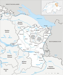
| Location | Glarus/St. Gallen, Switzerland |
| Range | Glarus Alps |
| Coordinates | 46°58′41″N9°14′48″E / 46.97806°N 9.24667°E Coordinates: 46°58′41″N9°14′48″E / 46.97806°N 9.24667°E |
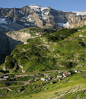
The Riseten Pass (German : Risetenpass) is a mountain pass of the Glarus Alps, located on the border between the Swiss cantons of St. Gallen and Glarus, at an elevation of 2,189 m (7,182 ft). It crosses the col between the peaks of the Wissgandstöckli and Foostock. [1]

German is a West Germanic language that is mainly spoken in Central Europe. It is the most widely spoken and official or co-official language in Germany, Austria, Switzerland, South Tyrol (Italy), the German-speaking Community of Belgium, and Liechtenstein. It is also one of the three official languages of Luxembourg and a co-official language in the Opole Voivodeship in Poland. The languages which are most similar to German are the other members of the West Germanic language branch: Afrikaans, Dutch, English, the Frisian languages, Low German/Low Saxon, Luxembourgish, and Yiddish. There are also strong similarities in vocabulary with Danish, Norwegian and Swedish, although those belong to the North Germanic group. German is the second most widely spoken Germanic language, after English.

A mountain pass is a navigable route through a mountain range or over a ridge. Since many of the world's mountain ranges have presented formidable barriers to travel, passes have played a key role in trade, war, and both human and animal migration throughout Earth's history. At lower elevations it may be called a hill pass. The highest vehicle-accessible pass in the world appears to be Mana Pass, located in the Himalayas on the border between India and Tibet, China.

The Glarus Alps are a mountain range in central Switzerland. They are bordered by the Uri Alps and the Schwyz Alps to the west, the Lepontine Alps to the south, the Appenzell Alps to the northeast. The eastern part of the Glarus Alps contains a major thrust fault which was declared a geologic UNESCO world heritage site.
Contents
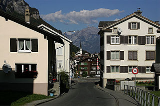
The pass is traversed by a trail, which connects the village of Weisstannen, in the canton of St. Gallen at an elevation of 1,004 m (3,294 ft), with the valley of the Krauch stream and thence with the village of Matt, in the canton of Glarus at an elevation of 831 m (2,726 ft). [1]

Weisstannen is a village located in the canton of St. Gallen, Switzerland. It lies in the municipality of Mels, south-west of Sargans.