
A pub is a drinking establishment licensed to serve alcoholic drinks for consumption on the premises. The term first appeared in the late 17th century, and was used to differentiate private houses from those which were open to the public as alehouses, taverns and inns. Today, there is no strict definition, but CAMRA states a pub has four characteristics:
- is open to the public without membership or residency
- serves draught beer or cider without requiring food be consumed
- has at least one indoor area not laid out for meals
- allows drinks to be bought at a bar

Brooklyn is a borough of New York City, coextensive with Kings County, located on the westernmost edge of Long Island in the U.S. state of New York. Kings County is the most populous county in the State of New York, and the second-most-densely-populated county in the United States, behind New York County (Manhattan). Brooklyn is also New York City's most populous borough, with 2,736,074 residents in 2020. If Brooklyn were an independent city, it would be the third most populous in the U.S. after the rest of New York City and Los Angeles, and ahead of Chicago.

The Boston Post Road was a system of mail-delivery routes between New York City and Boston, Massachusetts, that evolved into one of the first major highways in the United States.

The Battle of Long Island, also known as the Battle of Brooklyn and the Battle of Brooklyn Heights, was an action of the American Revolutionary War fought on August 27, 1776, at the western edge of Long Island in present-day Brooklyn. The British defeated the Continental Army and gained access to the strategically important Port of New York, which they held for the rest of the war. It was the first major battle to take place after the United States declared its independence on July 4, 1776, in Philadelphia. It was the largest battle of the Revolutionary War in terms of both troop deployment and combat.

A tavern is a type of business where people gather to drink alcoholic beverages and be served food such as different types of roast meats and cheese, and where travelers would receive lodging. An inn is a tavern that has a license to put up guests as lodgers. The word derives from the Latin taberna whose original meaning was a shed, workshop, stall, or pub.

East Williamsburg is a name for the area in the northwestern portion of Brooklyn, New York City. East Williamsburg consists roughly of what was the 3rd District of the Village of Williamsburgh and what is now called the East Williamsburg In-Place Industrial Park (EWIPIP), bounded by the neighborhoods of Northside and Southside Williamsburg to the west, Greenpoint to the north, Bushwick to the south and southeast, and both Maspeth and Ridgewood in Queens to the east. Much of this area is still referred to as either Bushwick, Williamsburg, or Greenpoint with the term East Williamsburg falling out of use since the 1990s.

Wakefield is a village in the town of South Kingstown, Rhode Island, United States, and the commercial center of South Kingstown. Together with the village of Peace Dale, it is treated by the U.S. Census as a component of the census-designated place identified as Wakefield-Peacedale, Rhode Island. West Kingston, another South Kingstown village, was the traditional county seat of Washington County. Since 1991, the Washington County Courthouse has been in Wakefield. The Sheriff's Office which handles corrections is also in Wakefield.
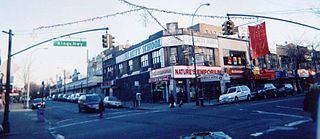
Kings Highway is a broad avenue that curves about the southern part of the Borough of Brooklyn in New York City. Its west end is at Bay Parkway and 78th Street. East of Ocean Avenue, the street is largely residential. It tracks eastward, then northeast, then north through Brooklyn and reaches East 98th Street in central Brooklyn. At that point, it flows into Howard Avenue to provide seamless access to Eastern Parkway, another major road in Brooklyn with side medians and service roads.
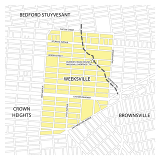
Weeksville is a historic neighborhood founded by free African Americans in what is now Brooklyn, New York, United States. Today it is part of the present-day neighborhood of Crown Heights.
The Washington–Rochambeau Revolutionary Route is a 680-mile (1,090 km) series of roads used in 1781 by the Continental Army under the command of George Washington and the Expédition Particulière under the command of Jean-Baptiste de Rochambeau during their 14-week march from Newport, Rhode Island to Yorktown, Virginia. 4,000 French and 3,000 American soldiers began the march.
Old York Road is a roadway that was built during the 18th century to connect Philadelphia with New York City. Through New Jersey it was built along the Raritan "Naraticong Trail", also known as the Tuckaraming Trail. A memorial plaque to the friendship of the Naraticong Indians, who permitted the road to be built over their trail, is at the intersection of Old York Road and Canal in Raritan, NJ. The Swift Sure Stage Coach Line completed the journey between the two cities in two days and cost a few dollars.
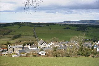
Tre-Taliesin is a village in Ceredigion on the A487 road, 9 miles north of Aberystwyth, Wales, and 9 miles south of Machynlleth. It is in the parish of Llangynfelyn.
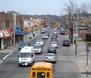
Metropolitan Avenue is a major east-west street in Queens and northern Brooklyn, New York City. Its western end is at the East River in Williamsburg, Brooklyn, and the eastern end at Jamaica Avenue in Jamaica, Queens. The avenue was constructed in 1816 as the Williamsburgh and Jamaica Turnpike, though previously it served as an Indian trail.

Rio Bueno is a settlement in Jamaica. It has a population of 1,096 as of 2009.

The Heights of Guan is a historical name given to a series of hills extending in a ridge along western Long Island in New York State. The ridge extends in an east-northeast direction across the modern-day New York City boroughs of Brooklyn and Queens, with hills varying in height from 100 to 150 feet. The southern slope of the ridge has a relatively steep drop and the northern slope is more gradual. Further to the south is an outwash plain bordered by the Atlantic Ocean. Geologically, the ridge is part of the Harbor Hill Moraine formed 13,000 to 12,000 years ago during the Wisconsin glaciation.

Union Course was a horse racing course in what is now Woodhaven, Queens, in New York City. It hosted some of the most famous horse races in American history, including the 1823 match between American Eclipse and Sir Henry. The track was located between what are now Jamaica Avenue on the north, Atlantic Avenue on the south, 78th Street on the west, and 85th Street on the east.
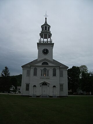
The East Poultney Historic District encompasses the historic center of the rural village of East Poultney, Vermont. The district is centered on the triangular green at the center of the village, and was developed mainly from the late 18th through mid-19th centuries, producing a village with strong Federal and Greek Revival architecture. It was listed on the National Register of Historic Places in 1978.
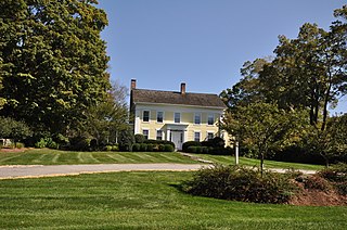
The Sunny Ridge Historic District encompasses a historic former crossroads village in Washington, Connecticut. It consists of properties abutting the triangular intersection of Sunny Ridge Road, Nettletown Hollow Road, and Old Litchfield Road. This area was in the 18th and 19th centuries a stop on a north-south stagecoach and mail route. It was listed on the National Register of Historic Places in 1995.