
Argyll and Bute is one of 32 unitary council areas in Scotland and a lieutenancy area. The current lord-lieutenant for Argyll and Bute is Jane Margaret MacLeod. The administrative centre for the council area is in Lochgilphead at Kilmory Castle, a 19th-century Gothic Revival building and estate. The current council leader is Councillor Jim Lynch.
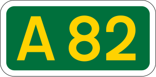
The A82 is a major road in Scotland that runs from Glasgow to Inverness via Fort William. It is one of the principal north-south routes in Scotland and is mostly a trunk road managed by Transport Scotland, who view it as an important link from the Central Belt to the Scottish Highlands and beyond. The road passes close to numerous landmarks, including Loch Lomond, Rannoch Moor, Glen Coe, the Ballachulish Bridge, Ben Nevis, the Commando Memorial, Loch Ness, and Urquhart Castle. Along with the A9 and the A90 it is one of the three major north–south trunk roads connecting the Central Belt to the North.

The A85 is a major road in Scotland. It runs east from Oban along the south bank of Loch Etive, through Lochawe and Tyndrum, Crianlarich, Lochearnhead, St Fillans and Crieff before passing through Perth, where it crosses the River Tay via Perth Bridge to Bridgend. Its name between Crieff and Perth is the Crieff Road. It then runs concurrently with the A90 to the Swallow Roundabout, before diverging to follow the Invergowrie Bypass, Riverside Avenue and Riverside Drive before terminating in Dundee city centre.
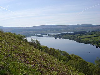
Loch Awe is a large body of freshwater in Argyll and Bute, Scottish Highlands. It has also given its name to a village on its banks, variously known as Loch Awe or Lochawe. There are islands within the loch such as Innis Chonnell and Inishail.
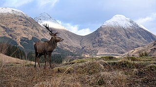
Glen Coe is a glen of volcanic origins, in the Highlands of Scotland. It lies in the north of the county of Argyll, close to the border with the historic province of Lochaber, within the modern council area of Highland. Glen Coe is regarded as the home of Scottish mountaineering and is popular with hillwalkers and climbers.

Loch Etive is a 30 km sea loch in Argyll and Bute, Scotland. It reaches the sea at Connel, 5 km north of Oban. It measures 31.6 km long and from 1.2 km to 1.6 km (1 mi) wide. Its depth varies greatly, up to a maximum of 150 m (490 ft).
Glen Etive is a glen in the Scottish Highlands. The River Etive rises on the peaks surrounding Rannoch Moor, with several tributary streams coming together at the Kings House Hotel, at the head of Glen Coe. From the Kings House, the Etive flows for about 18 km, reaching the sea loch, Loch Etive. The river and its tributaries are popular with whitewater kayakers and at high water levels it is a test piece of the area and a classic run.

The Battle of the Pass of Brander in Scotland forms a small part of the wider struggle known as the Wars of Scottish Independence, and a large part of the civil war between the Bruce and Balliol factions, a parallel and overlapping conflict. It was a victory for King Robert the Bruce over the MacDougalls of Argyll, kinsmen of John Comyn, also known as the Red Comyn, who had been killed by Bruce and his adherents at Dumfries in 1306. The sources do not allow us to determine the date of the battle with any degree of precision: various dates between 1308 and 1309 have been suggested, though the late summer of 1308 would seem to be the most likely. Traquair dates it to August 1308.
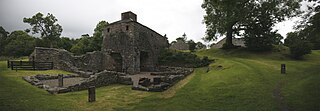
Bonawe is a village in Ardchattan Parish Argyll and Bute, Scotland opposite Taynuilt on the north shore of Loch Etive, most famous for the shipping firm J & A Gardener's Bonawe Quarry - now owned by Breedon Aggregates Scotland Ltd. Bonawe is primarily a linear settlement along on the B845 road and the coast. The iron furnace is at Bonawe in Glenorchy & Inishail Parish across Loch Etive nr Taynuilt in Muckairn Parish.

Connel is a village in Argyll and Bute, Scotland. It is situated on the southern shore of Loch Etive. The Lusragan Burn flows through the village and into the loch.

Taynuilt is a large village in Argyll and Bute, Scotland located at the western entrance to the narrow Pass of Brander.

Connel Bridge is a cantilever bridge that spans Loch Etive at Connel in Scotland. The bridge takes the A828 road across the narrowest part of the loch, at the Falls of Lora. It is a category B listed structure.

Stob Ghabhar is a mountain in the Scottish Highlands, part of the Black Mount group. It is a Munro with a height of 1,089.2 metres (3,573 ft). Stob Ghabhar lies nine kilometres (5.6 mi) northwest of Bridge of Orchy and stands on the border of the Argyll and Highland council areas.

Creise is a mountain summit in the Black Mount range, in the Scottish Highlands. It overlooks the northern end of Glen Etive and its height is 1,100 metres (3,600 ft). Creise is one of four Munros in the Black Mount, along with Meall a' Bhuiridh, Stob Ghabhar and Stob a' Choire Odhair. The mountain is a long and flattish ridge, whose highest point was unnamed until 1981. It is popular with cross-country skiers, being near the White Corries ski area from where it is often climbed along with adjoining Meall a' Bhuiridh. The steep and craggy northern buttress, Sròn na Crèise, is well seen from the A82 road and the Kings House Hotel.

Kirkcowan is an area about 15 miles in length, and from nearly two to nearly seven miles in breadth, comprising 30,580 acres, of which 7000 are arable, 300 woodland and plantations, and the remainder meadow, pasture in Machars, in the historical county of Wigtownshire, in Dumfries and Galloway, Scotland, with the village of Kirkcowan, bounded on the east by the river Bladnoch, on the west by the river Tarff, and is 6 miles W. by S.W. from Newton Stewart.

The River Add is a river which runs through Argyll and Bute on the west coast of Scotland. Historically, it was known as the river Airigh but to avoid confusion with the Aray, it was renamed the River Add.
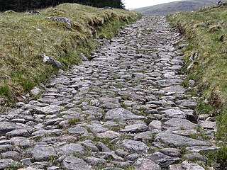
A network of military roads, sometimes called General Wade's Military Roads, was constructed in the Scottish Highlands during the middle part of the 18th century as part of an attempt by the British Government to bring order to a part of the country which had risen up in the Jacobite rebellion of 1715.

Loch of Avich is a large freshwater loch that lies approximately 1 mi (1.6 km) west of Loch Awe in Argyll and Bute in Scotland. It is the second biggest loch in the Etive basin after Loch Awe. It trends east-northeast, west-southwest and is narrowly triangular in shape. At the southwest end of the loch is the islet Innis Luana on which stands the ruins of an ancient castle named Caisteal na Nighinn Ruaidhe. The castle may have been the original seat of Clan Campbell. Near the north shore on the islet of Eilean Fraoch is the remains of a crannog.

Ben Nevis and Glen Coe is a national scenic area (NSA) covering part of the Highlands of Scotland surrounding Ben Nevis and Glen Coe, in which certain forms of development are restricted. It is one of 40 such areas in Scotland, which are defined so as to identify areas of exceptional scenery and to ensure its protection from inappropriate development. The Ben Nevis and Glen Coe NSA covers 903 km2 (349 sq mi) of land, lying within the Highland, Argyll and Bute and Perth and Kinross council areas. A further 19 km2 (7.3 sq mi) of the NSA are marine, covering the sea loch of Loch Leven.

The Awe Hydro-Electric Scheme was the penultimate scheme developed by the North of Scotland Hydro-Electric Board. It centres around Loch Awe, in Argyll and Bute, on the southern edge of the Scottish Highlands. It consists of three power stations, two conventional hydro-electric stations, and the Cruachan power station, the first large pumped storage scheme built by the Board. It was completed in 1965.
