
The River Stour is an English river that rises in the county of Oxfordshire but largely flows through Warwickshire. It is a tributary of the Avon, which it joins just south west of Stratford-upon-Avon.

The River Roding is a river in England that rises at Molehill Green in Essex. It then flows south through Essex and London and forms Barking Creek as it reaches the River Thames.

The River Cam is a small river in Gloucestershire, England. It flows for 12 miles (20 km) eastwards into the Gloucester and Sharpness Canal.
The Matfield River is a 6.3-mile-long (10.1 km) river in Plymouth County, Massachusetts. It flows south through the town of East Bridgewater to a confluence with the Town River, forming the Taunton River. The Matfield River, where it flows through the historic village of Elmwood and flows under Route 18, is commonly known as the Elmwood River.

The River Stort is a river in Essex and Hertfordshire, England. It is 24 miles (38 km) long and flows from just south of the village of Langley to the River Lea at Hoddesdon.

Niingsvatnet (Norwegian) or Meahccejávri (Northern Sami) is a Norwegian lake that lies high in the mountains on the border of two municipalities: Evenes in Nordland county and Tjeldsund in Troms og Finnmark county.

Phillips Brook is a 19.6-mile-long (31.5 km) river in northern New Hampshire in the United States. It is a tributary of the Upper Ammonoosuc River and part of the Connecticut River watershed.
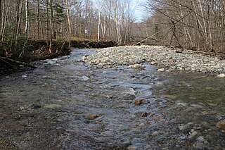
Oliverian Brook is a 13.1-mile-long (21.1 km) river in western New Hampshire in the United States. It is a tributary of the Connecticut River, which flows to Long Island Sound.

The Cold River is a 16.7-mile-long (26.9 km) river in western Maine in the United States. It very briefly enters New Hampshire as well. It is part of the Saco River drainage basin.

The East Branch of the Pemigewasset River is a 15.8-mile-long (25.4 km) river located in the White Mountains of New Hampshire in the United States. It is a tributary of the Pemigewasset River, part of the Merrimack River watershed.
The Blackwater River is a 37.5-mile-long (60.4 km) river located in central New Hampshire in the United States. It is a tributary of the Contoocook River, part of the Merrimack River watershed.

The Waits River is a 24.5-mile-long (39.4 km) river in eastern Vermont in the United States. It is a tributary of the Connecticut River, which flows to Long Island Sound. According to the Geographic Names Information System, it has also been known historically as "Wait's River" and as "Ma-houn-quam-mas-see." The Waits River Formation is a rock unit named after the river since it underlies most of the river.

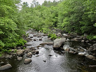
The Bearcamp River is a 26.3-mile-long (42.3 km) river at the southern edge of the White Mountains in New Hampshire, the United States. It is the largest tributary of Ossipee Lake, part of the Saco River watershed leading to the Atlantic Ocean.
The East Branch of the Mohawk River is a 4.6-mile-long (7.4 km) river in northern New Hampshire in the United States. It is a tributary of the West Branch Mohawk River and in turn the Mohawk River, which flows west to the Connecticut River, which in turn flows south to Long Island Sound, an arm of the Atlantic Ocean.
The Red Hill River is a 6.5-mile-long (10.5 km) river in the Lakes Region of central New Hampshire in the United States. It is a tributary of Lake Winnipesaukee, part of the Merrimack River watershed.

The Sydling Water is an 8 km (5 mi) long river in Dorset, England, which flows from north to south from Up Sydling until it joins the River Frome near Grimstone.

Ithikkara River is a 56 km long river which flows through the Kollam district of Kerala in India. It originates in the Alayamon hill ranges of the Western Ghats in the eastern part of the Kollam district. It flows through the towns of Alayamon, Ayoor, Chadayamangalam, Edamulackal, Pakalkuri, Oyoor, Chathannoor, Ithikkara and Pooyappally before emptying into the Paravur estuary in Paravur. The village of Ithikkara is located on the banks of the river, situated 15 km from Kollam.

The River Cegidog is a river in north-east Wales. It flows mainly through Flintshire but towards the end of its course it forms the border between Flintshire and Wrexham County Borough.
Abbott Run is a de facto river in the U.S. state of Massachusetts and Rhode Island. It flows approximately 10 miles (16 km).

The Valapattanam River is a 110 km long river which flows through the Kannur district in North Kerala. It is the longest river in the Kannur district.

