This article needs additional citations for verification .(March 2016) |

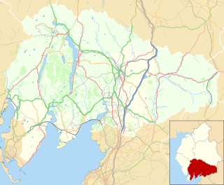
The River Gowan is a short river in Cumbria, running easterly through the village of Ings before joining the River Kent at Staveley.
This article needs additional citations for verification .(March 2016) |
The River Gowan is a short river in Cumbria, running easterly through the village of Ings before joining the River Kent at Staveley.
It is difficult to determine where the river got its name. In Scottish English, gowan the name for the common daisy or occasionally the buttercup . It is derived from the original form gollan which is the marsh marigold, the name was made famous by Robert Burns in a poem originally entitled "The Gowan" which is now known as "To a Mountain Daisy". The Lakeland poet William Wordsworth also uses the word gowan to refer to a common wayside flower indicating that the name was used in the area and therefore it is possible that the river got its name from the fact that it flows through many flower meadows on the valley floor. In Scottish Gaelic Gowen/Gowan can also mean "blacksmith". The name may therefore otherwise have come from the Scots Gaelic or from Irish missionaries who are known to have travelled in Cumbria during the Anglo-Saxon period and have given many words to the local dialect.

In 2013 work was completed on a river improvement project to restore meanders between Ings and Staveley involving the removal of 71 metres of man-made flood embankment. This was part of project funded by the Environment Agency and Natural England which aims to bring river units of the River Kent & Tributaries Site of Special Scientific Interest/Special Area of Conservation into "improving" condition. The Kent is designated a Special Area of Conservation, primarily as an important habitat for the endangered White-clawed Crayfish ( Austropotamobius pallipes ). [1]
It is anticipated that apart from ecological benefits, the reconnection of the river with its flood plain will help alleviate flooding downstream. [2]
The Solway Firth is a firth that forms part of the border between England and Scotland, between Cumbria and Dumfries and Galloway. It stretches from St Bees Head, just south of Whitehaven in Cumbria, to the Mull of Galloway, on the western end of Dumfries and Galloway. The Isle of Man is also very near to the firth. The firth comprises part of the Irish Sea.

The River Tay is the longest river in Scotland and the seventh-longest in Great Britain. The Tay originates in western Scotland on the slopes of Ben Lui, then flows easterly across the Highlands, through Loch Dochart, Loch Iubhair and Loch Tay, then continues east through Strathtay, in the centre of Scotland, then southeasterly through Perth, where it becomes tidal, to its mouth at the Firth of Tay, south of Dundee. It is the largest river in the British Isles by measured discharge. Its catchment is approximately 2,000 square miles (5,200 km2), the Tweed's is 1,500 square miles (3,900 km2) and the Spey's is 1,097 square miles (2,840 km2).
Cumberland is a historic county of North West England that had an administrative function from the 12th century until 1974. It is bordered by the historic counties of Northumberland to the northeast, County Durham to the east, Westmorland to the southeast, Lancashire to the south, and the Scottish counties of Dumfriesshire and Roxburghshire to the north. It formed an administrative county from 1889 to 1974 and now forms part of Cumbria.

The Moray Firth is a roughly triangular inlet of the North Sea, north and east of Inverness, which is in the Highland council area of north of Scotland. It is the largest firth in Scotland, stretching from Duncansby Head in the north, in the Highland council area, and Fraserburgh in the east, in the Aberdeenshire council area, to Inverness and the Beauly Firth in the west. Therefore, three council areas have Moray Firth coastline: Highland to the west and north of the Moray Firth and Highland, Moray and Aberdeenshire to the south. The firth has more than 800 kilometres of coastline, much of which is cliff.
Cumbric was a variety of the Common Brittonic language spoken during the Early Middle Ages in the Hen Ogledd or "Old North" in what is now Northern England and southern Lowland Scotland. It was closely related to Old Welsh and the other Brittonic languages. Place name evidence suggests Cumbric may also have been spoken as far south as Pendle and the Yorkshire Dales. The prevailing view is that it became extinct in the 12th century, after the incorporation of the semi-independent Kingdom of Strathclyde into the Kingdom of Scotland.

The River Kent is a short river in the county of Cumbria in England. It originates in hills surrounding Kentmere, and flows for around 20 miles (32 km) into the north of Morecambe Bay. The upper reaches and the western bank of the estuary are located within the boundaries of the Lake District National Park. The river flows in a generally north to south direction, passing through Kentmere, Staveley, Burneside, Kendal and Sedgwick. Near Sedgwick, the river passes through a rock gorge which produces a number of low waterfalls. This section is popular with kayakers as it offers high quality whitewater for several days after rain. The village of Arnside is situated on the east bank of the Kent estuary, just above Morecambe Bay, and a tidal bore known as the Arnside Bore forms in the estuary at this point on high spring tides.
Gowan may refer to:

Staveley is a village in the South Lakeland district, in Cumbria, England. Historically part of Westmorland, it is situated 4 miles (6 km) northwest of Kendal where the River Kent is joined by its tributary the Gowan. It is also known as Staveley-in-Westmorland and Staveley-in-Kendal to distinguish it from Staveley-in-Cartmel. There are three civil parishes – Nether Staveley, Over Staveley and Hugill (part). Their total population at the 2011 Census was 1,593 but this includes those living in the hamlet of Ings in Hugill parish.

The River Sprint is a river in Cumbria, England with its source high up on the south-facing side of Harter Fell. It flows into the River Kent just to the south of Burneside.

The Barony of Kendal is a subdivision of the English historic county of Westmorland. It is one of two ancient baronies that make up the county, the other being the Barony of Westmorland. In 1974, the entire county became part of the modern county of Cumbria and ceased to have an administrative function. At the same time, Kendal borough along with some other rural and urban districts in Westmorland was merged with the neighbouring parts of Lancashire, Furness and Cartmel, and also the Sedbergh Rural District of the West Riding of Yorkshire into the new South Lakeland district of the new county.
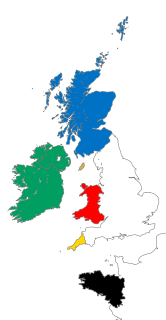
The Celtic nations are a cultural area and collection of geographical regions in Northwestern Europe where the Celtic languages and cultural traits have survived. The term nation is used in its original sense to mean a people who share a common identity and culture and are identified with a traditional territory.

Kentmere is a valley, village and civil parish in the Lake District National Park, a few miles from Kendal in the South Lakeland district of Cumbria, England. Historically in Westmorland, at the 2011 census Kentmere had a population of 159.

Cumbrian toponymy refers to the study of place names in Cumbria, a county in North West England, and as a result of the spread of the ancient Cumbric language, further parts of northern England and the Southern Uplands of Scotland.

The River Ehen is a river in Cumbria, England.
The Solway Plain or Solway Basin is a coastal plain located mostly in northwest Cumbria in England, extending just over the Scottish border to the low-lying area around Gretna and Annan. It lies generally north and west of Carlisle along the Solway Firth, and is drained by the rivers Esk and Lyne. It is associated with the westernmost part of Hadrian's Wall. In medieval times, clay houses known as dabbins were commonly built on the Solway Plain. The Solway coast has been designated an “Area of Outstanding Natural Beauty”.

Acaster South Ings is a Site of Special Scientific Interest, or SSSI, near York, England. It consists of two alluvial flood-meadows, and was designated in 1988 because it supports diverse fauna and flora, some of which is rare in the Vale of York area. One of the rarities is the tansy beetle, which feeds on the leaves of the tansy plant.

Hugill is a civil parish in the South Lakeland district of the English county of Cumbria. Hugill includes the village of Ings and the hamlets of Grassgarth, and Reston plus a large part of the village of Staveley and the west bank of the River Kent north of Barley Bridge. It was formerly a part of the Barony of Kendal. In the 2001 census the parish had a population of 416, increasing at the 2011 census to 446. Approximately 60% of the population live in Staveley or the Kent valley.
The Shannon Callows are areas of flat land along the shores of the River Shannon. These areas lie between Athlone in County Westmeath, where the river flows out of Lough Ree, and Portumna in County Galway, where it enters Lough Derg, in central Ireland. The shallow grade of the river here results in occasional flooding of the Callows.
Nether Staveley is a civil parish in South Lakeland, Cumbria, England. The parish comprises the part of the village of Staveley south of the River Gowan and River Kent, and areas of farmland south of the village. In the 2001 census the parish had a population of 677, increasing at the 2011 census to 710.

Bishop Monkton Ings is a Site of Special Scientific Interest, or SSSI, situated east of Bishop Monkton village in North Yorkshire, England. It consists mostly of marshy, calcareous grassland, with some broadleaved woodland, and some fen alongside the two watercourses which run through the site. This varied wetland forms a habitat for a variety of plants, including the semi-parasitic marsh lousewort (Pedicularis palustris).
Coordinates: 54°22′30″N2°48′50″W / 54.3749°N 2.8139°W
| | This Cumbria location article is a stub. You can help Wikipedia by expanding it. |