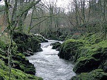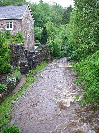
The Afon Sawdde is a river in the county of Carmarthenshire, Wales. For most of its course it flows through the Brecon Beacons National Park and Fforest Fawr Geopark.

The Afon Sawdde is a river in the county of Carmarthenshire, Wales. For most of its course it flows through the Brecon Beacons National Park and Fforest Fawr Geopark.
The river rises on the northern slopes of the Black Mountain and flows north, then west, then northwest for a total of some 18 km to its confluence with the River Towy near Llangadog. The source of the river is Llyn y Fan Fach, a lake of glacial origin sitting in a deep cwm beneath Bannau Sir Gaer. The lake itself is intimately associated with the legend of the Lady of the Lake, a Welsh tale from the Middle Ages.

Its major tributaries are the Nant Crynfe, Afon Llechach on its right bank and the Afon Meilwch, Afon Clydach and Sawdde Fechan on its left bank. [1]
The river is closely followed by the A4069 road for several kilometres southeast road from Llangadog, not least where the river enters the wooded gorge section between Rhyd-y-saint and Pont Newydd. Almost continuous exposures of a Devonian and Silurian rock sequence occur in the bed and sides of the river in this part of its course and have resulted in its designation as a geological site of special scientific interest.
The name of the river may derive from the Welsh word 'sawdd' meaning 'sinking' though equally it may be from a personal name. [2] Its tributary the Clydach is one of several rivers bearing this name in South Wales and thought to derive from an earlier Celtic word 'klou' or 'kleu' together with the suffix '-ach' which is of Irish origin. The sense is of a 'strong-flowing', 'washing' or stony river. [3]

River Neath is a river in south Wales running south west from the point at which its headwaters arising in the Brecon Beacons National Park converge to its mouth at Baglan Bay below Briton Ferry on the east side of Swansea Bay.

The River Tawe is a 30 miles (48 km) long river in South Wales. Its headwaters flow initially east from its source below Llyn y Fan Fawr south of Moel Feity in the Black Mountains, the westernmost range of the Brecon Beacons National Park, before the river turns south and then southwest to its estuary at Swansea. Its main tributaries are the right bank Upper and Lower Clydach Rivers and the Afon Twrch. The total area of the catchment is some 246 km2 (95 sq mi). The Tawe passes through a number of towns and villages including Ystradgynlais, Ystalyfera, Pontardawe, and Clydach and meets the sea at Swansea Bay below Swansea. The Tawe Valley is more commonly known as the Swansea Valley.

The Lower Clydach River is a river in South Wales which rises on the slopes of Mynydd y Betws west of Cwmgors and flows for around 10 km through Cwm Clydach to its confluence with the River Tawe at Clydach. It runs through the RSPB's Cwm Clydach Nature Reserve just to the north of Clydach. - 51.69581°N 3.8992°W.

The Black Mountain is a mountain range in South, Mid and West Wales, straddling the administrative boundary between Carmarthenshire and Powys and forming the westernmost range of the Brecon Beacons National Park. Its highest point is Fan Brycheiniog at 802 metres or 2,631 ft. The Black Mountain also forms a part of the Fforest Fawr Geopark.

The River Cynon in South Wales is a main tributary of the Taff. Its source is the rising of Llygad Cynon at 219 m (719 ft) above sea level at Penderyn, Rhondda Cynon Taf and flows roughly southeast, into the Taff at Abercynon in the same district. The water emerging at Llygad Cynon has been traced back to the sink of the Nant Cadlan at Ogof Fawr.

The River Clydach is a short, steep and fast-flowing river in Monmouthshire and the county borough of Blaenau Gwent in south Wales. It lies within the Brecon Beacons National Park. It is around 10 kilometres (6 mi) in length.

The Afon Twrch is a river which rises in the Black Mountain in south Wales. It forms the boundary between the counties of Brecknockshire and Carmarthenshire and, downstream of Ystradowen, between Brecknockshire and Glamorgan.

The Afon Tarell is a river in Powys, Wales, which rises to the west of the Brecon Beacons in Brecon Beacons National Park and flows north, then north-east, for 12 miles (20 km) into the River Usk.

The Afon Senni is a river in Powys, Wales which rises in the Fforest Fawr section of the Brecon Beacons National Park and flows northwards for 11 kilometres (7 mi) to a confluence with the River Usk at Sennybridge.
Heol Senni is a hamlet in the valley of the Afon Senni just north of the Fforest Fawr section of the Brecon Beacons National Park. It lies within the community of Maescar in the county of Powys, Wales. The Welsh name means the 'road by Senni' and reflects its position near the crossing of the river by the minor road running from the A4067 to the A4215 road. This route was, and to some extent still is, an important link between Brecon and the upper Swansea Valley.

The Grwyne Fawr is a river in the Brecon Beacons National Park in south Wales. A section of it forms the administrative border between Powys and Monmouthshire and also of the historic counties of Brecon and Monmouth. The river and its major tributary the Grwyne Fechan flow into the River Usk at Glangrwyney.

The Afon Cennen is a river in the county of Carmarthenshire, south Wales. It rises on the northern slopes of the Black Mountain to the east of the summit of Tair Carn Uchaf and flows north to Blaencennen Farm, then westwards past Carreg Cennen Castle, continuing through the village of Trap where it exits the Brecon Beacons National Park. Near the hamlet of Derwydd it turns northwest for a mile then northeast to run through the village of Ffairfach to its confluence with the River Towy opposite Llandeilo.

The River Honddu is a river in the Black Mountains within the Brecon Beacons National Park, southeast Wales. Early recorded versions of the name are of the form Hothenei and hodni which are believed to contain the adjective 'hawdd' meaning for example, pleasant or easy. Later forms such as Honddye have undergone metathesis whereby -ddn- became -ndd-.

The River Honddu is a river in the county of Powys, mid Wales. Early recorded versions of the name are of the form Hothenei and hodni which are believed to contain the Welsh adjective 'hawdd', meaning 'pleasant' or 'easy', together with a suffix -ni. Later forms such as Honddey and Honthy have undergone metathesis whereby -ddn- became -ndd-.

The Nant Brân is a short river which rises on the southern slopes of Mynydd Epynt in Powys, Wales. The word 'brân' means 'crow' in Welsh: the name may therefore allude to the dark colour of its waters.

Llanfrynach is a village and community in the county of Powys, Wales, and the historic county of Brecknockshire. The population of the community as taken at the 2011 census was 571. It lies just to the southeast of Brecon in the Brecon Beacons National Park. The village sits astride the Nant Menasgin, a right bank tributary of the River Usk. The B4558 passes just to its north and the Monmouthshire and Brecon Canal also passes around the village. The Welsh name signifies the 'church of Brynach'. The community includes the hamlets of Llanhamlach and Groesffordd.

The River Clydach or Afon Clydach is a river in the county borough of Neath Port Talbot, Wales. It runs generally southwards from the western slopes of Mynydd Marchywel for about 9 km and past Fforest Goch, Bryncoch and Neath Abbey to join the River Neath near Neath. Each of the rivers bearing the name 'Clydach' in South Wales is thought to derive from an earlier Celtic word 'klou' or 'kleu' together with the suffix '-ach' which is of Irish origin. The sense is of a 'strong-flowing', 'washing' or stony river.
The Afon Cilieni is a short river which rises on the southern slopes of Mynydd Epynt in Powys, Wales. The name may mean ' the river rising in a small nook'.

The River Rhiw is a short river in the north of Powys in Wales. Two headwater tributaries both named Afon Rhiw flow east to join at Dwyrhiew and then continue in a generally easterly direction to join the River Severn east of Berriew. The northern Rhiw emerges from Llyn y Bugail on Mynydd Waun Fawr whilst the southern Rhiw rises near Mynydd Dwyriw. The combined river flows past the hamlets of New Mills, Manafon and Pant-y-ffridd, accompanied by the B4390 road all the way to Berriew. Other tributaries include the Nant Wtre-wen, Crygnant, Nant y Llyn Mawr and Dolgar Brook. It is bridged and forded at numerous points, one of which is an aqueduct carrying the Montgomery Canal over it at Berriew. At the eastern end of the river is Glansevern Hall and gardens.
The Afon Gwyrfai is a short river in Gwynedd, Wales. For half of its length it flows through Snowdonia National Park. Exiting Llyn y Gader it flows north through the small village of Rhyd-ddu to enter the southeastern end of Llyn Cwellyn. Downstream of the lake it flows northwest past Betws Garmon, leaving the national park and continues to the southern edge of Waunfawr. It then turns slightly west to flow on to Bontnewydd beyond which it turns slightly south to enter Foryd Bay. The tidal channel within the bay flows north into the western end of the Menai Strait. Principal tributary streams include the Afon Treweunydd which contributes water from the reservoir of Llyn Ffynnon-y-gwas and from the lakes of Llyn Glas, Llyn Coch and Llyn Nadroedd in Cwm Clogwyn immediately west of the summit of Snowdon. The tidal channel of the Gwyrfai within Foryd Bay also accepts the flow of the left bank tributaries, the Afon Foryd, Afon Rhyd and Afon Carrog. The river is shadowed by the line of the Welsh Highland Railway for much of its length, and by which it is crossed four times.
![]() Media related to River Sawdde at Wikimedia Commons
Media related to River Sawdde at Wikimedia Commons