
Chislehurst is a suburban district of south-east London, England, in the London Borough of Bromley. It lies east of Bromley, south-west of Sidcup and north-west of Orpington, 10 miles (16 km) south-east of Charing Cross. Before the creation of Greater London in 1965, it was in Kent. According to the 2021 census, Chislehurst has a population of 15,600.
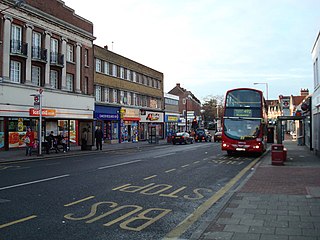
Sidcup is an area of south-east London, England, primarily in the London Borough of Bexley. It is 11.3 miles (18.2 km) south-east of Charing Cross, bordering the London Boroughs of Bromley and Greenwich. It was part of Kent prior to the creation of Greater London in 1965.

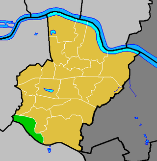
The London Borough of Bexley is a London borough in south-east London, forming part of Outer London. It has a population of 248,287. The main settlements are Sidcup, Erith, Bexleyheath, Crayford, Welling and Old Bexley. The London Borough of Bexley is within the Thames Gateway, an area designated as a national priority for urban regeneration. The local authority is Bexley London Borough Council.

Bexley is an area of south-eastern Greater London, England and part of the London Borough of Bexley. It is sometimes known as Bexley Village or Old Bexley to differentiate the area from the wider borough. It is located 13 miles (21 km) east-southeast of Charing Cross and south of Bexleyheath.

Eltham is a district of southeast London, England, within the Royal Borough of Greenwich. It is 8.7 miles (14.0 km) east-southeast of Charing Cross, and is identified in the London Plan as one of 35 major centres in Greater London. The three wards of Eltham North, South and West have a total population of 35,459. 88,000 people live in Eltham.
Chislehurst and Sidcup Urban District was a local government district and civil parish in north west Kent, England from 1934 to 1965.

Foots Cray is an area of South East London, England, within the London Borough of Bexley. Prior to 1965 it was in the historic county of Kent. It is located south-east of Sidcup, north of Orpington and north west of Swanley.
Danson Park is a public park in the London Borough of Bexley, South East London, located between Welling and Bexleyheath. At 75 hectares, it is the second largest public park in the borough, and the most used by the community. Opened in 1925, it is often considered the finest green open space in the borough, and is Grade II listed on the Register of Historic Parks and Gardens. The park also gives its name to the electoral ward that covers the park and the surrounding area. The park is located at grid reference TQ472752. The southern boundary of both the park and the ward is delineated by Rochester Way, the A2 road.
Albany Park is an area in south east London, England, within the London Borough of Bexley. It is located 12.0 miles (19 km) south east of Charing Cross. Located midway between Sidcup and Bexley, Albany Park is situated on high ground overlooking the valleys of the River Cray and the River Shuttle.

Blackfen is an area of South East London, England, within the London Borough of Bexley. It is located north of Sidcup and south of Welling. Prior to the creation of Greater London in 1965 it was in the historic county of Kent.
The London Borough of Bexley owns and maintains over 100 parks and open spaces within its boundaries, with a total of 638 hectares. They include small gardens, river and woodland areas, and large parks with many sporting and other facilities.

The South East London Green Chain, also known as the Green Chain Walk, is a linked system of open spaces between the River Thames and Crystal Palace Park in London, England. In 1977 four London boroughs and the Greater London Council created this Green Chain of 300 open spaces to protect them from building activity. The four London boroughs are Bexley, Bromley, Lewisham and Greenwich. More recently it has been extended to include sections in Southwark. Many parts of the system are also part of the Capital Ring route.

The Prittle Brook is a 7.2 mile (11.59 km) watercourse in south Essex, England. A tributary of the River Roach, the brook rises in Thundersley and passes through Hadleigh, Leigh-on-Sea, Westcliff, Prittlewell, Rochford and discharges into the Roach and then into the North Sea via the Roach and Crouch estuaries.
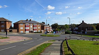
Longlands is an area of South East London that straddles the boundary of both the London Borough of Bexley and the Royal Borough of Greenwich. It lies north west of Sidcup and south east of Eltham.

Wyncham Stream is a small river within the London Boroughs of Bexley and Bromley in southeast London, England, United Kingdom. It is 5.6 km (3.5 mi) in length and is a tributary of the River Shuttle.
Ruxley is a rural settlement of South East London, England that straddles the boundary of the London Boroughs of Bromley and Bexley. It is located 13 miles southeast of Charing Cross, the traditional centre of London, in the Metropolitan Green Belt between Sidcup and Swanley and is also adjacent to the Greater London border with the county of Kent.

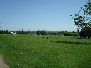
Foots Cray Meadows is an area of parkland and woodland 97 hectares in size, within the London Borough of Bexley, England. It borders the suburbs of Albany Park, Sidcup, Foots Cray, North Cray and Ruxley. The River Cray runs through it in a north-easterly direction. The London Loop, a public recreational walking path around London, also known as the "M25 for walkers", runs through the meadows parallel to the river from Sidcup Place, just south of the meadows. Two notable bridges cross the River Cray in the meadows: Five Arches bridge and the smaller Penny Farthing Bridge.

Mutton Brook is a stream which runs between East Finchley and Hendon in the London Borough of Barnet. It is a tributary of the River Brent, which is itself a tributary of the River Thames.

Avery Hill is an area of South East London mainly within Royal Borough of Greenwich, and with some parts in the London Borough of Bexley. It is located east of Eltham and north west of Sidcup. It is believed that the area is named after an aviary formerly located in the area.

St Botolph's Church is a church building in Ruxley, in the London Borough of Bromley, southeast London, England. It was constructed in the thirteenth century and dedicated to Botwulf of Thorney. St Botolph's was used as a church for around 300 years but was deconsecrated in 1557. The church was then used a farm building for over 400 years and the remains of an oast house are still adjacent to it. In the 1960s archaeological work was carried out on the site and found evidence of an older wooden building, suggesting there may have been an older Saxon church in the same location. Today the church is a Grade II listed building and a scheduled ancient monument on the grounds of Ruxley Manor Garden Centre, although many features are still intact, the church is in disrepair and English Heritage have agreed to pay a grant to help preserve the building.

