
The River Tean is a small river in the English county of Staffordshire. [2]
The River Tean is a small river in the English county of Staffordshire. [2]
This short river is a tributary of the River Dove; running 14.6 miles (23.5 km) south-east from its source at Dilhorne [3] to its confluence with the Dove east of Uttoxeter.
The following settlements are located along the river
Water levels are measured at two locations, Upper Tean [4] and Leasows Farm north of Uttoxeter. [5]
The river is subject to pollution from a range of diffuse and point sources, including sewage discharge, urban development and poor livestock management. [6] Environment Agency data shows that in 2023, the river was polluted by Severn Trent Water on 106 occasions, totaling 335 hours of continuous discharge. [7] Discharges along the river had steadily decreased between 2020 and 2022 but increased in 2023. Historic and ongoing pollution has led to a complete kill of a four mile stretch of the river below the Severn Trent Water sewage treatment plant at Checkley.[ citation needed ] Published Event Duration Monitoring (EDM) data shows that raw sewage discharges from the Combined Sewer Outfalls (CSO) are increasing in frequency, even during dry periods.[ citation needed ]
At least one angling club operates along the river, which supports populations of grayling and brown trout, with lesser numbers of river chub, common dace and Perch. Stretches of the river are suitable for fly fishing. [8]

The Trent is the third longest river in the United Kingdom. Its source is in Staffordshire, on the southern edge of Biddulph Moor. It flows through and drains the North Midlands into the Humber Estuary. The river is known for dramatic flooding after storms and spring snowmelt, which in the past often caused the river to change course.

The River Dearne South Yorkshire, England flows roughly east for more than 30 kilometres (19 mi), from its source just inside West Yorkshire. It flows through Denby Dale, Clayton West, Darton, Barnsley, Darfield, Wath upon Dearne, Bolton on Dearne, Adwick upon Dearne and Mexborough to its confluence with the River Don at Denaby Main. Its main tributary is the River Dove, which joins it at Darfield. The river was one of those affected by the 2007 United Kingdom floods.
Severn Trent plc is a water company based in Coventry, England. It supplies 4.6 million households and business across the Midlands and Wales.

The River Rother, a waterway in the northern midlands of England, gives its name to the town of Rotherham and to the Rother Valley parliamentary constituency. It rises in Pilsley in Derbyshire and flows in a generally northwards direction through the centre of Chesterfield, where it feeds the Chesterfield Canal, and on through the Rother Valley Country Park and several districts of Sheffield before joining the River Don at Rotherham in Yorkshire. Historically, it powered mills, mainly corn or flour mills, but most had ceased to operate by the early 20th century, and few of the mill buildings survive.

The River Wandle is a right-bank tributary of the River Thames in south London, England. With a total length of about 9 miles (14 km), the river passes through the London boroughs of Croydon, Sutton, Merton and Wandsworth, where it reaches the Thames. A short headwater – the Caterham Bourne – is partially in Surrey, the historic county of the river's catchment. Tributaries of the Wandle include Carshalton Ponds and Norbury Brook.

The River Ryton is a tributary of the River Idle. It rises close to the Chesterfield Canal near Kiveton Park, and is joined by a series of tributaries near Lindrick Common in the Metropolitan Borough of Rotherham, South Yorkshire, England. Most of its course is in Nottinghamshire, flowing through the town of Worksop. It meanders northwards to join the River Idle near the town of Bawtry on the South Yorkshire-Nottinghamshire border.

The River Dove is the principal river of the southwestern Peak District, in the Midlands of England, and is around 45 miles (72 km) in length. It rises on Axe Edge Moor near Buxton and flows generally south to its confluence with the River Trent at Newton Solney. From there, its waters reach the North Sea via the Humber Estuary. For almost its entire course it forms the boundary between the counties of Staffordshire and Derbyshire. The river meanders past Longnor and Hartington and cuts through a set of deep limestone gorges, Beresford Dale, Wolfscote Dale, Milldale and Dovedale.

Stone was a constituency in Staffordshire in the House of Commons of the UK Parliament. It was represented since its 1997 recreation by Sir Bill Cash, a Conservative. On 9 June 2023, he announced his intention to stand down at the 2024 general election.

The River Perry is a river in Shropshire, England. It rises near Oswestry and flows south to meet the River Severn above Shrewsbury. Along its 24 miles (39 km) length, its level drops by some 320 feet (95 m). The channel has been heavily engineered, both to enable water mills to be powered by it, and to improve the drainage of the surrounding land. There were at least seven corn mills in the 1880s, and the last one remained operational until 1966. The middle section of the river crosses Baggy Moor, where major improvements were made in 1777 to drain the moor. The scheme was one of the largest to enclose and improve land in North Shropshire, and the quality of the reclaimed land justified the high cost. A section of the river bed was lowered in the 1980s, to continue the process.

The River Vyrnwy flows through northern Powys, Wales, and Shropshire, England. The name derives from Severn, the river of which it is a tributary.

The River Allen is a river in the English county of Northumberland. The river has its sources in the hills of the Northern Pennines, and is formed by the confluence of the East and West Allen rivers. The Allen is itself, a tributary of the River Tyne. The Allen was formerly very polluted from mining activity upstream, but remediation schemes have been implemented to allow the water quality to improve.
Severn Trent Water Authority was one of ten regional water authorities established in 1974. Its area of operation was the catchments of the River Trent and River Severn. It assumed the powers and responsibilities of existing water supply authorities in those catchment areas, the Severn River Authority, the Trent River Authority and the sewage and sewage disposal responsibilities of the councils within its area.

Hollington is a village in the civil parish of Checkley, in the Staffordshire Moorlands district in Staffordshire, England. There are several villages of this name, including Hollington, Derbyshire a few miles to the east in the county of Derbyshire.

The Heath is a village in the East Staffordshire borough of Staffordshire, England. It is close to the border with Derbyshire. The village adjoins the town of Uttoxeter and the villages of Bramshall and Spath.
A regional water authority, commonly known as a water board, was one of a group of public bodies that came into existence in England and Wales in April 1974, as a result of the Water Act 1973 coming into force. This brought together in ten regional units a diverse range of bodies involved in water treatment and supply, sewage disposal, land drainage, river pollution and fisheries. They lasted until 1989, when the water industry was privatised and the water supply and sewerage and sewage disposal parts became companies and the regulatory arm formed the National Rivers Authority. Regional water authorities were also part of the Scottish water industry when three bodies covering the North, West and East of Scotland were created in 1996, to take over responsibilities for water supply and sewage treatment from the regional councils, but they only lasted until 2002, when they were replaced by the publicly owned Scottish Water.
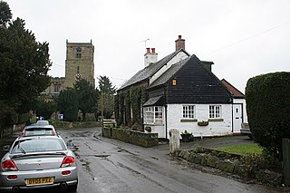
Checkley is a village and civil parish in the district of Staffordshire Moorlands in the English county of Staffordshire.

Totmonslow is a hundred in the county of Staffordshire, England. The hundred is in the north-east of Staffordshire and is named after the hamlet of the same name, which is a half mile east of Draycott in the Moors. The hamlet was the seat of the hundred court.

Lyme Brook is a tributary stream of the River Trent, which flows through Newcastle-under-Lyme, and the outlying areas of Stoke-on-Trent in Staffordshire, England.
52°54′24″N1°50′39″W / 52.9068°N 1.8441°W
| | This Staffordshire location article is a stub. You can help Wikipedia by expanding it. |