Gallery
 Oak trees over 100 years old line the entrance to Riverland Terrace
 The Wappoo Cut which borders one side of neighborhood
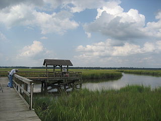
 Plymouth Park
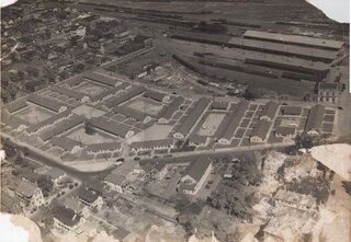
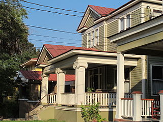
Riverland Terrace is a historic neighborhood in Charleston, South Carolina. It was first developed starting in 1925. [1] It is one of James Island, South Carolina's oldest neighborhoods. The Terrace is located 10 minutes west of downtown Charleston along Wappoo Creek and the inland waterway. The neighborhood boasts a public boat landing, Charleston Municipal Golf Course, a playground, five restaurants and numerous antique shops.
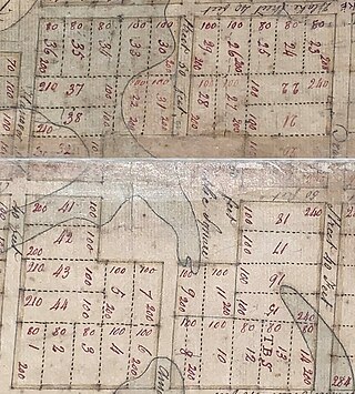
Edisto Realty Co. (a company owned by C. Bissell Jenkins and his three sons) announced its plans to immediately start laying plans for the development of 85 to 90 acres on James Island in October 1925. W.C. Wilbur & Co. was the real estate agency for the developer and offered special reduced pricing ($700 to $1750) on the original 229 lots for the first few weeks until November 10, 1925. The development included 13 commercial lots among the residential properties. The development did not follow a traditional grid layout but instead had winding streets. [2] The development is bordered to the north by the Wappoo Cut, and two man-made lakes were created out of inlets from the Wappoo Cut. [3]
The first houses were completed in May 1926. [4]
Leading into the neighborhood is the historic Avenue of Oaks, consisting of 73 live oak trees believed to be over 100 years old. The avenue of oaks had been begun about 1910, and the developers completed the installation of the oaks during the landscaping of the neighborhood starting in 1925. [5] In 2017, neighborhood residents had issues with the local electrical company cutting down trees unnecessarily. [6]
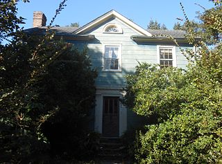
The Terrace consists of approximately 800 homes. Fort Pemberton, a Civil War fortification built in 1862, remains today.


James Island is a town in Charleston County, South Carolina, United States. It is located in the central and southern parts of James Island. James Island is included within the Charleston-North Charleston-Summerville metropolitan area and the Charleston-North Charleston Urbanized Area.

Sylvan Hills is a historic intown neighborhood in southwest Atlanta, Georgia, United States.

South Carolina Highway 61 (SC 61) is a 67-mile-long (108 km) state highway in the U.S. state of South Carolina. The highway is designated on a north–south direction, but physically travels in an east–west direction, from SC 30 in Charleston to U.S. Route 78 (US 78) near Branchville. The portion of SC 61 from Church Creek Bridge and 10 miles (16 km) north is designated a National Scenic Byway.

West Ashley, or more formally, west of the Ashley, is one of the six distinct areas of the city proper of Charleston, South Carolina. As of July 2022, its estimated population was 83,996. Its name is derived from the fact that the land is west of the Ashley River.

Ashley Landing is a shopping center in Charleston, South Carolina, United States. It was the first indoor shopping mall in the West Ashley area of Charleston when the complex was fully completed in 1972. The center, located at 1401 Sam Rittenberg Boulevard at the fork of Old Towne Road was developed by Gate City Realty Company of Fort Lauderdale, Florida. Ground was broken for the complex in 1962 with Ashley Plaza opening on April 16, 1964. At its opening the shopping center consisted of J.M. Fields Department Stores joined to a Pantry Pride supermarket, built at a cost of $1.75 million and owned by Sumar Corporation of South Carolina. The locally owned Condon's Department Store, constructed adjacent to Pantry Pride as a freestanding building, became the third tenant when it opened in 1970. The center, originally known as "Ashley Plaza" was noted for its large red and white neon pylon "Ashley Plaza" sign in the center of the parking lot that remained until 1989 when it was destroyed by Hurricane Hugo.
Hampton Park Terrace is the name both of a neighborhood and a National Register district located in peninsular Charleston, South Carolina. The neighborhood is bounded on the west by The Citadel, on the north by Hampton Park, on the east by Rutledge Ave., and on the south by Congress St. In addition, the one block of Parkwood Ave. south of Congress St. is considered, by some, to be included. The National Register district, on the other hand, is composed of the same area with two exceptions: (1) the northeasternmost block is excluded and (2) an extra block of President St. is included.

South Carolina Highway 700 (SC 700) is a 20.380-mile (32.798 km) state highway in the U.S. state of South Carolina. Known for most of its length as Maybank Highway, the state highway travels from a dead end in Rockville east to U.S. Route 17 (US 17) in Charleston. SC 700 connects Charleston with James Island, Johns Island, and Wadmalaw Island in southwestern Charleston County.

Allan Park is a park in Charleston, South Carolina. The parcel of land was donated to the City of Charleston by Amey Allan, the widow of James Allan and the developer of most of the eastern half of Hampton Park Terrace parks on the peninsula, on March 23, 1920. The park is lined with oak trees which replaced the palmetto trees in the original plans.
Concord Park is a 9.1-acre development in Charleston, South Carolina, near the Cooper River and South Carolina Aquarium. The name is used to refer to a 5.4 acre public park planned for the center of the development, the 3.7 acre mixed-use development along the north and south edges, and the overall development.
Corrine Jones Playground was formerly known as Hester Park because of its location along Hester Street in Charleston, South Carolina. The playground is located on a portion of the larger Buist Tract that had been used during World War II as housing for the influx of wartime workers.
Colonial Lake is a tidal pond in Charleston, South Carolina with wide walkways around it. The area is used as a park. For many years the lake was known as the Rutledge Street Pond; some residents still call it "The Pond." It acquired the name Colonial Lake in 1881, in honor of the "Colonial Commons" established in 1768.
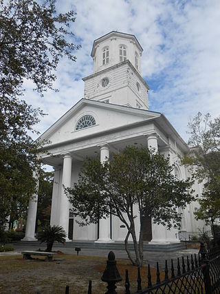
The Second Presbyterian Church is the fourth oldest church in Charleston, South Carolina.
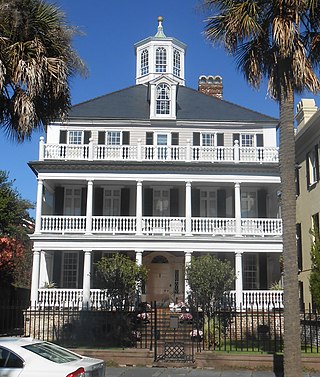
The John Ashe House is an 18th-century house at 32 South Battery, Charleston, South Carolina. The house's date of construction is unknown, but it was built sometime around 1782 and renovated in the 1930s. In August 2015, it replaced the James Simmons House as the most expensive house sold in Charleston when it sold for about $7.72 million.
The Wragg Borough Homes is a public housing project in Charleston, South Carolina. It is bounded by Drake Street, Chapel Street, America and Elizabeth Streets, and South Street.

The Wappoo Creek Bridge is a bridge that connects the cities of Charleston and James Island in South Carolina.
Yeamans Hall Club is a country club built on a 1100-acre tract about 12 miles from Charleston, South Carolina, in the town of Hanahan, South Carolina. It is located along the Cooper River on the site of a 17th-century plantation.
Wagener Terrace in Charleston, South Carolina is a large neighborhood made property that had been owned by Louis Dunnemann and Capt. F.W. Wagener.

Meeting Street Manor is a housing complex located in the upper Eastside in Charleston, South Carolina, and was the city's first housing development. When built in the 1930s, the development was technically two racially segregated halves with separate names. Since desegregation, both components are typically referred to as Meeting Street Manor, originally the name for the Whites-only portion.
Hampstead Mall is a public park in Charleston, South Carolina, of 140,625 square feet in the Hampstead Village neighborhood at the intersection of Columbus and America Streets.
Gadsden Green Homes is a housing complex located in the Westside neighborhood in Charleston, South Carolina. The name comes from the neighborhood which had been owned by Christopher Gadsden. The housing project was built in two stages: the eastern half was constructed in 1942 while the western half was finished in 1968.