Related Research Articles

Middlesex County is a county located in the north-central part of the U.S. state of New Jersey, extending inland from the Raritan Valley region to the northern portion of the Jersey Shore. As of the 2020 United States census, the county was the state's third-most populous county with a population of 863,162, its highest decennial count ever and an increase of 53,304 (+6.6%) from the 2010 census count of 809,858, which in turn reflected an increase of 59,696 (8.0%) from the 750,162 counted in the 2000 census. Middlesex is part of the New York metropolitan area. Many communities within the county serve as commuter towns to and from New York City and other points north. The county is part of the Central Jersey region of the state.

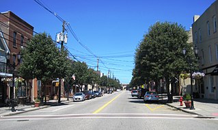
Riverton is a borough located in Burlington County, in the U.S. state of New Jersey. As of the 2020 United States census, the borough's population was 2,764, a decrease of 15 (−.5%) from the 2010 census count of 2,779, which in turn reflected an increase of 20 (+0.7%) from the 2,759 counted in the 2000 census. The borough, and all of Burlington County, is a part of the Philadelphia-Reading-Camden combined statistical area and the Delaware Valley.

Laurence Harbor is an unincorporated community and census-designated place (CDP) located along Raritan Bay within Old Bridge Township, Middlesex County, New Jersey, United States. As of the 2020 United States census, the CDP's population was 6,635, an increase of 99 (+1.5%) from the 6,536 recorded at the 2010 census, which in turn reflected an increase of 309 (+5.0%) from the 6,227 counted in the 2000 census.

Perth Amboy is a city in northeastern Middlesex County, in the U.S. state of New Jersey, within the New York metropolitan area. As of the 2020 United States census, the city's population was 55,436. Perth Amboy is known as the "City by the Bay", referring to its location adjoining Raritan Bay.

Sayreville is a borough in Middlesex County, in the U.S. state of New Jersey. Sayreville is within the heart of the Raritan Valley region, located on the south banks of the Raritan River, and also located on the Raritan Bay. As of the 2020 United States census, the borough's population was 45,345, an increase of 2,641 (+6.2%) from the 2010 census count of 42,704, which in turn reflected an increase of 2,327 (+5.8%) from the 40,377 counted in the 2000 census.

South Amboy is a suburban city in Middlesex County, in the U.S. state of New Jersey, located on Raritan Bay. As of the 2020 United States census, the city's population was 9,411, an increase of 780 (+9.0%) from the 2010 census count of 8,631, which in turn reflected an increase of 718 (+9.1%) from the 7,913 counted in the 2000 census.

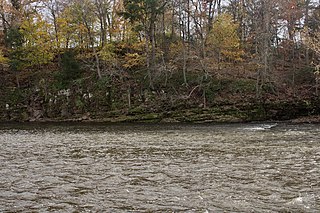
The Raritan River is a river of the U.S. state of New Jersey. Its watershed drains much of the central region of the state, emptying into the Raritan Bay near Staten Island on the Atlantic Ocean.

The Garden State Parkway (GSP) is a controlled-access toll road that stretches the north–south length of eastern New Jersey from the state's southernmost tip near Cape May north to the New York state line at Montvale. Its name refers to New Jersey's nickname, the "Garden State". The parkway has an unsigned reference number of Route 444 by the New Jersey Department of Transportation (NJDOT). At its north end, the road becomes the Garden State Parkway Connector, a component of the New York State Thruway system that connects to the Thruway mainline in Ramapo, New York.

The Governor Alfred E. Driscoll Bridge, is a bridge on the Garden State Parkway in the U.S. state of New Jersey, spanning the Raritan River near its mouth in Raritan Bay. The bridge connects the Middlesex County communities of Woodbridge Township on the north with Sayreville on the south. With a total of 15 travel lanes and 6 shoulder lanes, it is one of the world's widest and busiest motor vehicle bridges. Only 30 feet east of the Driscoll Bridge is the Edison Bridge, which carries U.S. Route 9. The bridge offers views of some of the taller buildings in the Lower Manhattan skyline, the New Brunswick skyline, the Verrazzano-Narrows Bridge, and the Outerbridge Crossing.
George E. Norcross III is an American businessman, organizer, and political boss. A member of the Democratic Party, Norcross is considered a power broker in southern New Jersey.

Central Jersey, or Central New Jersey, is the middle region of the U.S. state of New Jersey. The designation Central Jersey is a distinct administrative toponym. While New Jersey is often divided into North Jersey and South Jersey, many residents recognize Central Jersey as a distinct third entity. As of the 2020 census, Central Jersey has a population of 3,580,999.

Keasbey is a census-designated place (CDP) and unincorporated community in Woodbridge Township, Middlesex County, New Jersey, United States. It is located in the western outskirts of adjacent Perth Amboy. As of the 2020 census, the CDP's population was 3,027. Many Hispanic / Latino families have relocated from Perth Amboy to Keasbey.

The Starland Ballroom is a concert venue located in Sayreville, New Jersey. Beginning in the 1960s, the building was known as the Jernee Mill Inn, a local bar with a banquet hall. It was originally known as the Hunka Bunka Ballroom and then Willy's in the 1980s. It has operated as a dance music club but more often hosted concerts with primarily metal, punk and ska lineups.

The Raritan Bayshore is a region in central sections in the state of New Jersey. It is the area around Raritan Bay from The Amboys to Sandy Hook, in Middlesex and Monmouth counties, including the towns of Perth Amboy, South Amboy, Sayreville, Old Bridge, Matawan, Aberdeen, Keyport, Union Beach, Hazlet, Keansburg, Middletown, Atlantic Highlands, and Highlands. It is the northernmost part of the Jersey Shore, located just south of New York City. At Keansburg is a traditional amusement park while at Sandy Hook are found ocean beaches. The Sadowski Parkway beach area in Perth Amboy, which lies at the mouth of the Raritan River, was deemed the "Riviera of New Jersey" by local government. In recent years many of the beaches on the Bayshore area have been rediscovered and upgraded.

U.S. Route 9 (US 9) is a United States Numbered Highway in the Mid-Atlantic region of the United States, running from Laurel, Delaware, to Champlain, New York. In New Jersey, the route runs 166.80 miles (268.44 km) from the Cape May–Lewes Ferry terminal in North Cape May, Cape May County, where the ferry carries US 9 across the Delaware Bay to Lewes, Delaware, north to the George Washington Bridge in Fort Lee, Bergen County, where the route along with Interstate 95 (I-95) and US 1 continue into New York City. US 9 is the longest U.S. Highway in the state.
North Brunswick is a proposed railroad station along the Northeast Corridor (NEC) in North Brunswick, New Jersey, that will be built by New Jersey Transit Rail Operations (NJT) to serve its Northeast Corridor Line. Approved in 2013, it was planned to open in 2018 and projected to cost $30 million. It is one of several projects along the "New Jersey Speedway" section of the NEC.
Joseph Barry is an American real estate developer and co-founder of the Applied Housing Companies and founder of the Hudson Reporter newspaper chain.

The Raritan Bay Slag Superfund Site consists of a seawall along the coast of the Raritan Bay in the Laurence Harbor section of Old Bridge Township, New Jersey, United States. The seawall itself is made of slag. In this seawall, are large concentrations of lead, antimony, arsenic, and copper. The lead in particular has contaminated the nearby soil and surface water. The slag deposits are a by-product from NL Industries, a lead smelting company, dumping its wastes in the Raritan River. The New Jersey Department of Environmental Protection (NJDEP) investigated the area and found large concentrations of metals to be dangerous to human health. The NJDEP called the United States Environmental Protection Agency (EPA) to investigate the area further, which resulted in some of the slag being physically removed and the toxic areas being fenced off.

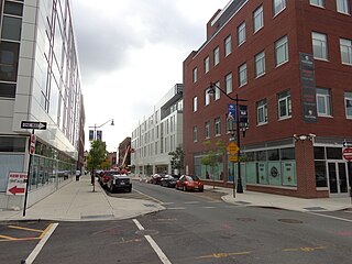
Teachers Village is a neighborhood centered around Halsey Street in Newark, New Jersey. It is located in Downtown Newark in southwest quadrant of the Four Corners Historic District, south of Market Street (SoMa) in the Central Ward between the Prudential Center and Springfield/Belmont.
References
- ↑ Loyer, Susan (May 15, 2023). "'New town': What's up with the $2.5B waterfront development off the Garden State Parkway?". Courier News.
- ↑ Goldberg, Ted (October 30, 2023). "Big development planned for Sayreville site after environmental cleanup". NJ Spotlight News.
- ↑ Slesinski, James J. (2014), Along the Raritan River: South Amboy to New Brunswick, Images of America Arcadia Publishing, ISBN 9781467121545
- ↑ Martin, Antoinette (February 5, 2006). "Competing Plans to Transform a Town". The New York Times. Archived from the original on June 30, 2024. Retrieved May 29, 2024.
- ↑ Morris, Sebastian (January 4, 2020). "City Officials Approve $2.5 Billion Waterfront Development in Sayreville, New Jersey". New York YIMBY. Archived from the original on July 22, 2024. Retrieved May 29, 2024.
- ↑ Burd, Joshua (March 12, 2015). "Millennial marketplace In Sayreville, Luxury Point aspires to be mall of the next generation". NJBIZ. Archived from the original on August 23, 2023. Retrieved April 27, 2020.
- ↑ Loyer, Susan (March 16, 2018). "$2.5 billion waterfront project will create town within a town in Sayreville". My Central Jersey. Archived from the original on August 23, 2023. Retrieved May 29, 2024.
- ↑ Hurdle, Jon (March 8, 2016). "A Project Reclaims an Abandoned Stretch of New Jersey Coast". The New York Times.
- ↑ Bergeron, Tom (November 13, 2017). "$2.5B, 418-acre Sayreville development to be announced". ROI-NJ. Archived from the original on May 24, 2024. Retrieved May 29, 2024.
- ↑ Burd, Joshua (May 26, 2014). "Coming soon Sayreville's mall for millennials". NJBIZ. Archived from the original on November 30, 2023. Retrieved April 27, 2020.
- ↑ Baldwin, Carly (December 19, 2023). "Riverton Development In Sayreville Gets $400 Million In Tax Breaks". Matawan-Aberdeen, NJ Patch. Archived from the original on April 29, 2024. Retrieved April 29, 2024.