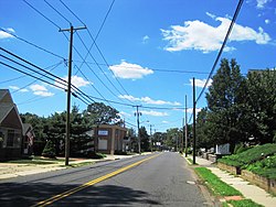
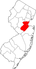
There are numerous historical and contemporary neighborhoods in Sayreville, a borough in Middlesex County, New Jersey, United States. [1] [2] [3] [4] [5] [6]
Sayreville has a total area of 18.704 square miles (48.442 km2), of which 15.842 square miles (41.030 km2) was land and 2.862 square miles (7.412 km2) was water (15.30%). [7] It is located on a peninsula shared with South Amboy, created by the Raritan River at the north, its tributary South River to the west, and the Raritan Bay to the east. [8] The original village of Sayreville has been known as Sayre's Village, Upper Sayreville, and Sayreville Proper.
Sayreville was originally settled by Europeans in the colonial era and was part the South Amboy Township formed in 1684. It seceded and incorporated as a township on April 6, 1876. The newly formed Township of Sayreville was created out of approximately 14 square miles of south of today's South Amboy consolidating the settlements at Morgan, Melrose, Ernston, and Sayre's Village under one municipal government. The area around the village was then known as Wood's Landing was renamed Sayreville after Sayre and Fisher Brick Company. Fewer than 2,000 people resided in the new township. Several areas take their name from stations along the Raritan River Railroad.[ citation needed ]
Sayreville developed into an industrial town in the late 19th century when most of the land was owned numerous clay, sand, and brick companies such the Such Clay Company, the Furman Brick Company, the Crossman Sand & Clay Company, Whitehead Brothers, and the Sayre & Fisher Brick Company, once the largest brickworks in the world. With the coming of other industries at the turn of the century such as DuPont, Hercules, and National Lead, Sayreville promoted itself as the “Home of Nationally Known Industries.” On April 2, 1919, the township was reincorporated as the Borough of Sayreville and ratified by a referendum held on April 29, 1919. [9]
According to Joseph T. Karcher, an attorney, who wrote the post-war promotional The case for Sayreville, Middlesex County, New Jersey in 1947, the borough had seven residential districts, which were separated by the large industrial complexes throughout the borough. [10] After World War II, with the sale of former clay land holdings to housing developers. President Park, a suburban subdivision, was built just after the war. [11] Sayreville's population grew from 8,000 in 1945 to over 32,000 by 1970.
Much of Sayreville's housing was built in the 1940s, 1950s, and 1960s. [12] In the 1950s many clay companies sold their land holdings and gave way new housing “developments”. [13] The largest, Laurel Park, became home to over 500 families. Other projects included Pershing Park, Deerfield Estates, Hope Homes, Parkway Homes, and Haven Village. In the 1960s more housing developments such as Woodside, Sayre Woods, and Oak Tree East and West were built. [14] In 1970s and 80s Sayreville transitioned from an industrial community to a suburb as its once vibrant industrial landscape gave way to housing developments, and as more residents commute to jobs outside of town it became more of bedroom community. By the 2000s, Sayreville's population surpassed 40,000 as brownfield land saw more housing construction.
Middlesex County is located in the north-central part of the U.S. state of New Jersey, extending inland from the Raritan Valley region to the northern portion of the Jersey Shore. As of the 2020 United States census, the county was the state's third-most populous county with a population of 863,162, its highest decennial count ever and an increase of 53,304 (+6.6%) from the 2010 census count of 809,858, which in turn reflected an increase of 59,696 (8.0%) from the 750,162 counted in the 2000 census. Middlesex is part of the New York metropolitan area. Many communities within the county serve as commuter towns to and from New York City and other points north. The county is part of the Central Jersey region of the state.
Highland Park is a borough in Middlesex County, in the U.S. state of New Jersey, in the New York City metropolitan area. The borough is located on the northern banks of the Raritan River, in the Raritan Valley region. As of the 2020 United States census, the borough's population was 15,072, an increase of 1,090 (+7.8%) from the 2010 census count of 13,982, which in turn reflected a decline of 17 (−0.1%) from the 13,999 counted in the 2000 census.
Laurence Harbor is an unincorporated community and census-designated place (CDP) located on the Raritan Bay within Old Bridge Township, in Middlesex County, in the U.S. state of New Jersey. As of the 2020 United States census, the CDP's population was 6,635, an increase of 99 (+1.5%) from the 6,536 recorded at the 2010 census, which in turn reflected an increase of 309 (+5.0%) from the 6,227 counted in the 2000 census.
Old Bridge Township is a township in Middlesex County, in the U.S. state of New Jersey, located in the Raritan Valley region and within the New York metropolitan area. As of the 2020 United States census, the township was the state's 21st-most-populous municipality, with a population of 66,876, an increase of 1,501 (+2.3%) from the 2010 census count of 65,375, which in turn reflected an increase of 4,919 (+8.1%) from the 60,456 counted in the 2000 census. As of the 2010 Census, the township was ranked 18th in the state by population, after being the state's 21st most-populous municipality in 2000. Old Bridge is a bedroom suburb of New York City located across the Raritan Bay from Staten Island, and it is about 25 miles (40 km) from Manhattan, and about 30 miles (48 km) south of Newark.
Perth Amboy is a city in northeastern Middlesex County, in the U.S. state of New Jersey, within the New York metropolitan area. As of the 2020 United States census, the city's population was 55,436. Perth Amboy is known as the "City by the Bay", referring to its location adjoining Raritan Bay.
Sayreville is a borough in Middlesex County, in the U.S. state of New Jersey. Sayreville is within the heart of the Raritan Valley region, located on the south banks of the Raritan River, and also located on the Raritan Bay. As of the 2020 United States census, the borough's population was 45,345, an increase of 2,641 (+6.2%) from the 2010 census count of 42,704, which in turn reflected an increase of 2,327 (+5.8%) from the 40,377 counted in the 2000 census.
South Amboy is a suburban city in Middlesex County, in the U.S. state of New Jersey, located on Raritan Bay. As of the 2020 United States census, the city's population was 9,411, an increase of 780 (+9.0%) from the 2010 census count of 8,631, which in turn reflected an increase of 718 (+9.1%) from the 7,913 counted in the 2000 census.
The Raritan River is a major river of New Jersey. Its watershed drains much of the mountainous area of the central part of the state, emptying into the Raritan Bay on the Atlantic Ocean.
The Raritan River Rail Road was a 12-mile (19 km) shortline railroad in Middlesex County, New Jersey U.S., Founded in 1888, it was based in South Amboy, from which it ran west as far as New Brunswick. It served both passengers and freight in its heyday and operated profitably throughout much of its existence. The Raritan River was absorbed into Conrail in 1980, becoming a branch line of Conrail Shared Assets Operations. It terminates at U.S. Route 1 in North Brunswick.
The Millstone River is a 38.6-mile-long (62.1 km) tributary of the Raritan River in central New Jersey in the United States.
New Jersey's 6th congressional district is represented by Democrat Frank Pallone, who has served the district in Congress since 1993. The district includes the northern and eastern portions of Middlesex County and the coastal areas of Monmouth County, including towns along the Raritan Bay.
The Sayre and Fisher Reading Room, in Sayreville, Middlesex County, New Jersey, United States, was constructed in 1883 for recreational use and for showcasing the Sayre and Fisher Brick Company ornamental products. Also known as Sayreville Hall, it was added to the New Jersey Register of Historic Places and National Register of Historic Places in 1979. It served as the town's unofficial library.
Melrose is a neighborhood in Sayreville in Middlesex County, New Jersey, United States. Melrose was consolidated with Ernston, Morgan, and Sayre's Village under one municipal government in 1876, when the newly formed Township of Sayreville was created from approximately 14 square miles (36 km2) of what was then South Amboy Township.
Morgan is a neighborhood in Sayreville in Middlesex County, in the U.S. state of New Jersey, named for Charles Morgan III who purchased the land on May 7, 1710.
The Runyon Watershed is a reservoir system located in Old Bridge Township, New Jersey, United States, just south of Sayreville. It is operated by the Middlesex Water Company. The 1,100 acres (450 ha) watershed area was first established in the late 1800 when it was purchased by the city of Perth Amboy, which developed a reservoir and waterworks in the 1920s, and turned over management to the company in 2003. The area is protected, with more than 500 acres of the tract are wetlands that are from development by the state's 1990 Watershed Moratorium Act A weather station in Runyon recorded a high temperature of 110 °F (43 °C) on July 10, 1936, setting the record for the hottest temperature ever recorded in New Jersey.
Sayreville Station is a neighborhood in Sayreville in Middlesex County, in the U.S. state of New Jersey. Originally terminus of Raritan River Railroad's Sayreville Branch between Upper and Lower Sayreville. The spur was abandoned in 1978.
The Horseshoe Road Complex Superfund Site in Sayreville, New Jersey is a 12-acre property located near the Raritan River. The industrial site has been out of operation since the early 1980s after a fire revealed 70 drums containing silver cyanide, ethyl acetate, and acetonitrile. The drums caught the attention of the Environmental Protection Agency (EPA) and by 1995 the Horseshoe Road Complex was on the National Priorities List. The site had three areas consisting of the Atlantic Development Corporation (ADC), Horseshoe Road Drum Dump, and Sayreville Pesticide Dump. The neighboring Atlantic Resources Corporation, the location for precious metal recovery, is addressed with the Horseshoe Road Complex (HRC) site due to the intermixing of chemical contamination. The on-site contamination is not an immediate threat to the surrounding community, although prolonged or repeated exposure to the site itself, will result in health effects. The HRC Superfund site is now in its final steps of cleanup in accordance to the EPA's plan.
Riverton is a real estate development located in Sayreville, New Jersey where the Edison Bridge and Driscoll Bridge cross the Raritan River. The site was formerly owned by National Lead.
The oldest neighborhood is Tangletown, off Main Street, where narrow two- and three-bedroom colonials built for factory workers a century ago are tightly packed along narrow, crooked lanes. Nearly half of the borough's approximately 15,500 housing units were built from 1940 to 1969.
1947: The postwar housing boom begins as borough attorney Joseph Karcher actively promotes the benefits of Sayreville, proclaiming that "the people prosper where industry prospers." With breakneck speed, the vast tracts of industrial land that separate Sayreville's seven neighborhoods are sold to housing developers. As America quickly became a suburban nation, for the first time, Sayreville's land itself became more valuable than the clay within...1950s: A great number of new housing "developments" are built throughout the sprawling borough as clay companies sell their land holdings, which had depreciated in value with the growing housing boom. Laurel Park, the largest of these developments, becomes home to over 500 families. Other new housing projects include Pershing Park, President Park, Deerfield Estates, Hope Homes, Parkway Homes, and Haven Village....1960s: More housing developments, such as Woodside, Sayre Woods, and Oak Tree East and West, raise Sayreville's population to 32,508 by the end of the decade.