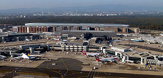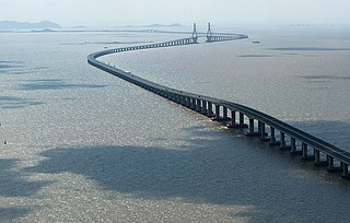
As a densely populated country in a central location in Europe and with a developed economy, Germany has a dense transport infrastructure.

Transport in Ghana is accomplished by road, rail, air and water. Ghana's transportation and communications networks are centered in the southern regions, especially the areas in which gold, cocoa, and timber are produced. The northern and central areas are connected through a major road system.

Transport in Japan is modern and highly developed. Japan's transport sector stands out for its energy efficiency: it uses less energy per person compared to other countries, thanks to a high share of rail transport and low overall travel distances. Transport in Japan is also very expensive in international comparison, reflecting high tolls and taxes, particularly on automobile transport. Japan's spending on roads has been large. The 1,200,000 kilometres (750,000 mi) of paved road are the main means of transport. Traffic in Japan drives on the left. A single network of high-speed, divided, limited-access toll roads connects major cities, which are operated by toll-collecting enterprises.

Transport in China has experienced major growth and expansion in recent years. Although China's transport system comprises a vast network of transport nodes across its huge territory, the nodes tend to concentrate in the more economically developed coastal areas and inland cities along major rivers. The physical state and comprehensiveness of China's transport infrastructure tend to vary widely by geography. While remote, rural areas still largely depend on non-mechanized means of transport, urban areas boast a wide variety of modern options, including a maglev system connecting the city center of Shanghai with Shanghai Pudong International Airport. Airports, roads, and railway construction will provide a massive employment boost in China over the next decade.
Transportation in South Korea is provided by extensive networks of railways, highways, bus routes, ferry services and air routes that traverse the country. South Korea is the third country in the world to operate a maglev train, which is an automatically run people mover at Incheon International Airport.

A highway is any public or private road or other public way on land. It is used for major roads, but also includes other public roads and public tracks. In the United States, it is used as an equivalent term to controlled-access highway, or a translation for Autobahn, autostrada, autoroute, etc.

Highways in Australia are generally high capacity roads managed by state and territory government agencies, though Australia's federal government contributes funding for important links between capital cities and major regional centres. Prior to European settlement, the earliest needs for trade and travel were met by narrow bush tracks, used by tribes of Indigenous Australians. The formal construction of roads began in 1788, after the founding of the colony of New South Wales, and a network of three major roads across the colony emerged by the 1820s. Similar road networks were established in the other colonies of Australia. Road construction programs in the early 19th century were generally underfunded, as they were dependent on government budgets, loans, and tolls; while there was a huge increase in road usage, due to the Australian gold rushes. Local government authorities, often known as Road Boards, were therefore established to be primarily responsible for funding and undertaking road construction and maintenance. The early 1900s saw both the increasingly widespread use of motorised transportation, and the creation of state road authorities in each state, between 1913 and 1926. These authorities managed each state's road network, with the main arterial roads controlled and maintained by the state, and other roads remaining the responsibility of local governments. The federal government became involved in road funding in the 1920s, distributing funding to the states. The depression of the 1930s slowed the funding and development of the major road network until the onset on World War II. Supply roads leading to the north of the country were considered vital, resulting in the construction of Barkly, Stuart, and Eyre Highways.

Expressways in South Korea, officially called as National expressways, are owned by the government, and operated mostly by the Korea Expressway Corporation, and to a less extent by the private sector. They were originally numbered in order of construction. Since August 24, 2001, they have been numbered in a scheme somewhat similar to that of the Interstate Highway System in the United States; the icons of the South Korean Expressways are notably similar to those in the United States because they are shaped like U.S. Highway shields and colored like Interstate shields with red, white, and blue, the colors of the flag of South Korea.

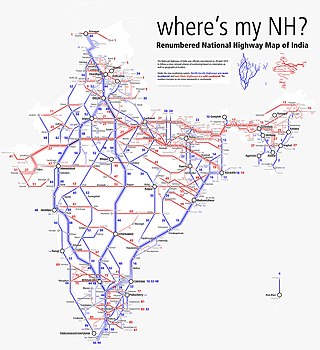
The National highways in India are a network of trunk roads owned by the Ministry of Road Transport and Highways. National highways have flyover access or some controlled-access, where entrance and exit is through the side of the flyover. At each highway intersection, flyovers are provided to bypass the traffic on the city, town, or village. These highways are designed for speeds of 100 km/h. Some national highways have interchanges in between, but do not have total controlled-access throughout the highways. The highways are constructed and managed by the Central Public Works Department (CPWD), the National Highways and Infrastructure Development Corporation Limited (NHIDCL), and the public works departments (PWD) of state governments. Currently, the longest National Highway in India is National Highway 44 at 4,112 km. India started four laning of major national highways with the National Highway Development Project (NHDP). As of March 2022 India have approximately 35,000 km of four laned National highways.

The China National Highways (CNH/Guodao) is a network of trunk roads across mainland China. Apart from the expressways of China that are planned and constructed later, most of the CNH are not controlled-access highways.

The Flinders Highway is a highway that crosses Queensland east to west, from Townsville on the Pacific coast to Cloncurry. The road continues as the Barkly Highway from Cloncurry to the Northern Territory border at Camooweal and beyond. The Flinders Highway passes a number of small outback towns and typical outback landscape predominates towards the inland. It was known as National Route 78 before Queensland began to convert to the alphanumeric system being adopted in Australia and is now designated as A6. The highway is also known as Overlanders Way. Its entire length is part of the National Land Transport Network.

The expressways of Japan make up a large network of controlled-access toll expressways.

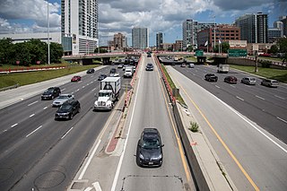
A controlled-access highway is a type of highway that has been designed for high-speed vehicular traffic, with all traffic flow—ingress and egress—regulated. Common English terms are freeway, motorway, and expressway. Other similar terms include throughway or thruway and parkway. Some of these may be limited-access highways, although this term can also refer to a class of highways with somewhat less isolation from other traffic.

National Route 16 is a national highway in Japan. A beltway around Tokyo, it links the major prefectural capital cities of Yokohama, Saitama, and Chiba as well as Hachiōji. It also serves Yokosuka and Sagamihara, Kasukabe, and Kisarazu. The total length is 241 km.

Transport in Sydney is provided by an extensive network of public transport operating modes including metro, train, bus, ferry and light rail, as well as an expansive network of roadways, cycleways and airports. According to the 2006 census, in terms of travel to work or study Sydney has the highest rate of public transport usage among the Australian capital cities of 26.3% with more than 80% of weekday trips to/from Central Sydney being made by public transport. According to the New South Wales State Plan, the state has Australia's largest public transport system. The public transport network is regulated by Transport for NSW.

As the third largest and second most populous country in Latin America, Mexico has developed an extensive transportation network to meet the needs of the economy. As with communications, transportation in Mexico is regulated by the Secretariat of Communications and Transportation, a federal executive cabinet branch.

The Ministry of Road Transport and Highways (MoRTH) is a ministry of the Government of India, that is the apex body for formulation and administration of the rules, regulations and laws relating to road transport, transport research and in also to increase the mobility and efficiency of the road transport system in India. Through its officers of Central Engineering Services (Roads) cadre it is responsible for the development of National Highways of the country. Road transport is a critical infrastructure for economic development of the country. It influences the pace, structure and pattern of development. In India, roads are used to transport over 60 percent of the total goods and 85 percent of the passenger traffic. Hence, development of this sector is of paramount importance for India and accounts for a significant part in the budget.

Roads in North Korea are classified into seven levels: motorways, and roads from level 1 to 6. Roads are the secondary means of transport in North Korea, after rail transport. The road network is underdeveloped. Roads are generally in poor condition, are little used and only a small part of the network is paved.
The Philippine highway network is a network of national roads owned and maintained by the Department of Public Works and Highways (DPWH) and organized into three classifications according to their function or purpose: national primary, secondary, and tertiary roads. The national roads connecting major cities are numbered from N1 to N83. They are mostly single and dual carriageways linking two or more cities.


