Provincial-level administrative divisions, or first-level administrative divisions, are the highest-level Chinese administrative divisions. There are 34 such divisions, classified as 23 provinces, four municipalities, five autonomous regions, and two Special Administrative Regions. All but Taiwan Province and a small fraction of Fujian Province are controlled by the People's Republic of China.

Expressways in South Korea, officially called as National expressways, were originally numbered in order of construction. Since August 24, 2001, they have been numbered in a scheme somewhat similar to that of the Interstate Highway System in the United States; the icons of the South Korean Expressways are notably similar to those in the United States because they are shaped like U.S. Highway shields and colored like Interstate shields with red, white and blue, the colors of the flag of South Korea.

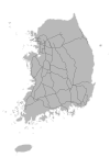
South Korea is made up of 17 first-tier administrative divisions: 6 metropolitan cities, 1 special city, 1 special autonomous city, and 9 provinces, including one special autonomous province. These are further subdivided into a variety of smaller entities, including cities, counties, districts, towns, townships, neighborhoods and villages.

The expressways of Japan make up a large network of controlled-access toll expressways.

The Isewangan Expressway is a national expressway in the Tōkai region of Japan. It is owned and operated by Central Nippon Expressway Company.

National Route 413 is a national highway of Japan connecting Fujiyoshida, Yamanashi and Sagamihara, Kanagawa in Japan, with a total length of 71.7 km (44.55 mi).

Dongpu Station is a station on Line 5 of the Guangzhou Metro. It is located underground Huangpu Avenue East (黄埔大道东) to the west of the Guangzhou Ring Road Expressway (广州环城高速公路) in the Tianhe District. It opened on 28 December 2009.
Line 18 is a Shanghai Metro line that has been under construction since May 12, 2016 with an expected completion date in 2020. The planned 44.6 km (27.7 mi) line with 30 stations will start from Changbei Road, Baoshan District, via Longyang Road to Hangtou Town, Pudong District. Line 18 will feature transfer points to lines 1, 2, 3, 6, 7, 8, 9, 10, 11, 12, 13, 14 and 16. The first phase will be 36.13 km (22.45 mi) long and run from South Changjiang Road station to Hangtou with 26 stations. The second phase is planned to extend the line northwest 7 km (4.3 mi) and add five new stations. Proposals to extend the line further west are under consideration.
South Korea has a nationwide system of national highways, officially called as General national highways, distinct from the expressways. The Ministry of Land, Transport and Maritime Affairs and other government agencies administer the national highways.

Urban expressways are intra-city expressways which are found in many of Japan's largest urban areas. Due to lack of space many of these expressways are constructed as viaducts running above local roads. The two largest networks are the Shuto Expressway in the Tokyo area and the Hanshin Expressway in the Osaka area. There are other smaller networks in Nagoya, Hiroshima, Kitakyūshū, and Fukuoka. Each network is managed separately from each other.

The Erenhot–Guangzhou Expressway, commonly referred to as the Erguang Expressway is an expressway that connects the cities of Erenhot, Inner Mongolia, and Guangzhou, Guangdong. When fully complete, it will be 2,685 km (1,668 mi) in length.

The Hong Kong Japanese School and Japanese International School (HKJS&JIS) is a Japanese international school in Hong Kong. It consists of a Japanese section and international section. The Hong Kong Japanese School Limited operates the school system.

The Kaohsiung Japanese School is a Japanese international school located on the campus of Kaohsiung Municipal Lingya District Jhong-Jheng Elementary School (高雄市苓雅區中正國民小學) in Lingya District, Kaohsiung, Taiwan in the Republic of China.
Line 4 of Ningbo Rail Transit is a rapid transit line under construction in Ningbo. It starts from Cicheng Town, Jiangbei District, and ends near Dongqian Lake in Yinzhou District. The project was approved on November 5, 2013 with the first phase is expected to open in 2020. Construction of Line 4 started in 2011 with the groundbreaking of the North Ring Elevated Expressway with the second deck of the structure being used for Line 4 trains. The rest of the line started construction on November 30, 2015. The line will initially use 36 sets of six car B-type trains with a maximum service speed of 80 km/h.
In South Korea, highways that are managed by the provincial governments are called Local highways. Usually route numbers have 2~4 digits; the first digit stands for the main province of its manager.
There are some Special Metropolitan City roads in Seoul. Basically in South Korea, urban municipalities maintain and designate highway routes. In Seoul, some of these routes are designated as motorways not allowed to walk. The numbering system of Seoul is complicated than the others: official number and guide number. Basically, official numbering system is used in the legal system only, while guide numbering system is used not only for the signage system, but also widely in public.

Chengdu Bus Rapid Transit is a Bus Rapid Transit system in Chengdu, the capital of Sichuan Province in the People's Republic of China. The current system consists of a loop line integrated with the Chengdu Second Ring Road with dedicated bus lanes running in the center two lanes of the expressway. Transfers are available to several Chengdu Metro stations. The line began a free trial run on May 31, 2013, and started official operation on June 11, 2013. It has 29 center platform stations located in expressway median which requires special buses with the doors on the left. The loop is served by Lines K1, K1A, K2 and K2A. All buses have wifi. A new 7.8 km (4.8 mi) radial line heading northeast from the BRT loop to Qingbaijiang District is under construction. The line, called the Fenghuang Shan BRT, is scheduled to open in 2017. Another 4.5 km (2.8 mi) elevated BRT line heading south of the BRT loop is also currently under constriction. This line is known as the Jiannan Avenue BRT and is projected to open in 2018. Additional BRT lines are planned to radiate from the loop with lines heading west to Wenjiang District, east via Shanbanqiao Road and south to Tianfu New Area. Additionally another BRT loop along the Third Ring Road was proposed.