
On March 27, 1980, a series of volcanic explosions and pyroclastic flows began at Mount St. Helens in Skamania County, Washington, United States. A series of phreatic blasts occurred from the summit and escalated until a major explosive eruption took place on May 18, 1980, at 8:32 am. The eruption, which had a volcanic explosivity index of 5, was the first to occur in the contiguous United States since the much smaller 1915 eruption of Lassen Peak in California. It has often been declared the most disastrous volcanic eruption in U.S. history.

Capitol Hill elev. 203m, is a hill in the city of Burnaby, British Columbia, Canada, and also is the name of the neighbourhood spanning the summit of the hill. Standing on the north side of Hastings Street and bounded by Willingdon Avenue to the west and Fell Avenue in the east, this neighbourhood is known for its Italian, Portuguese, and Croatian expat communities as well as being a student area associated with the nearby Simon Fraser University.

Indian Arm is a steep-sided glacial fjord adjacent to the city of Vancouver in southwestern British Columbia. Formed during the last Ice Age, it extends due north from Burrard Inlet, between the communities of Belcarra and the District of North Vancouver, then on into mountainous wilderness. Burrard Inlet and the opening of Indian Arm was mapped by Captain George Vancouver and fully explored days later by Dionisio Alcalá Galiano in June 1792.

Point Isabel Regional Shoreline in Richmond, California, is operated by East Bay Regional Park District, and is a multi-use park for joggers, windsurfers, kayakers, photographers, picnickers, and people walking dogs. It has access for pedestrians and via public transit, private vehicles, and bikes. It also features a concession offering food for people and grooming for pets. A longtime community organization and nonprofit, Point Isabel Dog Owners and Friends (PIDO), is active in the maintenance and improvement of the park.
North Burnaby is a general name for a large neighbourhood in the City of Burnaby, British Columbia, that includes a number of smaller ones. It stretches from Boundary Road in the west to Burnaby Mountain with Simon Fraser University in the east and is bounded by Burrard Inlet to the north and the Lougheed Highway to the south. It is a desirable place to live for many local and immigrant families, which is reflected by real-estate prices that keep climbing and have doubled in the last 15 years.
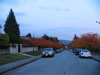
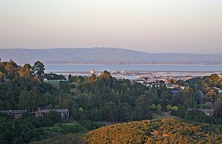
Parkcrest is a hillside neighbourhood in North Burnaby, British Columbia adjacent to Kensington Park which gave it its name. It has a long rectangular shape stretched north to south and is bounded by Springer Avenue to the west and Kensington Avenue to the east. To the north its border runs along Hastings Street, its southern border lies along the Lougheed Highway and Skytrain tracks. Its elevation gradually lowers to the south and ends up in Central Valley, quite low above the level of Burnaby Lake.
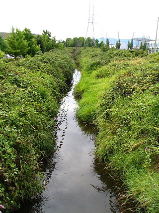
Still Creek is a long stream flowing across Central Burnaby, British Columbia and into Burnaby Lake. Still Creek's path lies mainly through the industrial area which contributes to its high level of pollution, although through dedicated work of local volunteers the creek is slowly recovering.

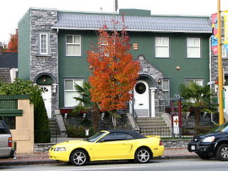
Montecito, for administrative and planning purposes also known as "Sperling-Broadway", is a neighbourhood in Burnaby, British Columbia, Canada.

Willingdon Heights is a neighbourhood in Burnaby, British Columbia, Canada. It is named after a major Burnaby thoroughfare Willingdon Avenue connecting North Burnaby with Kingsway and the Metrotown area in the south. Willingdon Heights was developed significantly during construction spurred by the National Housing Act in 1944 that made mortgage money more widely available and provided joint loans for housing for veterans under the Integrated Housing Plan (IHP).

Westridge is a residential neighbourhood in Burnaby, British Columbia, Canada.

Burnaby Public Library or BPL is a public library that serves Burnaby, British Columbia and the surrounding Lower Mainland. According to its 2019–2022 strategic plan, BPL aims to "empower the community to engage with and share stories, ideas and information." BPL provides access to information services and library collections through its four branches as well as online and through community outreach.

Middle Harbor Shoreline Park (MHSP) is located on San Francisco Bay and the Oakland Seaport entrance channel, west of downtown Oakland, California. It is owned and operated by the Port of Oakland. The park entrance is at the intersection of 7th Street and Middle Harbor Road. It is open seven days a week from 8 a.m. to dusk.
The Central Valley Greenway (CVG) is a 24-kilometre pedestrian and cyclist route in Metro Vancouver, running from Science World in Vancouver to New Westminster, through Burnaby. The greenway officially opened on June 27, 2009, with opening celebrations, guided bike tours, and walking tours on sections of the route. Despite its official opening, some sections are complete on an interim basis and are anticipated to be upgraded in the future.

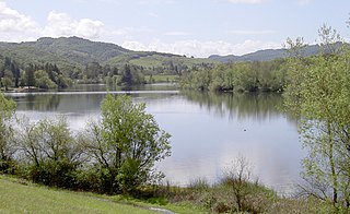
Buntzen Lake is a 4.8 kilometres (3 mi) long lake in Anmore, British Columbia, Canada, in the Greater Vancouver area. It is named after the first general manager of the B.C. Electric Co., Johannes Buntzen. There is a smaller lake just to the north named McCombe Lake.
Spring Lake Regional Park is a 320-acre (130 ha) public park in southeastern Santa Rosa, Sonoma County, California, United States. Centered on the Santa Rosa Creek Reservoir, the park is administered by the Sonoma County Regional Parks Department. Its coordinates are 38.45°N 122.65°W, and its official address is 391 Violetti Drive.
Pulgas Ridge Open Space Preserve is a public recreation area in the Santa Cruz Mountains, San Mateo County in northern California. It is managed by the Midpeninsula Regional Open Space District (MROSD).
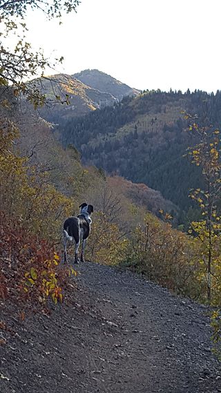
Millcreek Canyon is a canyon in the Wasatch Mountains and part of Millcreek City on the east side of the Salt Lake Valley, Utah. It is a popular recreation area both in the summer and in the winter. It was named by Brigham Young on August 22, 1847, before all of the mills that were built in and below the densely forested canyon. It is home to two restaurants and six Boy Scout Day Camps.

Oyster Bay Regional Shoreline is a park in San Leandro, California, part of the East Bay Regional Park District (EBRPD). It is located along the eastern shore of San Francisco Bay directly to the south of Oakland International Airport. The property was originally used as a landfill for 37 years, until it was filled to capacity in 1977, when it was capped with a clay cover. EBRPD bought the property in 1980, intending to use it as a park.
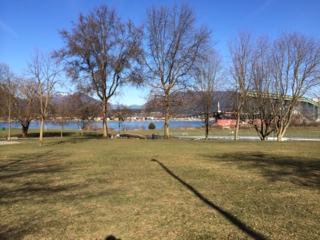
Fraser Mills was a municipality in British Columbia on the north bank of the Fraser River that was incorporated in 1913, but has since amalgamated with the City of Coquitlam.
Located in the Hastings-Sunrise district of Vancouver, British Columbia, Canada, New Brighton Park is a waterfront park facing the North Shore Mountains with beach access to the Burrard Inlet. The park is surrounded by industrial plants, the Hastings Racecourse, as well as access to the Port of Vancouver. During the summer, the park becomes a popular location for recreational activity. There is a soccer pitch, tennis courts, barbecue/picnic sites, two playgrounds, beaches, and an outdoor pool. For local residents, New Brighton Park provides a nearby location with similar facilities found at other popular recreational parks such as Kitsilano Beach, which is located on the west side of Vancouver. New Brighton Park is also in the process of being connected to Hastings Park via Creekway Park, which will allow people to walk and cycle between the two locations.
 Hill Avenue and Robert Burnaby Park with a distant view of The Lions
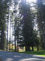 Robert Burnaby Park
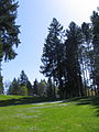 A daisy field


