
Burnaby is a city in the Lower Mainland region of British Columbia, Canada. Located in the centre of the Burrard Peninsula, it neighbours the City of Vancouver to the west, the District of North Vancouver across the confluence of the Burrard Inlet with its Indian Arm to the north, Port Moody and Coquitlam to the east, New Westminster and Surrey across the Fraser River to the southeast, and Richmond on the Lulu Island to the southwest.

Lancaster is a village in Erie County, New York, United States. As of the 2010 census, the village population was 10,352. It is part of the Buffalo-Niagara Falls metropolitan area.
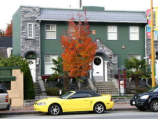
Kerrisdale is a neighbourhood in the city of Vancouver, British Columbia, Canada.

Burnaby—New Westminster was a federal electoral district in British Columbia, Canada, that was represented in the House of Commons of Canada from 2004 to 2015.

Capitol Hill, elev. 203m, is a hill in the city of Burnaby, British Columbia, Canada, and also is the name of the neighbourhood spanning the summit of the hill. Standing on the north side of Hastings Street and bounded by Willingdon Avenue to the west and Fell Avenue in the east, this neighbourhood is known for its Italian, Portuguese, and Croatian expat communities, as well as being a student area associated with the nearby Simon Fraser University.

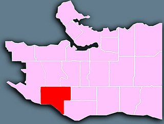
South Cambie is a neighbourhood in the city of Vancouver, British Columbia, Canada, that is generally considered one of the smallest neighbourhoods in the city, both in size and in population. It is wedged between one of the city's largest parks and the upscale neighbourhood of Shaughnessy, and is known for a large cluster of medical facilities.
North Burnaby is a general name for a large neighbourhood in the City of Burnaby, British Columbia, that includes a number of smaller ones. It stretches from Boundary Road in the west to Burnaby Mountain with Simon Fraser University in the east and is bounded by Burrard Inlet to the north and the Lougheed Highway to the south. It is a desirable place to live for many local and immigrant families, which is reflected by real-estate prices that keep climbing and have doubled in the last 15 years.
Parkcrest is a hillside neighbourhood in North Burnaby, British Columbia adjacent to Kensington Park which gave it its name. It has a long rectangular shape stretched north to south and is bounded by Springer Avenue to the west and Kensington Avenue to the east. To the north its border runs along Hastings Street, its southern border lies along the Lougheed Highway and Skytrain tracks. Its elevation gradually lowers to the south and ends up in Central Valley, quite low above the level of Burnaby Lake.
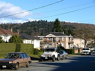
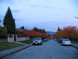
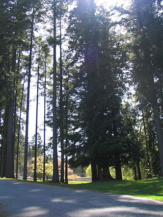
Lochdale is a single-family neighbourhood in the north-eastern part of Burnaby, near Burnaby Mountain. It lies between Kensington Ave to the west and Duthie Ave to the east. Hastings Street marks its northern limits while Halifax Street closes the rectangle in the south. Additionally, a large hillside residential area between Burnaby Mountain Parkway and Greystone Drive also belongs to Lochdale. Several major thoroughfares connecting north and south run through this neighbourhood - the earlier mentioned Kensington Avenue, Duthie Avenue, and Sperling Avenue.

Burnaby Heights, often referred to as The Heights, is a residential neighbourhood in North Burnaby. British Columbia, Canada. It is bounded by Boundary Road to the west, Gamma Avenue to the east and Hastings Street to the south. Its northern edge facing the North Shore Mountains comes down rather steeply to the shores of Burrard Inlet.
Robert Burnaby Park is a 48 hectare public park in East Burnaby, just south of Burnaby Lake, located off Edmonds and 4th Street in British Columbia, Canada. It is open all year around from dawn to dusk. It has an extensive trail system, as well as tennis courts and a swimming pool in the cleared upper slope area. The north end of the park contains the Robert Burnaby Park Disc Golf Course, one of only a handful in Metro Vancouver. It is a favourite picnic spot for many residents of Burnaby and New Westminster. Dogs are welcome in the park as long as they are on leash and are kept out of areas marked ecologically sensitive. There is also an off-leash zone for dogs in the northern part of the park. Propane barbeques as well as charcoal and open fire barbeques are allowed in the park. Hot ash can be disposed of in the ash pits within the park.
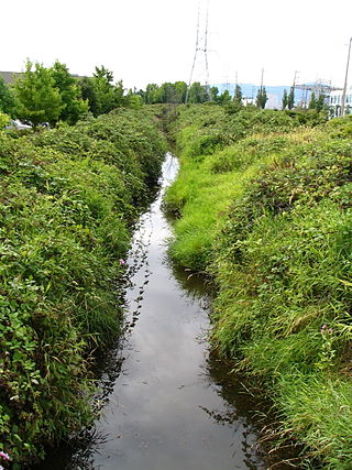
Still Creek is a long stream flowing across Central Burnaby, British Columbia and into Burnaby Lake. Still Creek's path lies mainly through the industrial area which contributes to its high level of pollution, although through dedicated work of local volunteers the creek is slowly recovering.

Squint Lake is a small lake in Burnaby, British Columbia, Canada. It is located southwest of Burnaby Mountain. Squint Lake is surrounded by Burnaby Mountain Golf Course. Squint Lake Park is to the north of the lake.

Eagle Creek is one of the most important creeks in Burnaby, British Columbia, Canada. It begins on Burnaby Mountain where it is fed by a large watershed, runs through Montecito and the nearby Squint Lake, and eventually flows into Burnaby Lake.

Willingdon Heights is a neighbourhood in Burnaby, British Columbia, Canada. It is named after a major Burnaby thoroughfare, Willingdon, Avenue connecting North Burnaby with Kingsway and the Metrotown area in the south. Willingdon Heights was developed significantly during construction spurred by the National Housing Act in 1944 that made mortgage money more widely available and provided joint loans for housing for veterans under the Integrated Housing Plan (IHP).

Westridge is a residential neighbourhood in Burnaby, British Columbia, Canada.
Upper Lonsdale is a suburban area in both the City and District of North Vancouver. This area runs north of Highway 1 to the corner of Lonsdale and Rockland. The first 5 blocks up Lonsdale Avenue are part of the City of North Vancouver, while the remaining blocks belong to the District of North Vancouver. Upper Lonsdale is the more residential part of Lonsdale Avenue, although it does have a couple of blocks of shops and services. The peak of Lonsdale Avenue sits at an elevation of 850 feet above sea level whereas Lower Lonsdale sits at sea level at some points. The bus line 230 to Upper Lonsdale and Lonsdale Quay serves the area all the way up to the end of Lonsdale Avenue, before going down Rockland Street. See Arthur Heywood-Lonsdale for the origins of the name Lonsdale.
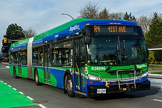
The R4 41st Ave is an express bus route with bus rapid transit elements in Metro Vancouver, British Columbia, Canada. Part of TransLink's RapidBus network, it replaced the 43 Express that travelled along 41st Avenue, a major east–west route that connects the University of British Columbia (UBC) to the SkyTrain system's Oakridge–41st Avenue station on the Canada Line and Joyce–Collingwood station on the Expo Line.
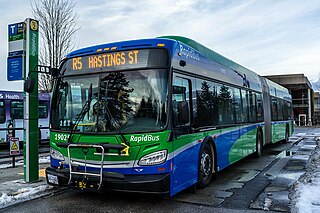
The R5 Hastings St is an express bus service with bus rapid transit elements in Metro Vancouver, Canada. Part of TransLink's RapidBus network, it travels along Hastings Street, a major east–west route, and connects Simon Fraser University to the SkyTrain system's Burrard station on the Expo Line in Downtown Vancouver. It replaced the 95 B-Line route on January 6, 2020.
Maywood is a mainly-rental low-income residential neighborhood in Burnaby, and is a part of the larger Metrotown area. The neighborhood consists of low-rise apartments built during the population boom in the Metrotown area in the 1970s, and 1980s, although the neighborhood is quickly changing with numerous highrises. Geographically, the Maywood neighbourhood's boundaries are Grange Street and Kingsway to the north, Nelson Avenue and Bennett and Bonsor Streets to the east, Imperial Street to the south and Boundary Road to the west, and it includes Central Park.

 Duthie Ave at Halifax Street
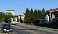 Halifax Street west of Duthie Ave
 Squint Lake in spring
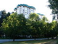 Halifax Street at Phillips Ave is the corner where several apartment and condo buildings are located


