The 97 B-Line was an express bus line in Metro Vancouver, British Columbia, Canada. It connected Coquitlam Central station on the West Coast Express system to Lougheed Town Centre station on the SkyTrain system. It was operated by Coast Mountain Bus Company and funded by TransLink. Going west, the route went along Clarke Rd., St. John's St., Ioco Rd, Guildford Way and Pinetree Way, and served Burnaby, Port Moody, and Coquitlam. The 97 B-Line was discontinued on December 18, 2016, as part of the December 2016 TransLink seasonal bus service changes, many resulting from the opening of the Evergreen Extension of the Millennium Line. The line carried 10,750 passengers on weekdays in 2011.

Capitol Hill, elev. 203m, is a hill in the city of Burnaby, British Columbia, Canada, and also is the name of the neighbourhood spanning the summit of the hill. Standing on the north side of Hastings Street and bounded by Willingdon Avenue to the west and Fell Avenue in the east, this neighbourhood is known for its Italian, Portuguese, and Croatian expat communities, as well as being a student area associated with the nearby Simon Fraser University.
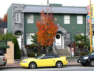
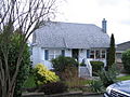
North Burnaby is a general name for a large neighbourhood in the City of Burnaby, British Columbia, that includes a number of smaller ones. It stretches from Boundary Road in the west to Burnaby Mountain with Simon Fraser University in the east and is bounded by Burrard Inlet to the north and the Lougheed Highway to the south. It is a desirable place to live for many local and immigrant families, which is reflected by real-estate prices that keep climbing and have doubled in the last 15 years.
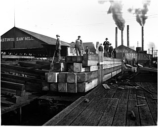
Hastings Mill was a sawmill on the south shore of Burrard Inlet and was the first commercial operation around which the settlement that would become Vancouver developed in British Columbia, Canada. Founded in 1865 by Edward Stamp, the sawmill operated until its closure in 1928.
Parkcrest is a hillside neighbourhood in North Burnaby, British Columbia adjacent to Kensington Park which gave it its name. It has a long rectangular shape stretched north to south and is bounded by Springer Avenue to the west and Kensington Avenue to the east. To the north its border runs along Hastings Street, its southern border lies along the Lougheed Highway and Skytrain tracks. Its elevation gradually lowers to the south and ends up in Central Valley, quite low above the level of Burnaby Lake.
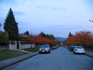
Lochdale is a single-family neighbourhood in the north-eastern part of Burnaby, near Burnaby Mountain. It lies between Kensington Ave to the west and Duthie Ave to the east. Hastings Street marks its northern limits while Halifax Street closes the rectangle in the south. Additionally, a large hillside residential area between Burnaby Mountain Parkway and Greystone Drive also belongs to Lochdale. Several major thoroughfares connecting north and south run through this neighbourhood - the earlier mentioned Kensington Avenue, Duthie Avenue, and Sperling Avenue.

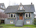
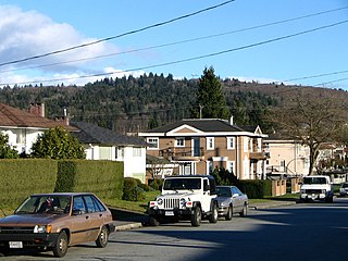
Willingdon Heights is a neighbourhood in Burnaby, British Columbia, Canada. It is named after a major Burnaby thoroughfare, Willingdon, Avenue connecting North Burnaby with Kingsway and the Metrotown area in the south. Willingdon Heights was developed significantly during construction spurred by the National Housing Act in 1944 that made mortgage money more widely available and provided joint loans for housing for veterans under the Integrated Housing Plan (IHP).
Upper Lonsdale is a suburban area in both the City and District of North Vancouver. This area runs north of Highway 1 to the corner of Lonsdale and Rockland. The first 5 blocks up Lonsdale Avenue are part of the City of North Vancouver, while the remaining blocks belong to the District of North Vancouver. Upper Lonsdale is the more residential part of Lonsdale Avenue, although it does have a couple of blocks of shops and services. The peak of Lonsdale Avenue sits at an elevation of 850 feet above sea level whereas Lower Lonsdale sits at sea level at some points. The bus line 230 to Upper Lonsdale and Lonsdale Quay serves the area all the way up to the end of Lonsdale Avenue, before going down Rockland Street. See Arthur Heywood-Lonsdale for the origins of the name Lonsdale.
James Henry Esmond Dorney was an Australian architect, known for a series of notable Streamline Moderne apartment blocks in Melbourne in the 1930s, and a series of inventive Modernist houses in Tasmania in the 1950s and 60s, where he has been credited with bringing Modernism to the island state. He is best known for the second house he built for himself in 1966, a remarkable design on a hilltop overlooking Hobart, Tasmania. Owned by the Hobart City Council since 2006, it is regularly open to the public.

Holy Trinity Church is an Anglican church in the centre of Hastings, a town and borough in the English county of East Sussex. It was built during the 1850s—a period when Hastings was growing rapidly as a seaside resort—by prolific and eccentric architect Samuel Sanders Teulon, who was "chief among the rogue architects of the mid-Victorian Gothic Revival". The Decorated/Early English-style church is distinguished by its opulently decorated interior and its layout on a difficult town-centre site, chosen after another location was found to be unsuitable. The church took eight years to build, and a planned tower was never added. English Heritage has listed the building at Grade II* for its architectural and historical importance.
St Helen's Church is the Anglican parish church of Ashby-de-la-Zouch, in the deanery of North West Leicestershire and the Diocese of Leicester. There was a church in the town in the 11th century, but the core of the present building mainly dates from work started in 1474, when the church was rebuilt by William Hastings at the same time that he converted his neighbouring manor house into a castle. The church was refurbished in about 1670 to create more space, but the large and increasing size of the congregation led to further work in 1829, and a major rebuild in 1878–80, including the widening of the nave by the addition of two outer aisles.
The Thornton Tunnel is a freight railway tunnel in Burnaby, British Columbia, running under the Willingdon Heights and Vancouver Heights neighbourhoods. It was built in 1969 by Canadian National to connect Second Narrows Bridge to the main line in Willingdon, and is 3.4 km long.
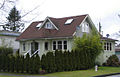
South Slope, sometimes referred to as Southern Burnaby, is a mainly single-family neighborhood in Burnaby in British Columbia, Canada, just southeast of Metrotown. It borders Suncrest, an all single-family home neighbourhood to the west, and goes as far east as Edmonds. Although the northern boundary of South Slope is Rumble Street, many residents north of the street consider themselves living in South Slope, including South Slope Elementary, and Burnaby South Secondary School. The neighbourhood gets its name from the steep slope it is located on. The neighbourhood is one of the oldest parts of the city, which can be seen be seen in Nelson Elementary, which is over a hundred years old, and dozens of Heritage Homes.
A redistribution of federal electoral districts ("ridings") began in Canada following the results of the 2021 Canadian census. The Constitution of Canada requires that federal electoral districts that compose the House of Commons undergo a redistribution of boundaries following each decennial Canadian census. The redistribution process began in October 2021; it was completed in October 2023. It is based on data obtained during the 2021 Canadian census. It is also based on the practice of giving each district only one member, which has been in effect since the 1968 election.