
Burnaby is a city in the Lower Mainland region of British Columbia, Canada. Located in the centre of the Burrard Peninsula, it neighbours the City of Vancouver to the west, the District of North Vancouver across the confluence of the Burrard Inlet with its Indian Arm to the north, Port Moody and Coquitlam to the east, New Westminster and Surrey across the Fraser River to the southeast, and Richmond on the Lulu Island to the southwest.
Highway 7, known for most of its length as the Lougheed Highway and Broadway, is an alternative route to Highway 1 through the Lower Mainland region of British Columbia. Whereas the controlled-access Highway 1 follows the southern bank of the Fraser River, Highway 7 follows the northern bank.

Lougheed Town Centre is an elevated station on the Expo and Millennium Lines of Metro Vancouver's SkyTrain rapid transit system. The station is located at Lougheed Highway and Austin Road in Burnaby, British Columbia, Canada. Initially a Millennium Line station, a reorganization of SkyTrain service patterns in 2016 brought a branch of the Expo Line over the existing tracks to serve the station. It is one of three stations where transfer between the Expo Line and the Millennium Line is possible, the other two such points of transfer being Commercial–Broadway and Production Way–University stations.

Brentwood Town Centre is an elevated station on the Millennium Line of Metro Vancouver's SkyTrain rapid transit system. The station is located above Lougheed Highway east of Willingdon Avenue in Burnaby, British Columbia, Canada. The station is adjacent to the Amazing Brentwood, a mid-size shopping centre.

Holdom is an elevated station on the Millennium Line of Metro Vancouver's SkyTrain rapid transit system. The station is located at the intersection of Lougheed Highway and Holdom Avenue in Burnaby, British Columbia, Canada. Located adjacent to the station is a residential development with two high-rise towers, low-rise units, and several commercial shops.

Sperling–Burnaby Lake is an elevated station on the Millennium Line of Metro Vancouver's SkyTrain rapid transit system. The station is located on the southeast corner of the intersection at Sperling Avenue and Lougheed Highway in Burnaby, British Columbia, Canada. The Burnaby Lake Regional Park is located nearby, from which the name of the station is partially derived.

Gilmore is an elevated station on the Millennium Line of Metro Vancouver's SkyTrain rapid transit system. The station is located on Gilmore Avenue in Burnaby, British Columbia, Canada.

The 99 B-Line is an express bus line with bus rapid transit elements in Metro Vancouver, British Columbia, Canada. It travels along Broadway, a major east–west thoroughfare, and connects the University of British Columbia (UBC) to Commercial–Broadway station on the SkyTrain system. It is operated by Coast Mountain Bus Company and funded by TransLink.

The 97 B-Line was an express bus line in Metro Vancouver, British Columbia, Canada. It connected Coquitlam Central station on the West Coast Express system to Lougheed Town Centre station on the SkyTrain system. It was operated by Coast Mountain Bus Company and funded by TransLink. Going west, the route went along Clarke Rd., St. John's St., Ioco Rd, Guildford Way and Pinetree Way, and served Burnaby, Port Moody, and Coquitlam. The 97 B-Line was discontinued on December 18, 2016, as part of the December 2016 TransLink seasonal bus service changes, many resulting from the opening of the Evergreen Extension of the Millennium Line. The line carried 10,750 passengers on weekdays in 2011.

The City of Lougheed is the second-largest shopping centre in Burnaby, British Columbia, Canada, with 57,100 square metres (615,000 sq ft) and over 160 shops and services. It opened in 1969 and is located in the northeast corner of Burnaby near the Coquitlam border. The centre is located adjacent to Lougheed Town Centre station, an interchange station that connects the Expo Line and Millennium Line of Metro Vancouver's SkyTrain rapid transit system.
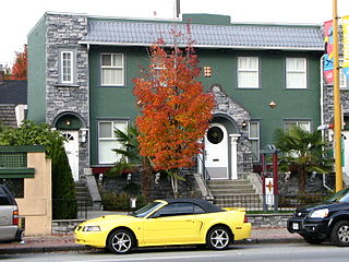
North Burnaby is a general name for a large neighbourhood in the City of Burnaby, British Columbia, that includes a number of smaller ones. It stretches from Boundary Road in the west to Burnaby Mountain with Simon Fraser University in the east and is bounded by Burrard Inlet to the north and the Lougheed Highway to the south. It is a desirable place to live for many local and immigrant families, which is reflected by real-estate prices that keep climbing and have doubled in the last 15 years.
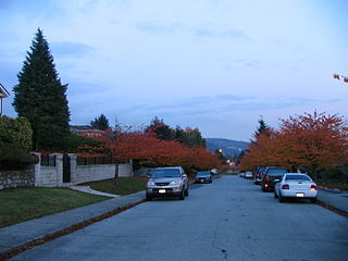
Parkcrest is a hillside neighbourhood in North Burnaby, British Columbia adjacent to Kensington Park which gave it its name. It has a long rectangular shape stretched north to south and is bounded by Springer Avenue to the west and Kensington Avenue to the east. To the north its border runs along Hastings Street, its southern border lies along the Lougheed Highway and Skytrain tracks. Its elevation gradually lowers to the south and ends up in Central Valley, quite low above the level of Burnaby Lake.
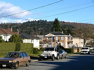
Lochdale is a single-family neighbourhood in the north-eastern part of Burnaby, near Burnaby Mountain. It lies between Kensington Ave to the west and Duthie Ave to the east. Hastings Street marks its northern limits while Halifax Street closes the rectangle in the south. Additionally, a large hillside residential area between Burnaby Mountain Parkway and Greystone Drive also belongs to Lochdale. Several major thoroughfares connecting north and south run through this neighbourhood - the earlier mentioned Kensington Avenue, Duthie Avenue, and Sperling Avenue.
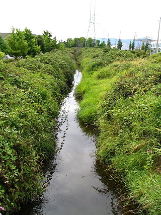
Still Creek is a long stream flowing across Central Burnaby, British Columbia and into Burnaby Lake. Still Creek's path lies mainly through the industrial area which contributes to its high level of pollution, although through dedicated work of local volunteers the creek is slowly recovering.

Willingdon Heights is a neighbourhood in Burnaby, British Columbia, Canada. It is named after a major Burnaby thoroughfare Willingdon Avenue connecting North Burnaby with Kingsway and the Metrotown area in the south. Willingdon Heights was developed significantly during construction spurred by the National Housing Act in 1944 that made mortgage money more widely available and provided joint loans for housing for veterans under the Integrated Housing Plan (IHP).

Broadway is a major east–west thoroughfare in the city of Vancouver, British Columbia, Canada. In Vancouver's numbered avenue grid system, it runs in place of a 9th Avenue, between 8th and 10th. The street has six lanes for most of its course. Portions of the street carry the British Columbia Highway 7 designation.
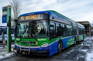
The R5 Hastings St is an express bus service with bus rapid transit elements in Metro Vancouver, Canada. Part of TransLink's RapidBus network, it travels along Hastings Street, a major east–west route, and connects Simon Fraser University to the SkyTrain system's Burrard station on the Expo Line in Downtown Vancouver. It replaced the 95 B-Line route on January 6, 2020.

Metrotown is a town centre serving the southwest quadrant of Burnaby, British Columbia, Canada. It is one of the city's four officially designated town centres, as well as one of Metro Vancouver's regional town centres. It is the central business district of the City of Burnaby.

The Amazing Brentwood is a shopping mall in Burnaby, British Columbia, Canada. It is located in the Brentwood Park area of North Burnaby, at the intersection of Willingdon Avenue and Lougheed Highway, approximately 1.5 kilometres (0.9 mi) from the city of Vancouver.


