Robert Craig Memorial Bridge

Last updated

Craig Memorial Bridge
Aerial view of Veterans' Glass City Skyway and Craig Memorial Bridge (2008).jpg
The Craig Memorial Bridge in 2008 with the Veterans' Glass City Skyway in the background
Coordinates 41°40′N83°31′W / 41.66°N 83.51°W / 41.66; -83.51 Coordinates: 41°40′N83°31′W / 41.66°N 83.51°W / 41.66; -83.51
CarriesOH-65.svg SR 65
Crosses Maumee River
Locale Toledo, Ohio
Characteristics
Design Bascule bridge
History
Construction end1956
Opened1957

The Robert Craig Memorial Bridge is a four-lane, double-leaf bascule bridge that spans the Maumee River approximately one mile downstream from downtown Toledo, Ohio. The bridge is named in memory of U.S. Army Second Lieutenant Robert Craig, a Scottish-born Toledoan who posthumously received the Medal of Honor during the Second World War.

Bascule bridge moveable bridge using a counterweight to balance a span through its upward swing to let boats move underneath

A bascule bridge is a moveable bridge with a counterweight that continuously balances a span, or "leaf", throughout its upward swing to provide clearance for boat traffic. It may be single- or double-leafed.

Maumee River river in the United States of America

The Maumee River is a river running from northeastern Indiana into northwestern Ohio and Lake Erie in the United States. It is formed at the confluence of the St. Joseph and St. Marys rivers, where Fort Wayne, Indiana, has developed, and meanders northeastwardly for 137 miles (220 km) through an agricultural region of glacial moraines before flowing into the Maumee Bay of Lake Erie. The city of Toledo is located at the mouth of the Maumee. The Maumee was designated an Ohio State Scenic River on July 18, 1974. The Maumee watershed is Ohio’s breadbasket; it is two-thirds farmland, mostly corn and soybeans. It is the largest watershed of any of the rivers feeding the Great Lakes, and supplies five percent of Lake Erie’s water.

Toledo, Ohio City in Ohio, United States

Toledo is a city in and the county seat of Lucas County, Ohio, United States. Toledo is in northwest Ohio, at the western end of Lake Erie bordering the state of Michigan. The city was founded in 1833 on the west bank of the Maumee River, and originally incorporated as part of Monroe County, Michigan Territory. It was re-founded in 1837, after conclusion of the Toledo War, when it was incorporated in Ohio.

Opening to traffic during January 1957, the Craig Memorial Bridge was notable as one of the few movable bridges on the Interstate Highway System as it carried Interstate 280 over the Maumee River shipping channel; it remained as such until the June 2007 completion of the Veterans' Glass City Skyway project. Since the re-routing of I-280, the bridge is now a local route—connecting Summit Street (on the west side of the river) to Front Street (on the east side). As such, the Craig Bridge has assumed the local role of its predecessor—an unnamed bridge that connected Ash Street to Consaul Street until its demolition following the opening of the Craig Bridge. Upon completion of the Glass City Skyway, State Route 65 was extended across the Craig Bridge from North Summit Street to Front Street. [1] [2] [3] [4] [5]

Interstate Highway System United States highway system

The Dwight D. Eisenhower National System of Interstate and Defense Highways, commonly known as the Interstate Highway System, is a network of controlled-access highways that forms part of the National Highway System in the United States. Construction of the system was authorized by the Federal Aid Highway Act of 1956. The system extends throughout the contiguous United States and has routes in Hawaii, Alaska, and Puerto Rico.

Interstate 280 (I-280) is a 12.41-mile-long highway that connects I-75 in northeast Toledo, Ohio with I-80/I-90 southeast of the city in northeastern Wood County, Ohio. Built between 1955 and 1959, the route was originally part of the Detroit-Toledo Expressway. Although first designated in 1959, the highway originally contained several at-grade intersections and other features which left it substandard to the Interstate Highway System until 1990. Further construction in 2007 built a new crossing of the Maumee River, replacing an outdated drawbridge. The highway serves as an easterly bypass of metropolitan Toledo, passing through the communities of Northwood and Oregon. It is one of two auxiliary Interstate highways serving Toledo, the other being Interstate 475.

Veterans Glass City Skyway bridge in United States of America

The Veterans' Glass City Skyway, commonly called the Toledo Skyway Bridge, is a cable-stayed bridge on Interstate 280 in Toledo, Ohio. After many delays, it opened in 2007. The bridge has taken traffic and reduced delays on the Robert Craig Memorial Bridge, a bascule bridge that was, until its transfer to local control, one of the last moveable bridges on the Interstate highway system. The Skyway is Ohio Department of Transportation's (ODOT) biggest single construction project.
Related Research Articles

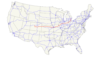
U.S. Route 24 highway in the United States

U.S. Route 24 is one of the original United States highways of 1926. It originally ran from Pontiac, Michigan, in the east to Kansas City, Missouri, in the west. Today, the highway's northern terminus is in Independence Township, Michigan, at an intersection with I-75 and its western terminus is near Minturn, Colorado at an intersection with I-70. The highway transitions from north–south to east–west signage in Toledo, Ohio.

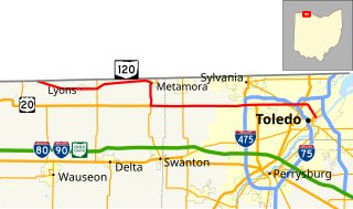
Ohio State Route 120 highway in Ohio

State Route 120 is an east–west state highway in the northwestern portion of the U.S. state of Ohio. Its western terminus is at the Michigan state line, where an unnumbered county highway continues west-northwest. State Route 120’s eastern terminus is in Toledo at State Route 65; the route is, for all practical purposes, a spur of U.S. Route 20, which generally bypasses Toledo to the west and south.

Interstate 280 (I-280) is a 17.85-mile (28.73 km) Interstate Highway in the U.S. state of New Jersey. It provides a spur from I-80 in Parsippany-Troy Hills, Morris County to Newark, and I-95 in Kearny, Hudson County. In Kearny, access is provided toward the Holland Tunnel and Lincoln Tunnel to New York City. The western part of the route runs through suburban areas of Morris and Essex counties, crossing the Watchung Mountains. Upon reaching The Oranges, the setting becomes more urbanized and I-280 runs along a depressed alignment before ascending again in Newark. I-280 includes a lift bridge, the William A. Stickel Memorial Bridge over the Passaic River between Newark and East Newark/Harrison. The highway is sometimes called the Essex Freeway. I-280 interchanges with several roads, including the Garden State Parkway in East Orange and Route 21 in Newark.

Ohio State Route 65 highway in Ohio

State Route 65 is a north–south highway in western Ohio. Its southern terminus is at State Route 47 near Sidney, and its northern terminus is at its interchange with Interstate 280 in Toledo. From south to north, the route passes through the cities of Jackson Center, Uniopolis, Lima, Columbus Grove, Ottawa, Leipsic, Belmore, McClure, Grand Rapids, Perrysburg, Rossford, and Toledo.

United States Army Second Lieutenant Robert Craig received the Medal of Honor for heroic service as an infantry officer during the Allied invasion of Sicily in World War II.

Interstate 90 (I-90) runs east–west across the northern tier of the U.S. state of Ohio. Much of it is along the Ohio Turnpike, but sections outside the turnpike pass through Cleveland and northeast into Pennsylvania.

Interstate 75 (I-75) runs from Cincinnati to Toledo by way of Dayton in the U.S. state of Ohio. The highway enters the state running concurrently with I-71 from Kentucky on the Brent Spence Bridge over the Ohio River and into the Bluegrass region. I-75 continues north into the Miami Valley and then passes through the Great Black Swamp before crossing into Michigan.

Harvard Terrace human settlement in Toledo, Ohio, United States of America

Harvard Terrace is a historic neighborhood in Toledo, Ohio; it is "bordered by Amherst Drive, Broadway, Glendale Avenue, and the Anthony Wayne Trail. It includes 435 residences, many of them designed by architects and built in the early 1900s."

Farnsworth Metropark

Farnsworth Metropark is a regional park located in Waterville, Ohio that is part of the Toledo Metroparks. The long narrow parks sits on the western shore of the Maumee River with a view of several islands, including Missionary, Butler and Indian islands, all of which are owned by the State of Ohio.

U.S. Route 24 in Ohio highway in Ohio

U.S. Route 24 (US 24) is a United States Numbered Highway that runs from Minturn, Colorado, to Independence Township, Michigan. In Ohio, it is an expressway and freeway for much of its length, from the Indiana state line to Maumee. From there northeasterly to the Michigan state line at Toledo, it is a surface highway.

Anthony Wayne Bridge

The Anthony Wayne Bridge, commonly called the High Level Bridge, was designed by Waddell & Hardesty and constructed by the McClintic-Marshall Company in 1931, and is a downtown Toledo, Ohio landmark named after General Anthony Wayne. It is a suspension bridge that spans the Maumee River. The bridge has some features that give it a unique aesthetic quality, including a sky blue color and various lattice patterns.

U.S. Route 23 in Ohio highway in Ohio

U.S. Route 23 (US 23) is a United States Numbered Highway that runs from Jacksonville, Florida, to Mackinaw City, Michigan. In the state of Ohio, it is a major north–south state highway that runs from the Kentucky border at Portsmouth to the Michigan border at Sylvania.

Downtown Toledo is the central business district of Toledo, Ohio. The area has seen a huge revival in the last few years with new retail, restaurants, entertainment venues, etc. moving into what had been, for many, considered a somewhat of a forgotten ghost town for years. Both the Warehouse District and the area surrounding the Huntington Center have been areas of recent growth.

Toledo Terminal Railroad was a railway company in the U.S. state of Ohio. Primarily a switching railroad, it made a complete loop around the city of Toledo, crossing the Maumee River twice.

Martin Luther King Bridge (Toledo, Ohio)

The Martin Luther King Memorial Bridge is a double-leaf bascule bridge adjacent to downtown Toledo, Ohio, where Cherry Street crosses the Maumee River to become Main Street on the east side of the city. The structure opened to traffic in 1914.

Cherry Street, Toledo

Cherry Street is a major east-west roadway in Toledo, Ohio. It crosses the Maumee River over the Martin Luther King Bridge, a bascule lift bridge, built in 1913.

Point Place (Toledo, Ohio) human settlement in Toledo, Ohio, United States of America

Point Place is a neighborhood in North Toledo, Ohio. Point Place was originally part of Washington Township, Lucas County in the 1800s, and was annexed into the city of Toledo, Ohio in 1937. Point Place is surrounded by the Ottawa River, Lake Erie, the Maumee Bay and the Maumee River. Point Place is near two major interstates, I-75, and I-280, which connects to I-80 (I-80/90). Summit Street runs through the middle of Point Place, and serves as the major center of commerce.

References

  1. Lyons, Sean (October 2, 2009). "Toledo's Own Craig Memorial Bridge: Part 1". The Blade. Toledo, OH.[ page needed ]
  2. Lyons, Sean (October 5, 2009). "Toledo's Own Craig Memorial Bridge: Part 2". The Blade. Toledo, OH.[ page needed ]
  3. Lyons, Sean (October 7, 2009). "Toledo's Own Craig Memorial Bridge: Part 3". The Blade. Toledo, OH.[ page needed ]
  4. Lyons, Sean (October 9, 2009). "Toledo's Own Craig Memorial Bridge: Part 4". The Blade. Toledo, OH.[ page needed ]
  5. Lyons, Sean (October 12, 2009). "Toledo's Own Craig Memorial Bridge: Part 5". The Blade. Toledo, OH.[ page needed ]

Commons-logo.svg Media related to Craig Memorial Bridge at Wikimedia Commons

Coordinates: 41°39′38″N83°30′44″W / 41.660620°N 83.512154°W / 41.660620; -83.512154

Geographic coordinate system Coordinate system

A geographic coordinate system is a coordinate system that enables every location on Earth to be specified by a set of numbers, letters or symbols. The coordinates are often chosen such that one of the numbers represents a vertical position and two or three of the numbers represent a horizontal position; alternatively, a geographic position may be expressed in a combined three-dimensional Cartesian vector. A common choice of coordinates is latitude, longitude and elevation. To specify a location on a plane requires a map projection.