Related Research Articles

Structural geology is the study of the three-dimensional distribution of rock units with respect to their deformational histories. The primary goal of structural geology is to use measurements of present-day rock geometries to uncover information about the history of deformation (strain) in the rocks, and ultimately, to understand the stress field that resulted in the observed strain and geometries. This understanding of the dynamics of the stress field can be linked to important events in the geologic past; a common goal is to understand the structural evolution of a particular area with respect to regionally widespread patterns of rock deformation due to plate tectonics.

Orogeny is the primary mechanism by which mountains are formed on continents. An orogeny is an event that takes place at a convergent plate margin when plate motion compresses the margin. This leads to both structural deformation and compositional differentiation of Earth's lithosphere. An orogenic belt or orogen develops as the compressed plate crumples and is uplifted to form one or more mountain ranges; this involves a series of geological processes collectively called orogenesis. A synorogenic process or event is one that occurs during an orogeny.

A lithosphere is the rigid, outermost shell of a terrestrial-type planet or natural satellite. On Earth, it is composed of the crust and the portion of the upper mantle that behaves elastically on time scales of up to thousands of years or more. The crust and upper mantle are distinguished on the basis of chemistry and mineralogy.

In geology, a fault is a planar fracture or discontinuity in a volume of rock across which there has been significant displacement as a result of rock-mass movements. Large faults within Earth's crust result from the action of plate tectonic forces, with the largest forming the boundaries between the plates, such as subduction zones or transform faults. Energy release associated with rapid movement on active faults is the cause of most earthquakes. Faults may also displace slowly, by aseismic creep.

In structural geology, a fold is a stack of originally planar surfaces, such as sedimentary strata, that are bent or curved during permanent deformation. Folds in rocks vary in size from microscopic crinkles to mountain-sized folds. They occur as single isolated folds or in periodic sets. Synsedimentary folds are those formed during sedimentary deposition.

Mountain formation refers to the geological processes that underlie the formation of mountains. These processes are associated with large-scale movements of the Earth's crust. Folding, faulting, volcanic activity, igneous intrusion and metamorphism can all be parts of the orogenic process of mountain building. The formation of mountains is not necessarily related to the geological structures found on it.

Mylonite is a fine-grained, compact metamorphic rock produced by dynamic recrystallization of the constituent minerals resulting in a reduction of the grain size of the rock. Mylonites can have many different mineralogical compositions; it is a classification based on the textural appearance of the rock.

Boudinage is a geological term for structures formed by extension, where a rigid tabular body such as hornfels, is stretched and deformed amidst less competent surroundings. The competent bed begins to break up, forming sausage-shaped boudins. Boudinage is common and can occur at any scale, from microscopic to lithospheric, and can be found in all terranes. In lithospheric-scale tectonics, boudinage of strong layers can signify large-scale creep transfer of rock matter. The study of boudinage can also help provide insight into the forces involved in tectonic deformation of rocks and their strength.
Strike-slip tectonics is concerned with the structures formed by, and the tectonic processes associated with, zones of lateral displacement within the Earth's crust or lithosphere. It is one of the three main types of tectonic regime, the others being extensional tectonics and thrust tectonics. These match the three types of plate boundary: transform (strike-slip), divergent (extensional) and convergent (thrust). Areas of strike-slip tectonics are associated with particular deformation styles including Riedel shears, flower structures and strike-slip duplexes. This type of tectonics is characteristic of several geological environments, including oceanic and continental transform faults, zones of oblique collision and the deforming foreland of a zone of continental collision.
Eldridge Moores was an American geologist. He specialized in the understanding of ophiolites and the geology of the continental crust of the Western United States and Tethyan belt, the geology of Greece, Cyprus, and Pakistan, and the tectonic development of the Sierra Nevada and the Alpine - Himalayan systems.

Geodynamics is a subfield of geophysics dealing with dynamics of the Earth. It applies physics, chemistry and mathematics to the understanding of how mantle convection leads to plate tectonics and geologic phenomena such as seafloor spreading, mountain building, volcanoes, earthquakes, faulting and so on. It also attempts to probe the internal activity by measuring magnetic fields, gravity, and seismic waves, as well as the mineralogy of rocks and their isotopic composition. Methods of geodynamics are also applied to exploration of other planets.
Non-volcanic passive margins (NVPM) constitute one end member of the transitional crustal types that lie beneath passive continental margins; the other end member being volcanic passive margins (VPM). Transitional crust welds continental crust to oceanic crust along the lines of continental break-up. Both VPM and NVPM form during rifting, when a continent rifts to form a new ocean basin. NVPM are different from VPM because of a lack of volcanism. Instead of intrusive magmatic structures, the transitional crust is composed of stretched continental crust and exhumed upper mantle. NVPM are typically submerged and buried beneath thick sediments, so they must be studied using geophysical techniques or drilling. NVPM have diagnostic seismic, gravity, and magnetic characteristics that can be used to distinguish them from VPM and for demarcating the transition between continental and oceanic crust.

The back-arc region is the area behind a volcanic arc. In island volcanic arcs, it consists of back-arc basins of oceanic crust with abyssal depths, which may be separated by remnant arcs, similar to island arcs. In continental arcs, the back-arc region is part of continental platform, either dry land (subaerial) or forming shallow marine basins.

The Atacama Fault Zone (AFZ) is an extensive system of faults cutting across the Chilean Coastal Cordillera in Northern Chile between the Andean Mountain range and the Pacific Ocean. The fault system is North-South striking and runs for more than 1100 km North and up to 50 km in width through the Andean forearc region. The zone is a direct result of the ongoing subduction of the Eastward moving Nazca Plate beneath the South American Plate and is believed to have formed in the Early Jurassic during the beginnings of the Andean orogeny. The zone can be split into 3 regions: the North, Central and South.
Strain partitioning is commonly referred to as a deformation process in which the total strain experienced on a rock, area, or region, is heterogeneously distributed in terms of the strain intensity and strain type. This process is observed on a range of scales spanning from the grain – crystal scale to the plate – lithospheric scale, and occurs in both the brittle and plastic deformation regimes. The manner and intensity by which strain is distributed are controlled by a number of factors listed below.

The discovery of extrasolar Earth-sized planets has encouraged research into their potential for habitability. One of the generally agreed requirements for a life-sustaining planet is a mobile, fractured lithosphere cyclically recycled into a vigorously convecting mantle, in a process commonly known as plate tectonics. Plate tectonics provide a means of geochemical regulation of atmospheric particulates, as well as removal of carbon from the atmosphere. This prevents a “runaway greenhouse” effect that can result in inhospitable surface temperatures and vaporization of liquid surface water. Planetary scientists have not reached a consensus on whether Earth-like exoplanets have plate tectonics, but it is widely thought that the likelihood of plate tectonics on an Earth-like exoplanet is a function of planetary radius, initial temperature upon coalescence, insolation, and presence or absence of liquid-phase surface water.

Salt deformation is the change of shape of natural salt bodies in response to forces and mechanisms that controls salt flow. Such deformation can generate large salt structures such as underground salt layers, salt diapirs or salt sheets at the surface. Strictly speaking, salt structures are formed by rock salt that is composed of pure halite (NaCl) crystal. However, most halite in nature appears in impure form, therefore rock salt usually refers to all rocks that composed mainly of halite, sometimes also as a mixture with other evaporites such as gypsum and anhydrite. Earth's salt deformation generally involves such mixed materials.
This is a compilation of the properties of different analog materials used to simulate deformational processes in structural geology. Such experiments are often called analog or analogue models. The organization of this page follows the review of rock analog materials in structural geology and tectonics of Reber et al. 2020.
The Superior Craton is a stable crustal block covering Quebec, Ontario, and southeast Manitoba in Canada, and northern Minnesota in the United States. It is the biggest craton among those formed during the Archean period. A craton is a large part of the Earth's crust that has been stable and subjected to very little geological changes over a long time. The size of Superior Craton is about 1,572,000 km2. The craton underwent a series of events from 4.3 to 2.57 Ga. These events included the growth, drifting and deformation of both oceanic and continental crusts.
Kevin C. A. Burke was a geologist known for his contributions in the theory of plate tectonics. In the course of his life, Burke held multiple professorships, most recent of which (1983-2018) was the position of professor of geology and tectonics at the Department of Earth and Atmospheric Science, University of Houston. His studies on plate tectonics, deep mantle processes, sedimentology, erosion, soil formation and other topics extended over several decades and influenced multiple generations of geologists and geophysicists around the world.
References
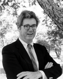
- ↑ Twiss’ webpage at UC Davis (from Internet Archive)
- ↑ Robert J. Twiss (November 1976). "Structural superplastic creep and linear viscosity in the earth's mantle". Earth and Planetary Science Letters . 33 (1): 86–100. Bibcode:1976E&PSL..33...86T. doi:10.1016/0012-821x(76)90160-6.
- ↑ Robert J. Twiss, Michael J. Gefell (January 1990). "Curved slickenfibers: a new brittle shear sense indicator with application to a sheared serpentinite". Journal of Structural Geology . 12 (4): 471–481. Bibcode:1990JSG....12..471T. doi:10.1016/0191-8141(90)90035-w.
- ↑ Robert J. Twiss, Randall Marrett (2010). "Determining brittle extension and shear strain using fault-length and displacement systematics: Part I: Theory" doi : 10.1016/j.jsg.2010.04.007
| General | |
|---|---|
| National libraries | |
| Other | |
| | This article about an American scientist is a stub. You can help Wikipedia by expanding it. |
| | This biographical article about a geologist is a stub. You can help Wikipedia by expanding it. |