Robert Waddington (mathematician)

Last updated

Robert Waddington (died 1779) was a mathematician, astronomer and teacher of navigation. He is best known as one of the observers appointed by the Royal Society to observe the 1761 transit of Venus with Nevil Maskelyne on the island of Saint Helena. On that voyage they made successful use of the lunar-distance method of establishing longitude at sea. Waddington subsequently taught the method at his academy in London and published a navigation manual, A Practical Method for Finding the Longitude and Latitude of a Ship at Sea, by Observations of the Moon (1763). [1] [2]

Contents

Life before 1761

Little is known about Waddington's early life, although he was probably the "Mr. Rob. Waddington of Hull" who appeared in The Gentleman's Diary or The Mathematical Repository in 1758 and Benjamin Martin's General Magazine of Arts and Sciences in 1759. The papers of the gentleman astronomer Nathaniel Pigott [3] show that Waddington was living in his household, in Whitton, Middlesex, immediately before his appointment as an observer by the Royal Society. It is from these manuscripts that we have a detailed knowledge of Waddington's experience of the Saint Helena expedition and his subsequent attempts to forge a career as a teacher, mathematical practitioner and longitude projector.

Voyage to Saint Helena

In 1760 Waddington was appointed by the Royal Society to accompany Nevil Maskelyne on a voyage to Saint Helena as one of two expeditions being organised by the Society, and paid for by George II, to observe the 1761 Transit of Venus. [1] The expedition's equipment was ordered by Maskelyne and the Society arranged transport from the East India Company. The Directors of the East India Company in London wrote to The Governor of St Helena on 31 December 1760 to inform them that "Revd. Mr. Nevil Maskelyne and Mr. Robert Waddington take passage on the Prince Henry to St. Helena. As this is done to make some improvements in Astronomy which will be of general utility the two last named gentlemen are upon their arrival and during their stay to be accommodated by you in a suitable manner with diet and apartments at the Company's expense and you are to give them all the assistance as to materials, workmen, and whatsoever else the service they are employed upon may require." The reply confirmed their readiness to help and stated "We have already erected an observatory for them in the country". [4]

In the event, Waddington and Maskelyne's view of the transit of Venus on 6 July 1761 was thwarted by clouds. However, the voyages to and from the island proved to be very significant to the subsequent careers of both men as they used it to make longitude determinations by the lunar-distance method testing the accuracy of lunar tables calculated by Tobias Mayer. Maskelyne's log of the voyage records their efforts to do this, with the assistance of officers from the ship, and refers to the use of "Mr Waddington's Quadrant", a Hadley's quadrant adapted by him to better facilitate lunar-distance observations [5] Waddington kept his own account of the voyages, and seems to have produced more accurate observations than Maskelyne. He told Piggott that their observations "finds a Practical & Certain Method" of determining longitude "& may be depended upon to one Degree of Longitude". [1] This wording and degree of accuracy echoes that in the 1714 Longitude Act, which offered a reward of £10,000 for methods that kept or found longitude to within a degree.

Subsequent career

Waddington returned from Saint Helena before Maskelyne, who stayed on to attempt observations of the parallax of Sirius. He arrived back in London on 21 September 1761 and began to forge a career around providing teaching and texts on navigation, particularly the lunar-distance method of finding longitude. Waddington, having announced publicly by his method longitude "may be generally obtained to less than half a Degree, and always to less than One Degree", hoped that he might be in a position to receive a reward from the Board of Longitude. [1] His contribution was a method of observing and computing the data, but was based on Mayer's lunar tables and the earlier publication of precomputed tables and rules by Nicolas Louis de Lacaille. His 1763 Practical Method for Finding the Longitude included such instructions and tables, which he claimed would reduce the necessary computation from several hours to three-quarters of an hour. [2] Maskelyne, on his return to London, produced his own version of such a text in the same year, The British Mariner's Guide, although never seems to have expected a reward from the Board of Longitude for his effort. [6]

Waddington styled himself "Teacher of Mathematics at the Mathematical Academy in Three Tun-court, Mile's-lane, London", where he taught officers of the East India Company and also sold Hadley's quadrants. In 1763 he attempted, unsuccessfully, to gain employment from the Royal Society. By 1764 he had moved to Rolls Building, Chancery Lane. [1] He reported to Piggott his hopes that he and Maskelyne might gain the interest of the Board of Longitude but his only formal approach to them seems to have been in 1771, when a petition was read at a meeting on 11 May stating that he had much improved, and successfully trialled, the steering compass, or binnacle. [7]

In 1777 he published his longest and most comprehensive work, An Epitome of Theoretical and Practical Navigation. [8] As The Edinburgh Magazine reported in 1778, he claimed that the book could "teach the young navigator every particular essential to his art, without his being under the necessity of having recourse to any other author." [9]

Waddington's will, dated 12 May 1775 and proved posthumously in 1779, states his address as Downing Street, Westminster. His wife, Margaret, was the beneficiary. [10]

Further reading

Related Research Articles

<span class="mw-page-title-main">Longitude</span> Geographic coordinate that specifies the east-west position of a point on the Earths surface

Longitude is a geographic coordinate that specifies the east–west position of a point on the surface of the Earth, or another celestial body. It is an angular measurement, usually expressed in degrees and denoted by the Greek letter lambda (λ). Meridians are imaginary semicircular lines running from pole to pole that connect points with the same longitude. The prime meridian defines 0° longitude; by convention the International Reference Meridian for the Earth passes near the Royal Observatory in Greenwich, south-east London on the island of Great Britain. Positive longitudes are east of the prime meridian, and negative ones are west.

<span class="mw-page-title-main">Nicolas-Louis de Lacaille</span> French astronomer and geodesist

Abbé Nicolas-Louis de Lacaille, formerly sometimes spelled de la Caille, was a French astronomer and geodesist who named 14 out of the 88 constellations. From 1750 to 1754, he studied the sky at the Cape of Good Hope in present-day South Africa. Lacaille observed over 10,000 stars using just a half-inch refracting telescope.

<span class="mw-page-title-main">Nevil Maskelyne</span> British astronomer and physicist (1732–1811)

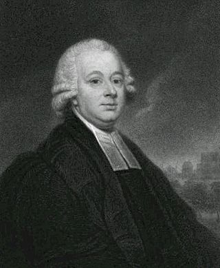
Nevil Maskelyne was the fifth British Astronomer Royal. He held the office from 1765 to 1811. He was the first person to scientifically measure the mass of the planet Earth. He created The Nautical Almanac, in full the British Nautical Almanac and Astronomical Ephemeris for the Meridian of the Royal Observatory at Greenwich using Tobias Mayer's corrections for Euler's Lunar Theory tables.

<span class="mw-page-title-main">Charles Mason</span> English astronomer and surveyor (1728–1786)

Charles Mason was an English-American astronomer who made significant contributions to 18th-century science and American history, particularly through his survey with Jeremiah Dixon of the Mason–Dixon line, which came to mark the border between Maryland and Pennsylvania (1764–1768). The border between Delaware and Maryland is also defined by a part of the Mason–Dixon line.

<span class="mw-page-title-main">Jeremiah Dixon</span> British astronomer and surveyor (1733–1779)

Jeremiah Dixon was an English surveyor and astronomer who is best known for his work with Charles Mason, from 1763 to 1767, in determining what was later called the Mason–Dixon line.

<span class="mw-page-title-main">Nathaniel Bliss</span> English astronomer

Nathaniel Bliss was an English astronomer of the 18th century, serving as Britain's fourth Astronomer Royal between 1762 and 1764.

The year 1767 in science and technology involved some significant events.

<span class="mw-page-title-main">John Bird (astronomer)</span> British mathematical instrument maker

John Bird was a British mathematical instrument maker who was notable for inventing the sextant. He came to London in 1740 where he worked for Jonathan Sisson and George Graham. By 1745, he had his own business in the Strand. Bird was commissioned to make a brass quadrant 8 feet across for the Royal Observatory at Greenwich, where it was mounted on 16 February 1750, and where it is still preserved. Soon after, duplicates were ordered for France, Spain and Russia.

Charles Green was a British astronomer, noted for his assignment by the Royal Society in 1768 to the expedition sent to the Pacific Ocean in order to observe the transit of Venus aboard James Cook's Endeavour.

<span class="mw-page-title-main">John Campbell (Royal Navy officer)</span> 18th-century British naval officer, navigator and colonial governor

Vice-Admiral John Campbell (1720–1790) was born in the parish of Kirkbean in Kirkcudbrightshire, Scotland. Campbell was a British naval officer, navigational expert and colonial governor.

<span class="mw-page-title-main">Lunar distance (navigation)</span> Angular distance between the Moon and another celestial body

In celestial navigation, lunar distance, also called a lunar, is the angular distance between the Moon and another celestial body. The lunar distances method uses this angle and a nautical almanac to calculate Greenwich time if so desired, or by extension any other time. That calculated time can be used in solving a spherical triangle. The theory was first published by Johannes Werner in 1524, before the necessary almanacs had been published. A fuller method was published in 1763 and used until about 1850 when it was superseded by the marine chronometer. A similar method uses the positions of the Galilean moons of Jupiter.

Richard Dunthorne was an English astronomer and surveyor, who worked in Cambridge as astronomical and scientific assistant to Roger Long, and also concurrently for many years as surveyor to the Bedford Level Corporation.

<span class="mw-page-title-main">History of longitude</span> Record of humanitys attempts to find east-west position on Earth

The history of longitude describes the centuries-long effort by astronomers, cartographers and navigators to discover a means of determining the longitude of any given place on Earth. The measurement of longitude is important to both cartography and navigation. In particular, for safe ocean navigation, knowledge of both latitude and longitude is required, however latitude can be determined with good accuracy with local astronomical observations.

William Wales was a British mathematician and astronomer who sailed on Captain Cook's second voyage of discovery, then became Master of the Royal Mathematical School at Christ's Hospital and a Fellow of the Royal Society.

Reuben Burrow was an English mathematician, surveyor and orientalist. Initially a teacher, he was appointed assistant to Sir Nevil Maskelyne, the fifth Astronomer Royal, at the Royal Greenwich Observatory, and was involved in the Schiehallion experiment. He later conducted research in India, teaching himself Sanskrit and becoming one of the first members of the Asiatic Society. He was the first to measure the length of a degree of an arc of longitude along the Tropic of Cancer. His other major achievements included a study of Indian mathematics, although he earned a reputation for being rude and unpolished amid the leading figures in science who came mostly from the upper-class. One commentator called him "an able mathematician but a most vulgar and scurrilous dog."

<span class="mw-page-title-main">William Lax</span> English astronomer and mathematician (1761–1836)

William Lax was an English astronomer and mathematician who served as Lowndean Professor of Astronomy and Geometry at the University of Cambridge for 41 years.

William Bayly (1737–1810) was an English astronomer.

Samuel Dunn was a British mathematician, teacher, cartographer and amateur astronomer.

Mary Edwards was a human computer for the British Nautical Almanac and one of a very few women paid directly by the Board of Longitude, and to earn a living from scientific work at the time.

<span class="mw-page-title-main">John Crosley</span> English astronomer and mathematician

John Crosley (1762–1817) was an English astronomer and mathematician who was an assistant at the Royal Observatory, Greenwich, a computer of the Nautical Almanac, an observer on maritime voyages of scientific exploration and a member and President of the Spitalfields Mathematical Society.

References

  1. 1 2 3 4 5 Bennett, Jim (2014). "'The Rev. Mr. Nevil Maskelyne, F.R.S. and Myself': The Story of Robert Waddington". Maskelyne: Astronomer Royal. London: Robert Hale Ltd: 59–88.
  2. 1 2 Waddington, Robert (1763). A Practical Method for Finding the Longitude and Latitude of a Ship at Sea, by Observations of the Moon. London: W. Richardson and S. Clark.
  3. "Catalogue of the Royal Astronomical Society archives" . Retrieved 2 May 2015.
  4. Janisch, Hudson Ralph (1885). Extracts from the St. Helena Records. St. Helena. p. 195.{{cite book}}: CS1 maint: location missing publisher (link)
  5. Maskelyne, Nevil. "Journal of voyage to St Helena". Cambridge Digital Library. Retrieved 2 May 2015.
  6. Maskelyne, Nevil (1763). The British Mariner's Guide. London.
  7. "Confirmed Minutes of the Board of Longitude, 1737-1779". Cambridge Digital Library. Retrieved 2 May 2015.
  8. Waddington, Robert (1777). Rob. Waddington's Epitome of Theoretical and Practical Navigation. London.
  9. "Books: Natural History, Medicine, Mathematics, &c". The Edinburgh Magazine, and Literary Miscellany. 40: 501. 1778. Retrieved 2 May 2015.
  10. "Will of Robert Waddington of Westminster , Middlesex". The National Archives. Retrieved 2 May 2015.