Large ice piedmont covering the northeast of Alexander Island, Antarctica
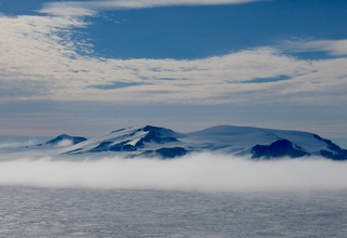
Roberts Ice Piedmont (69°0′S70°20′W / 69.000°S 70.333°W / -69.000; -70.333) is a large ice piedmont, 20 nautical miles (37km) long in a north–south direction and 15 nautical miles (28km) wide, lying to the north and northwest of Mount Calais and occupying most of the northeast corner of Alexander Island, Antarctica. It was first seen from a distance and roughly surveyed by the French Antarctic Expedition, 1908–10, under Charcot. It was photographed from the air by the British Graham Land Expedition (BGLE) on August 15, 1936, and roughly mapped from these photos. It was then named by the United Kingdom Antarctic Place-Names Committee (UK-APC) in 1955 after Brian B. Roberts (1912–78), a British ornithologist, polar specialist and leading figure in the development of Antarctic nomenclature; ornithologist, BGLE, 1934–37; Secretary, United Kingdom Antarctic Place-names Committee, 1945–74. About six nunataks are situated within the Roberts Ice Piedmont, these are Hengist Nunatak (a separate nunatak) and the Horsa Nunataks (a group of about five nunataks). Both of these features are named after Saxon kings of England in the fifth century; however, they have no association or relation with Brian B. Roberts and the Roberts Ice Piedmont itself.
Shackleton Glacier is a major Antarctic glacier, over 60 nautical miles long and from 5 to 10 nautical miles wide, descending from the Antarctic Plateau from the vicinity of Roberts Massif and flowing north through the Queen Maud Mountains to enter the Ross Ice Shelf between Mount Speed and Waldron Spurs. Discovered by the United States Antarctic Service (USAS) (1939–41) and named by the Advisory Committee on Antarctic Names (US-ACAN) for Sir Ernest Shackleton, British Antarctic explorer.
Mikkelsen Bay is a bay, 15 nautical miles wide at its mouth and indenting 10 nautical miles, entered between Bertrand Ice Piedmont and Cape Berteaux along the west coast of Graham Land, Antarctica.
Northeast Glacier is a steep, heavily crevassed glacier, 13 nautical miles long and 5 nautical miles wide at its mouth, which flows from McLeod Hill westward and then south-westwards into Marguerite Bay between the Debenham Islands and Roman Four Promontory, on the west coast of Graham Land, Antarctica.
Rymill Bay is a bay, 9 nautical miles wide at its mouth and indenting 5 nautical miles between Red Rock Ridge and Bertrand Ice Piedmont along the west coast of Graham Land, Antarctica.
The Eternity Range is a range of mountains 28 nautical miles long, rising to 3,239 metres (10,627 ft), and trending north–south approximately in the middle of the Antarctic Peninsula. The range is divided into three main mountain blocks, the major summits in each from north to south being Mounts Faith, Hope and Charity.
The Guest Peninsula is a snow-covered peninsula about 45 nautical miles long between the Sulzberger Ice Shelf and Block Bay, in the northwest part of Marie Byrd Land, Antarctica.
Arrowsmith Peninsula is a cape about 40 miles (64 km) long on the west coast of Graham Land, west of Forel Glacier, Sharp Glacier and Lallemand Fjord, and northwest of Bourgeois Fjord, with Hanusse Bay lying to the northwest. It was surveyed by the Falkland Islands Dependencies Survey (FIDS) in 1955-58 and named for Edwin Porter Arrowsmith, Governor of the Falkland Islands.
Wilson Hills is a group of scattered hills, nunataks and ridges that extend northwest–southeast about 70 nautical miles between Matusevich Glacier and Pryor Glacier in Antarctica.
The Airy Glacier is a glacier 20 nautical miles (37 km) long and 6 nautical miles (11 km) wide, flowing west to the northeast portion of Forster Ice Piedmont, near the west coast of the Antarctic Peninsula.
Prospect Glacier is a glacier between Kinnear Mountains and Mayer Hills, flowing north into Forster Ice Piedmont on the west coast of Antarctic Peninsula. It was first roughly surveyed in 1936 by the British Graham Land Expedition (BGLE) under Rymill. In 1954 the United Kingdom Antarctic Place-Names Committee (UK-APC) gave the name Prospect Pass to a col between Eureka Glacier and the glacier here described. During resurvey of the area by the Falkland Islands Dependencies Survey (FIDS) in 1958, the col was found to be an indeterminate feature, while this glacier is well marked and requires a name.
Puccini Spur is a rock spur, 6 nautical miles (11 km) long, extending southwest into the Mozart Ice Piedmont close south of Mahler Spur in the north part of Alexander Island, Antarctica. It was first seen from the air and roughly mapped by the British Graham Land Expedition (BGLE) in 1937. The Puccini Spur was accurately delineated from air photos taken by the Ronne Antarctic Research Expedition (RARE), 1947–48, and by Searle of the Falkland Islands Dependencies Survey (FIDS) in 1960. It is named by United Kingdom Antarctic Place-Names Committee (UK-APC) after Giacomo Puccini (1858–1924), an Italian operatic composer.
Casey Inlet is an ice-filled inlet at the terminus of Casey Glacier, between Miller Point and Cape Walcott, on the east coast of Palmer Land, Antarctica.
Mozart Ice Piedmont is an ice piedmont, 60 nautical miles (110 km) long-running in a NW-SE direction and 15 nautical miles (28 km) wide in its widest part, on the west coast of Alexander Island, Antarctica. Mapped from air photos taken by the Ronne Antarctic Research Expedition (RARE) in 1947, by Searle of the Falkland Islands Dependencies Survey (FIDS) in 1960. Named by the United Kingdom Antarctic Place-Names Committee (UK-APC) for Wolfgang Amadeus Mozart (1756–1791), famous Austrian composer. Some landforms within this area are named in association with the Mozart Ice Piedmont such as Figaro Nunatak, along with a few other landforms.
The Eland Mountains are a range of mountains which rise above 2,440 metres (8,010 ft) and extend about 20 nautical miles in a northeast–southwest direction along the south side of Clifford Glacier, on the east coast of Palmer Land, Antarctica.
Fleming Glacier is a broad glacier 25 nautical miles (46 km) long on the west side of the Antarctic Peninsula, flowing west-northwest and terminating in Forster Ice Piedmont to the east of the Wordie Ice Shelf. The glacier was charted by the British Graham Land Expedition (BGLE) under John Rymill, 1934–37, and was photographed from the air by the United States Antarctic Service on September 29, 1940. This hitherto unnamed feature was named by the Advisory Committee on Antarctic Names in 1947 for Reverend W.L.S. Fleming, Dean of Trinity Hall, Cambridge University; also, chaplain, chief scientist, and geologist of the BGLE.
The Goodenough Glacier is a broad sweeping glacier to the south of the Batterbee Mountains, flowing from the west shore of Palmer Land, Antarctica, into George VI Sound and the George VI Ice Shelf.
The Medina Peaks are rugged, mainly ice-free, peaks surmounting a ridge 15 nautical miles long, extending north along the east side of Goodale Glacier to the edge of the Ross Ice Shelf, Antarctica.
Hughes Ice Piedmont is the ice piedmont between Cordini Glacier and Smith Inlet on the east coast of Palmer Land, Antarctica.
Seller Glacier is a well-defined glacier, 20 nautical miles (37 km) long and 4 nautical miles (7 km) wide flowing westward into Forster Ice Piedmont, western Antarctic Peninsula, just north of Flinders Peak. Roughly surveyed by British Graham Land Expedition (BGLE), 1936–37, and resurveyed by Falkland Islands Dependencies Survey (FIDS) in December 1958.
This page is based on this Wikipedia article Text is available under the CC BY-SA 4.0 license; additional terms may apply. Images, videos and audio are available under their respective licenses.