Sunnyside is a town on the Avalon Peninsula in Newfoundland and Labrador, Canada. It is in Division 1 on Bull Arm.

Twillingate is a town of 2,121 people located on the Twillingate Islands ("Toulinquet") in Notre Dame Bay, off the north eastern shore of the island of Newfoundland in the province of Newfoundland and Labrador, Canada. The town is about 100 kilometres (62 mi) north of Lewisporte and Gander.
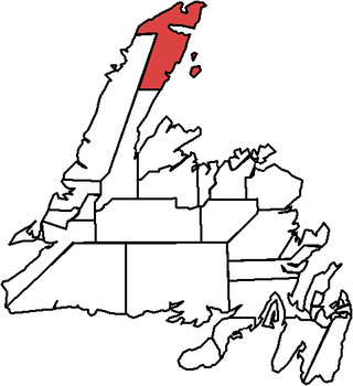
The Straits – White Bay North is a defunct provincial electoral district for the House of Assembly of Newfoundland and Labrador, Canada. The district was known as Strait of Belle Isle prior to the 1996 election. In the 2007 redistribution, it added five per cent of St. Barbe. As of 2011, there are 6,851 eligible voters living within the district.
Burlington is an incorporated town in Newfoundland and Labrador, Canada. It is a small fishing and lumbering community on Route 413 at the north side of the mouth of Green Bay. Burlington is located approximately 40 km from Baie Verte.

Port Hope Simpson is a town located on the southeastern Labrador coast, 215 km (134 mi) from the Quebec/Southern Labrador border in Canada. In 1944 it was named after John Hope Simpson as a company town.
Buchans is a town located in the central part of the island of Newfoundland in the province of Newfoundland and Labrador. It is situated on the northwest shore of Beothuk Lake on the Buchans River.
Conche is a community on the Northern Peninsula of Newfoundland and Labrador, Canada. Its population in 2021 was 149.
King's Point is a town on the north shore of the southwest arm of Green Bay in Newfoundland and Labrador, Canada. King's Point is 24 km (15 mi) by road from Springdale, and 10 km (6.2 mi) from the Trans-Canada Highway.
Virgin Arm–Carter's Cove is a local service district and designated place on New World Island in the Canadian province of Newfoundland and Labrador. Virgin Arm-Carter's Cove is located approximately 90 km Northwest of Gander in Subdivision H of Division No. 8.
Gooseberry Cove is a settlement in the Trinity Bay area of Newfoundland located on an area of land known as the Southwest Arm, which extends off the Trans Canada Highway on Route 204. It is neighbored by the communities of Butter Cove and Southport.
Bay de Verde is an incorporated town in Conception Bay on the northern tip of the Bay de Verde Peninsula of Newfoundland and Labrador, Canada. The first recorded inhabitants at Bay de Verde arrived in 1662. Bay de Verde became an incorporated town in 1950.
Indian Bay is located in Newfoundland, Canada.
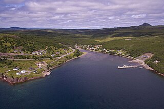
Bide Arm is a community located on the Great Northern Peninsula in the Canadian province of Newfoundland and Labrador. It amalgamated with the former Town of Roddickton on January 1, 2009, to create the Town of Roddickton-Bide Arm. Bide Arm had a population of 192 in the Canada 2006 Census.
Centreville–Wareham–Trinity is a town in the Canadian province of Newfoundland and Labrador, located on Bonavista Bay. The town had a population of 1,116 in the Canada 2021 Census, down from 1,147 in 2016.

Cox's Cove is a town in the Canadian province of Newfoundland and Labrador. The town had a population of 664 in the Canada 2021 Census. The small community is mainly based on the fishery, mink farm, and construction industries.
Wiltondale is a settlement on western Newfoundland in the Canadian province of Newfoundland and Labrador. It is located at the intersection between Route 430 and Route 431.
Roddickton-Bide Arm is a town located in the northern peninsula of the island of Newfoundland within the province of Newfoundland and Labrador. It was formed on January 1, 2009 through the amalgamation of the former towns of Roddickton and Bide Arm.

Roberts Arm is a small town located near Crescent Lake, Newfoundland and Labrador, Canada in Division No. 8, Newfoundland and Labrador. It is found on the northern part of Newfoundland. Roberts Arm boasts of its Lake Monster, Cressie, which is claimed to be living in Crescent Lake. Recent years saw the development of a majestic hiking trail which encompasses the end of the lake nearest to the community, Hazelnut Adventure Trail.

Division No. 1, Subdivision G is an unorganized subdivision on the Avalon Peninsula in Newfoundland and Labrador, Canada. It is in Division 1 and contains the unincorporated communities of Baccalieu Island, Besom Cove, Bradley's Cove, Burnt Point, Caplin Cove, Daniel's Cove, Grates Cove, Gull Island, Job's Cove, Kingston, Long Beach, Lower Island Cove, Low Point, Northern Bay, Ochre Pit Cove, Red Head Cove, Riverhead, Smooth Cove and Western Bay.
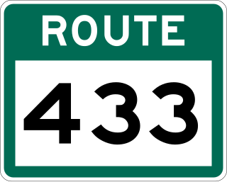
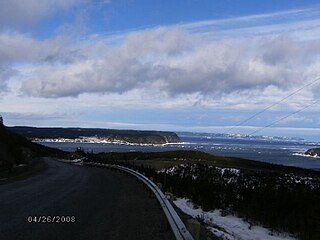
Route 433, also known as Englee Highway, is a 35.7-kilometre-long (22.2 mi) north–south highway on the Great Northern Peninsula of Newfoundland in the Canadian province of Newfoundland and Labrador. It connects the towns of Englee, Bide Arm, Roddickton, as well as Conche via Route 434, with Route 432 and Main Brook.