Romanovsky District

Last updated
Location of Altai Krai in Russia Map of Russia - Altai Krai (2008-03).svg
Location of Altai Krai in Russia
Location of Saratov Oblast in Russia Map of Russia - Saratov Oblast (2008-03).svg
Location of Saratov Oblast in Russia

Romanovsky District is the name of several administrative and municipal districts in Russia:

Russia transcontinental country in Eastern Europe and Northern Asia

Russia, officially the Russian Federation, is a transcontinental country in Eastern Europe and North Asia. At 17,125,200 square kilometres (6,612,100 sq mi), Russia is the largest country in the world by area, covering more than one-eighth of the Earth's inhabited land area, and the ninth most populous, with about 146.77 million people as of 2019, excluding Crimea. About 77% of the population live in the western, European part of the country. Russia's capital, Moscow, is the largest metropolitan area in Europe proper and one of the largest cities in the world; other major cities include Saint Petersburg, Novosibirsk, Yekaterinburg and Nizhny Novgorod. Extending across the entirety of Northern Asia and much of Eastern Europe, Russia spans eleven time zones and incorporates a wide range of environments and landforms. From northwest to southeast, Russia shares land borders with Norway, Finland, Estonia, Latvia, Lithuania and Poland, Belarus, Ukraine, Georgia, Azerbaijan, Kazakhstan, China, Mongolia and North Korea. It shares maritime borders with Japan by the Sea of Okhotsk and the U.S. state of Alaska across the Bering Strait. However, Russia recognises two more countries that border it, Abkhazia and South Ossetia, both of which are internationally recognized as parts of Georgia.
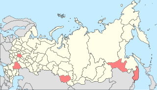
Romanovsky District, Altai Krai District in Altai Krai, Russia

Romanovsky District is an administrative and municipal district (raion), one of the fifty-nine in Altai Krai, Russia. It is located in the western central part of the krai. The area of the district is 2,082 square kilometers (804 sq mi). Its administrative center is the rural locality of Romanovo. Population: 13,179 (2010 Census); 15,412 (2002 Census); 16,111 (1989 Census). The population of Romanovo accounts for 42.7% of the district's total population.

Altai Krai First-level administrative division of Russia

Altai Krai is a federal subject of Russia. It borders with, clockwise from the west, Kazakhstan, Novosibirsk and Kemerovo Oblasts, and the Altai Republic. The krai's administrative center is the city of Barnaul. As of the 2010 Census, the population of the krai was 2,419,755.

Romanovsky District, Saratov Oblast District in Saratov Oblast, Russia

Romanovsky District is an administrative and municipal district (raion), one of the thirty-eight in Saratov Oblast, Russia. It is located in the west of the oblast. The area of the district is 1,300 square kilometers (500 sq mi). Its administrative center is the urban locality of Romanovka. Population: 16,226 ; 18,150 (2002 Census); 19,404 (1989 Census). The population of Romanovka accounts for 44.8% of the district's total population.

See also

Related Research Articles

Krasnoarmeysky District is the name of several administrative and municipal divisions in Russia. The districts are generally named for the Red Army.

Kamensky District Wikipedia disambiguation page

Kamensky District is the name of several administrative and municipal districts in Russia. The name is generally derived from or is related to the root "kamen" ("stone")—a common toponymic feature.

Mikhaylovsky District Wikimedia disambiguation page

Mikhaylovsky District is the name of several administrative and municipal districts in Russia. The name is generally derived from or is related to the male first name Mikhail.

Pavlovsky District is the name of several administrative and municipal districts in Russia. The district names are generally related to or derived from the male first name Pavel.

Petropavlovsky District Wikipedia disambiguation page

Petropavlovsky District is the name of several administrative and municipal districts in Russia:

Petrovsky District, Russia Wikipedia disambiguation page

Petrovsky District is the name of several administrative and municipal districts in Russia. The districts' name generally derives from or is related to the male first name Pyotr.

Smolensky District Wikipedia disambiguation page

Smolensky District is the name of several administrative and municipal districts in Russia:

Sovetsky District is the name of several administrative and municipal divisions in Russia. The name literally means "Soviet".

Troitsky District Wikipedia disambiguation page

Troitsky District is the name of several administrative and municipal districts in Russia:

Yegoryevsky District Wikimedia disambiguation page

Yegoryevsky District is the name of several administrative and municipal districts in Russia:

Kalininsky District, Saratov Oblast District in Saratov Oblast, Russia

Kalininsky District is an administrative and municipal district (raion), one of the thirty-eight in Saratov Oblast, Russia. It is located in the west of the oblast. The area of the district is 2,000 square kilometers (770 sq mi). Its administrative center is the town of Kalininsk. Population: 33,302 ; 39,732 (2002 Census); 39,739 (1989 Census). The population of Kalininsk accounts for 49.4% of the district's total population.

Krasnokutsky District District in Saratov Oblast, Russia

Krasnokutsky District is an administrative and municipal district (raion), one of the thirty-eight in Saratov Oblast, Russia. It is located in the south of the oblast. The area of the district is 2,900 square kilometers (1,100 sq mi). Its administrative center is the town of Krasny Kut. Population: 34,676 ; 36,445 (2002 Census); 37,551 (1989 Census). The population of Krasny Kut accounts for 41.6% of the district's total population.

Krasnopartizansky District District in Saratov Oblast, Russia

Krasnopartizansky District is an administrative and municipal district (raion), one of the thirty-eight in Saratov Oblast, Russia. It is located in the east of the oblast. The area of the district is 2,400 square kilometers (930 sq mi). Its administrative center is the urban locality of Gorny. Population: 13,008 ; 17,709 (2002 Census); 20,174 (1989 Census). The population of Gorny accounts for 39.1% of the district's total population.

Lysogorsky District District in Saratov Oblast, Russia

Lysogorsky District is an administrative and municipal district (raion), one of the thirty-eight in Saratov Oblast, Russia. It is located in the southwest of the oblast. The area of the district is 2,300 square kilometers (890 sq mi). Its administrative center is the urban locality of Lysye Gory. Population: 19,948 ; 21,260 (2002 Census); 20,797 (1989 Census). The population of Lysye Gory accounts for 36.0% of the district's total population.

Novoburassky District District in Saratov Oblast, Russia

Novoburassky District is an administrative and municipal district (raion), one of the thirty-eight in Saratov Oblast, Russia. It is located in the north of the oblast. The area of the district is 1,700 square kilometers (660 sq mi). Its administrative center is the urban locality of Novye Burasy. Population: 16,359 ; 18,188 (2002 Census); 16,703 (1989 Census). The population of Novye Burasy accounts for 35.9% of the district's total population.

Turkovsky District District in Saratov Oblast, Russia

Turkovsky District is an administrative and municipal district (raion), one of the thirty-eight in Saratov Oblast, Russia. It is located in the northwest of the oblast. The area of the district is 1,400 square kilometers (540 sq mi). Its administrative center is the urban locality of Turki. Population: 12,834 ; 15,852 (2002 Census); 18,409 (1989 Census). The population of Turki accounts for 47.7% of the district's total population.

Yershovsky District District in Saratov Oblast, Russia

Yershovsky District is an administrative and municipal district (raion), one of the thirty-eight in Saratov Oblast, Russia. It is located in the eastern central part of the oblast. The area of the district is 4,300 square kilometers (1,700 sq mi). Its administrative center is the town of Yershov. Population: 41,609 ; 50,337 (2002 Census); 53,333 (1989 Census). The population of Yershov accounts for 51.5% of the district's total population.

Uglovsky District is the name of several administrative and municipal districts in Russia.

References

  1. Алтайский краевой Совет народных депутатов. Закон №28-ЗС от 1 марта 2008 г. «Об административно-территориальном устройстве Алтайского края», в ред. Закона №16-ЗС от 4 апреля 2017 г. «О присоединении станции Железнодорожная Казарма 572 км к посёлку Октябрьскому Октябрьского сельсовета Кулундинского района Алтайского края и внесении изменений в отдельные законы Алтайского края». Вступил в силу 8 марта 2008 г. Опубликован: "Алтайская правда", №67, 8 марта 2008 г. (Altai Krai Council of People's Deputies. Law #28-ZS of March 1, 2008 On the Administrative-Territorial Structure of Altai Krai, as amended by the Law #16-ZS of April 4, 2017 On Merging the Station of Zheleznodorozhnaya Kazarma 572 km into the Settlement of Oktyabrsky in Oktyabrsky Selsoviet of Kulundinsky District of Altai Krai and on Amending Various Laws of Altai Krai. Effective as of March 8, 2008.).
  2. Алтайский краевой Совет народных депутатов. Закон №142-ЗС от 24 декабря 2007 г. «О статусе и границах муниципальных и административно-территориальных образований Романовского района Алтайского края», в ред. Закона №55-ЗС от 5 июля 2012 г. «О внесении изменений в отдельные Законы Алтайского края в связи с преобразованием муниципальных и административно-территориальных образований». Вступил в силу через 10 дней после дня официального опубликования. Опубликован: "Алтайская правда", №№4–5 (без приложений), 12 января 2008 г. (Altai Krai Council of People's Deputies. Law #142-ZS of December 24, 2007 On the Status and the Borders of the Municipal and the Administrative-Territorial Formations of Romanovsky District of Altai Krai, as amended by the Law #55-ZS of July 5, 2012 On Amending Various Laws of Altai Krai Due to the Transformation of the Municipal and Administrative-Territorial Formations. Effective as of after 10 days after the day of the official publication.).
  3. Саратовская областная Дума. Закон №46-ЗСО от 2 июня 2005 г. «Устав (Основной Закон) Саратовской области», в ред. Закона №54-ЗСО от 28 апреля 2015 г. «О внесении изменений в Устав (Основной Закон) Саратовской области». Вступил в силу после официального опубликования. Опубликован: "Неделя области", Спецвыпуск, №38 (156), 4 июня 2005 г. (Saratov Oblast Duma. Law #46-ZSO of June 2, 2005 Charter (Basic Law) of Saratov Oblast, as amended by the Law #54-ZSO of April 28, 2015 On Amending the Charter (Basic Law) of Saratov Oblast. Effective as of after the official publication.).
  4. Саратовская областная Дума. Закон №102-ЗСО от 27 декабря 2004 г. «О муниципальных образованиях, входящих в состав Романовского муниципального района», в ред. Закона №76-ЗСО от 16 мая 2013 г. «О преобразовании Краснолиманского и Романовского муниципальных образований Романовского муниципального района Саратовской области и о внесении изменений в Закон Саратовской области "О муниципальных образованиях, входящих в состав Романовского муниципального района"». Вступил в силу с 1 января 2005 г. Опубликован: "Саратов — столица Поволжья", №7–8 (1230–1231), 18 января 2005 г. (Saratov Oblast Duma. Law #102-ZSO of December 27, 2004 On the Municipal Formations Constituting Romanovsky Municipal District, as amended by the Law #76-ZSO of May 16, 2013 On the Transformation of Krasnolimanskoye and Romanovskoye Municipal Formations in Romanovsky Municipal District of Saratov Oblast and on Amending the Law of Saratov Oblast "On the Municipal Formations Constituting Romanovsky Municipal District". Effective as of January 1, 2005.).