The geography of Israel is very diverse, with desert conditions in the south, and snow-capped mountains in the north. Israel is located at the eastern end of the Mediterranean Sea in Western Asia. It is bounded to the north by Lebanon, the northeast by Syria, the east by Jordan and the West Bank, and to the southwest by Egypt. To the west of Israel is the Mediterranean Sea, which makes up the majority of Israel's 273 km (170 mi) coastline, and the Gaza Strip. Israel has a small coastline on the Red Sea in the south.

Antipatris was a city built during the first century BC by Herod the Great, who named it in honour of his father, Antipater. The site, now a national park in central Israel, was inhabited from the Chalcolithic Period to the late Roman Period. The remains of Antipatris are known today as Tel Afek, although formerly as Kŭlat Râs el 'Ain. It has been identified as either the tower of Aphek mentioned by Josephus, or the biblical Aphek, best known from the story of the Battle of Aphek. During the Crusader Period the site was known as Surdi fontes, "Silent springs". The Ottoman fortress known as Binar Bashi or Ras al-Ayn was built there in the 16th century.

Rosh HaAyin is a city in the Central District of Israel. In 2021, it had a population of 71,651.
The National Water Carrier of Israel is the largest water project in Israel, completed in 1964. Its main purpose is to transfer water from the Sea of Galilee in the north of the country to the highly populated center and arid south and to enable efficient use of water and regulation of the water supply in the country. Up to 72,000 cubic meters of water can flow through the carrier each hour, totalling 1.7 million cubic meters in a day.
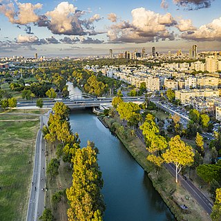
The Yarkon River, also Yarqon River or Jarkon River, is a river in central Israel. The source of the Yarkon is at Tel Afek (Antipatris), north of Petah Tikva. It flows west through Gush Dan and Tel Aviv's Yarkon Park into the Mediterranean Sea. Its Arabic name, al-Auja, means "the meandering". The Yarkon is the largest coastal river in Israel, at 27.5 km in length.

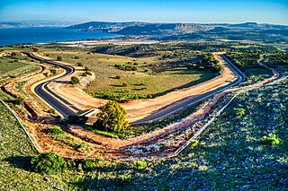
The Israel National Trail is a hiking trail that crosses the entire length of the country of Israel, with its northern end at Kibbutz Kfar Giladi, near the Lebanese border in the far north of the country, extending to Eilat at the southernmost tip of Israel on the Red Sea, with a total length of 1,040 km (650 mi). The trail was inaugurated in 1995.

Israeli coastal plain is the coastal plain along Israel's Mediterranean Sea coast, extending 187 kilometres (116 mi) north to south. It is a geographical region defined morphologically by the sea, in terms of topography and soil, and also in its climate, flora and fauna. It is narrow in the north and broadens considerably towards the south, and is continuous, except the short section where Mount Carmel reaches almost all the way to the sea. The Coastal Plain is bordered to the east by – north to south – the topographically higher regions of the Galilee, the low and flat Jezreel Valley, the Carmel range, the mountains of Samaria, the hill country of Judea known as the Shephelah, and the Negev Mountains in the south. To the north it is separated from the coastal plain of Lebanon by the cliffs of Rosh HaNikra, which jut out into the sea from the Galilee mountains, but to the south it continues into the Egyptian Sinai Peninsula.
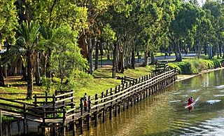
Yarkon Park is a large park in Tel Aviv, Israel, with about sixteen million visits annually. Named after the Yarkon River which flows through it, the park includes extensive lawns, sports facilities, botanical gardens, an aviary, a water park, two outdoor concert venues and lakes. The park covers an area of 3.5 km². At 375 hectares, it is slightly larger than Central Park in New York, and double the size of Hyde Park, London.

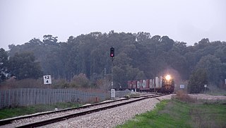
Rail transport in Israel includes heavy rail as well as light rail. Excluding light rail, the network consists of 1,384 kilometers (860 mi) of track, and is undergoing constant expansion. All of the lines are standard gauge and as of 2023 approximately one-fifth of the heavy rail network is electrified, with additional electrification work underway. A government owned rail company, Israel Railways, manages the entire heavy rail network. Most of the network is located on the densely populated coastal plain.

Bnei Brak–Ramat HaHayal railway station is a suburban passenger railway station in Israel, operated by Israel Railways. It is located on the Yarkon Railway near the Bnei Brak–Ramat Gan and Bnei Brak–Tel Aviv borders next to the Ayalon Mall and Ramat Gan Stadium. In spite of its proximity to important industrial and commercial areas of Gush Dan as well as to residential areas of Tel Aviv, Bnei Brak is one of the less-popular stations of Israel Railways, possibly because of its misleading name and lack of awareness. As a result, in an effort to increase the public's awareness of the station, the name of the Ramat HaHayal neighborhood located to the north of the station was added to the station's name in 2016.
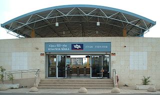
The Petah Tikva Segula railway station is a suburban passenger railway station in Israel, operated by Israel Railways.
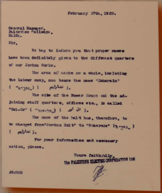
Naharayim, historically the Jisr Majami area, where the Yarmouk River flows into the Jordan River, was named by the Palestine Electric Company in a letter dated 27 February 1929 to Palestine Railways giving "proper names" to the "different quarters of our Jordan Works" one of these being the "works as a whole including the labour camp" to be called "Naharaim" and another being the site of the "Power House and the adjoining staff quarters, offices" to be called Tel Or. Most of the plant was situated in the Emirate of Transjordan and stretched from the northern canal near the Ashdot Ya'akov in Northern Mandatory Palestine to the Jisr el-Majami in the south.
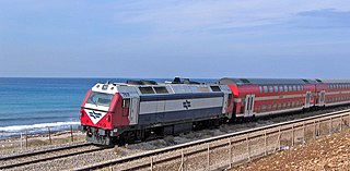
The Coastal railway line is a mainline railway in Israel, which begins just south of the Lebanon-Israel border on the Mediterranean coast, near the town of Nahariya in Northern Israel and stretches almost the entire Mediterranean coast of the country, to just north of the border with the Gaza Strip in the south.
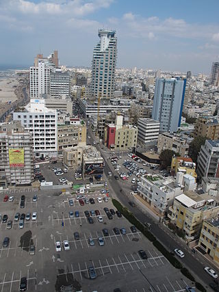
HaYarkon Street is a major street which runs roughly parallel with the coastline in Tel Aviv, Israel, carrying traffic north and south.

The Ayalon River is a perennial stream in Israel, originating in the Judean Hills and discharging into the Yarkon River in the area of Tel Aviv.
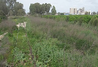
The Eastern Railway refers to a railroad in central Israel stretching from Lod to Hadera. The section between Kfar Saba and Lod, as well as a short section just north of Hadera are currently in use but the rest of the railway has not been operative since 1969. However, in 2019 a large-scale project began to rebuild and upgrade the railway along the entire route.

Wadi Auja, also spelled Ouja, known in Hebrew as Nahal Yitav is a valley or stream, in the West Bank, originating near the Ein Samia spring and flowing to Al-Auja near Jericho before it runs into the Jordan River.
The Yarkon Railway is a double-track railroad following the course of the Yarkon River in the central area of Israel. It is about 15 km long, stretching from the Coastal Railway to the Eastern Railway.

Rosh HaAyin South railway station is a railway station near Rosh HaAyin, Israel. Despite the name, it is located north-west of the city, near the historic site of Antipatris.