Rosići

Last updated
Rosići
Village
Serbia adm location map.svg
Red pog.svg
Rosići
Coordinates: 44°03′N19°56′E / 44.050°N 19.933°E / 44.050; 19.933
CountryFlag of Serbia.svg  Serbia
District Zlatibor District
Municipality Kosjerić
Population (2002)
  Total 316
Time zone CET (UTC+1)
  Summer (DST) CEST (UTC+2)

Rosići is a village in the municipality of Kosjerić, western Serbia. According to the 2002 census, the village has a population of 316 people. [1]

Village Small clustered human settlement smaller than a town

A village is a clustered human settlement or community, larger than a hamlet but smaller than a town, with a population ranging from a few hundred to a few thousand. Though villages are often located in rural areas, the term urban village is also applied to certain urban neighborhoods. Villages are normally permanent, with fixed dwellings; however, transient villages can occur. Further, the dwellings of a village are fairly close to one another, not scattered broadly over the landscape, as a dispersed settlement.

Kosjerić Town and municipality in Šumadija and Western Serbia, Serbia

Kosjeríć is a town and municipality located in the Zlatibor District of western Serbia. The municipality has a population of 12,090 inhabitants, but the town itself has 3,992. The municipality's area is 359 square kilometres (139 sq mi), with 26 villages mostly placed in the river valleys, though there are also some settlements in the mountains at altitudes of more than 1,000 metres.

Serbia Republic in Southeastern Europe

Serbia, officially the Republic of Serbia, is a country situated at the crossroads of Central and Southeast Europe in the southern Pannonian Plain and the central Balkans. The sovereign state borders Hungary to the north, Romania to the northeast, Bulgaria to the southeast, North Macedonia to the south, Croatia and Bosnia and Herzegovina to the west, and Montenegro to the southwest. The country claims a border with Albania through the disputed territory of Kosovo. Serbia's population is about seven million. Its capital, Belgrade, ranks among the oldest and largest citiеs in Europe.

Related Research Articles

Bosut (village) Place in Vojvodina, Serbia

Bosut is a village located in the Sremska Mitrovica municipality, in the Syrmia District of Serbia. It is situated near the Bosut River, in the autonomous province of Vojvodina. The village has a Serb ethnic majority and its population numbers 1,139 people.

Noćaj Place in Vojvodina, Serbia

Noćaj is a village in northern Serbia. It is located in the Sremska Mitrovica municipality, in the Syrmia District, Vojvodina province. The population of Noćaj numbering 2,120 people, and most of its inhabitants are ethnic Serbs (2,098).

Karlovčić Village in Vojvodina, Serbia

Karlovčić is a village in Serbia. It is situated in the Pećinci municipality, in the Srem District, Vojvodina province. The village has a Serb ethnic majority and its population numbering 1,243 people.

Popinci Village in Vojvodina, Serbia

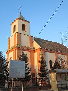
Popinci is a village in Serbia. It is situated in the Pećinci municipality, in the Srem District, Vojvodina province. The village has a Serb ethnic majority and its population numbering 1,360 people.

Sibač Village in Vojvodina, Serbia

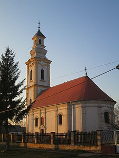
Sibač is a village in Serbia. It is situated in the Pećinci municipality, in the Srem District, Vojvodina province. The village has a Serb ethnic majority and its population numbering 544 people.

Sremski Mihaljevci Village in Vojvodina, Serbia

Sremski Mihaljevci is a village in Serbia. It is situated in the Pećinci municipality, in the Srem District, Vojvodina province. The village has a Serb ethnic majority and its population numbering 837 people.

Cujmir Commune in Mehedinți County, Romania

Cujmir is a commune in Mehedinți County, Romania, with 3,834 inhabitants as of 2002. It is composed of three villages: Aurora, Cujmir and Cujmiru Mic.

Mandabe Place in Menabe, Madagascar

Mandabe is a town and commune in Madagascar. It belongs to the district of Mahabo, which is a part of Menabe Region. The population of the commune was estimated to be approximately 27,000 in 2001 commune census.

Străoane Commune in Vrancea County, Romania

Străoane is a commune located in Vrancea County, Romania. It is composed of four villages: Muncelu, Repedea, Străoane and Văleni.

Crevedia Commune in Dâmbovița County, Romania

Crevedia is a commune in Dâmbovița County, southern Romania with a population of 6,617 people. It is composed of five villages: Cocani, Crevedia, Dârza, Mănăstirea and Samurcași.

Răzvad Commune in Dâmbovița County, Romania

Răzvad is a commune in Dâmbovița County, southern Romania with a population of 8,235 people. It is composed of three villages: Gorgota, Răzvad and Valea Voievozilor.

Roșiile Commune in Vâlcea County, Romania

Roșiile is a commune located in Vâlcea County, Romania. It is composed of eleven villages: Balaciu, Cherăști, Hotăroaia, Lupuiești, Păsărei, Pertești, Pleșești, Rățălești, Romanești, Roșiile and Zgubea.

Baldovinești Commune in Olt County, Romania

Baldovinești is a commune in Olt County, Romania. It is composed of three villages: Baldovinești, Gubandru and Pietriș. It included four other villages until 2004, when they were split off to form Găvănești Commune.

Robercin Village in Masovian, Poland

Robercin is a village in the administrative district of Gmina Piaseczno, within Piaseczno County, Masovian Voivodeship, in east-central Poland. It lies approximately 6 kilometres (4 mi) west of Piaseczno and 20 km (12 mi) south of Warsaw.

Wola Gołkowska Village in Masovian, Poland

Wola Gołkowska is a village in the administrative district of Gmina Piaseczno, within Piaseczno County, Masovian Voivodeship, in east-central Poland. It lies approximately 6 kilometres (4 mi) west of Piaseczno and 20 km (12 mi) south of Warsaw.

Lubotyń, Opole Voivodeship Village in Opole, Poland

Lubotyń is a village in the administrative district of Gmina Kietrz, within Głubczyce County, Opole Voivodeship, in south-western Poland, close to the Czech border. It lies approximately 7 kilometres (4 mi) south-west of Kietrz, 19 km (12 mi) south-east of Głubczyce, and 69 km (43 mi) south of the regional capital Opole.

Mehurići Village in Federation of Bosnia and Herzegovina, Bosnia and Herzegovina

Mehurići is a village in the municipality of Busovača, Bosnia and Herzegovina.

Joosu is a village in Põlva Parish, Põlva County in southeastern Estonia.

Mađer Village in Zlatibor District, Serbia

Mađer is a village in the municipality of Požega, western Serbia. According to the 2002 census, the village has a population of 153 people.

Popučke Village in Kolubara District, Serbia

Popučke is a village in the municipality of Valjevo, Serbia. According to the 2002 census, the village has a population of 2607 people.

References

  1. Popis stanovništva, domaćinstava i Stanova 2002. Knjiga 1: Nacionalna ili etnička pripadnost po naseljima. Republika Srbija, Republički zavod za statistiku Beograd 2003. ISBN   86-84433-00-9

Coordinates: 44°03′N19°56′E / 44.050°N 19.933°E / 44.050; 19.933

Geographic coordinate system Coordinate system

A geographic coordinate system is a coordinate system that enables every location on Earth to be specified by a set of numbers, letters or symbols. The coordinates are often chosen such that one of the numbers represents a vertical position and two or three of the numbers represent a horizontal position; alternatively, a geographic position may be expressed in a combined three-dimensional Cartesian vector. A common choice of coordinates is latitude, longitude and elevation. To specify a location on a plane requires a map projection.