Roszki-Sączki

Last updated
Roszki-Sączki
Village
Country Flag of Poland.svg  Poland
Voivodeship Podlaskie
County Wysokie Mazowieckie
Gmina Sokoły

Roszki-Sączki [ˈrɔʂki ˈsɔnt͡ʂki] is a village in the administrative district of Gmina Sokoły, within Wysokie Mazowieckie County, Podlaskie Voivodeship, in north-eastern Poland. [1]

Village Small clustered human settlement smaller than a town

A village is a clustered human settlement or community, larger than a hamlet but smaller than a town, with a population ranging from a few hundred to a few thousand. Though villages are often located in rural areas, the term urban village is also applied to certain urban neighborhoods. Villages are normally permanent, with fixed dwellings; however, transient villages can occur. Further, the dwellings of a village are fairly close to one another, not scattered broadly over the landscape, as a dispersed settlement.

Gmina Sokoły is a rural gmina in Wysokie Mazowieckie County, Podlaskie Voivodeship, in north-eastern Poland. Its seat is the village of Sokoły, which lies approximately 15 kilometres (9 mi) north-east of Wysokie Mazowieckie and 35 km (22 mi) south-west of the regional capital Białystok.

Wysokie Mazowieckie County County in Podlaskie, Poland

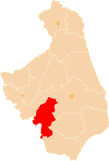
Wysokie Mazowieckie County is a unit of territorial administration and local government (powiat) in Podlaskie Voivodeship, north-eastern Poland. It came into being on January 1, 1999, as a result of the Polish local government reforms passed in 1998. Its administrative seat and largest town is Wysokie Mazowieckie, which lies 49 kilometres (30 mi) south-west of the regional capital Białystok. The only other towns in the county are Ciechanowiec, lying 27 km (17 mi) south of Wysokie, Szepietowo, 6 km (4 mi) south of Wysokie, and as from 1 January 2011 Czyżew.

Related Research Articles

In recreational mathematics, a Keith number or repfigit number is a number in the following integer sequence:

Soviet Military Cemetery, Warsaw cemetery

The Soviet Military Cemetery in Warsaw, Poland, is the burial place of over 20,000 Soviet soldiers who died fighting against Nazi Germany. It contains one of the first major monuments to be built in Warsaw to those who fought in the Second World War. It includes examples of Socialist Realist art showing workers and other civilians greeting the victorious soldiers.

Zona Bananera, Magdalena municipality in Caribbean, Colombia

Zona Bananera is a municipality of the Magdalena Department in northern Colombia. Its main town is Prado Sevilla.

Roman Catholic Diocese of Ciudad Real diocese of the Catholic Church

The Roman Catholic Diocese of Ciudad Real is a diocese located in the city of Ciudad Real in the Ecclesiastical province of Toledo in Spain.

Blokkøya is an island in the southwestern part of Scareholmane, an island group in Thousand Islands, an archipelago south of Edgeøya.

Drăgușeni is a commune in Galați County, Romania with a population of 5,255 people. It is composed of seven villages: Adam, Căuiești, Drăgușeni, Fundeanu, Ghinghești, Nicopole and Știețești.

Pełki Village in Masovian, Poland

Pełki is a village in the administrative district of Gmina Bieżuń, within Żuromin County, Masovian Voivodeship, in east-central Poland. It lies approximately 10 kilometres (6 mi) north-east of Bieżuń, 13 km (8 mi) south-east of Żuromin, and 108 km (67 mi) north-west of Warsaw.

Đổng Xá Commune and village in Bắc Kạn Province, Vietnam

Đồng Xá is a commune () and village in Na Rì District, Bắc Kạn Province, in Vietnam.

Mount Nebo is one of the 31 barangays of Valencia City, Bukidnon. It includes the sitios of Hillside, Handuman, Tama-ing, Migtulod, MVC, Mirasol, Hillside 2. It is bounded by Lurogan in the east, Lilingayon in the northwest, the municipality of Lantapan in the north, and Tugaya in the south.

Çatağıl' is a village in the District of İscehisar, Afyonkarahisar Province, Turkey.

Nikola Tesla (Niška Banja) Suburb in Niška Banja, Serbia

Nikola Tesla is a city suburb situated in Niška Banja municipality in Serbia.

Çavdarlı is a village in the District of Hanak, Ardahan Province, Turkey.

Dehgah-e Lalmir is a village in Margha Rural District, in the Central District of Izeh County, Khuzestan Province, Iran. At the 2006 census, its population was 93, in 17 families.

Ars Musici is a German classical music record label founded in Freiburg im Breisgau in 1993 by Rudolf Ruby after his retirement from Deutsche Harmonia Mundi. The label was purchased in 2008 by Membran.

Bolterdalen is a valley in Nordenskiöld Land at Spitsbergen, Svalbard. It is located south of Adventdalen, and the Bolterelva river flows through the valley.

Unión Santeña is a corregimiento in Chimán District, Panamá Province, Panama with a population of 920 as of 2010. It was created by Law 5 of January 19, 1998. Its population as of 2000 was 1,023.

Novokayakent (Новокаякент) is a village in Dagestan Republic. It is the administrative centre of Kayakentsky District.

Vineyard Township is an inactive township in Lawrence County, in the U.S. state of Missouri.

Walton Township is an inactive township in Washington County, in the U.S. state of Missouri.

Union Township is a township in Webster County, in the U.S. state of Missouri.

References


Coordinates: 52°59′12″N22°45′53″E / 52.9867°N 22.7647°E / 52.9867; 22.7647

Geographic coordinate system Coordinate system

A geographic coordinate system is a coordinate system that enables every location on Earth to be specified by a set of numbers, letters or symbols. The coordinates are often chosen such that one of the numbers represents a vertical position and two or three of the numbers represent a horizontal position; alternatively, a geographic position may be expressed in a combined three-dimensional Cartesian vector. A common choice of coordinates is latitude, longitude and elevation. To specify a location on a plane requires a map projection.