Rowanty Creek

Last updated
Rowanty Creek
Tributary to Nottoway River
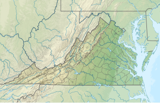
USA Virginia location map.svg
Red pog.svg
Location
CountryUnited States
StateVirginia
CountySussex
Prince George
Dinwiddie
Physical characteristics
Sourceconfluence of Hatcher Run and Gravelly Run
  locationabout 4 miles east of Dinwiddie, Virginia
  coordinates 37°05′40″N077°28′25″W / 37.09444°N 77.47361°W / 37.09444; -77.47361 [1]
  elevationabout 98 feet
Mouth confluence of Rowanty Creek and Nottoway River
  location
about 2 miles northeast of Stony Creek, Virginia
  coordinates
36°58′17″N077°20′46″W / 36.97139°N 77.34611°W / 36.97139; -77.34611 [2]
  elevation
50 feet amsl
Length22 km/14 miles [3]
Basin features
Progressionsoutheast
River system Nottoway River
Tributaries 
  leftHatcher Run
Picture Branch
Rocky Branch
Arthur Swamp
Warren Swamp
  rightGravelly Run
Little Cattail Creek
Health Meadows Branch
Fox Branch
Harvells Branch
Bolling Swamp
Galley Swamp
BridgesDinwiddie County 669
Dinwiddie County 703
US 301
I-95
Sussex County 602

Rowanty Creek is a 14-mile long creek that is a tributary to the Nottoway River in southeastern Virginia. It is formed at the confluence of Hatcher Run and Gravelly Run.
Contents

Course

Rowanty Creek flows southeast from its confluence source in a braided swamp. Along the way, it encounters a few constrictions that narrow the floodplain. A number of swamps are connected together near its mouth with the Nottoway River.

Sources

The confluence of Hatcher Run and Gravelly Run mark the source of Rowanty Creek. Hatcher Run is about 7 km/4 miles in length and arises at an elevation of about 310 feet near Poole Siding, Virginia. [4] Hatcher Run is impounded in two places, Jordon Lake and Speers Millpond. Gravelly Run at 17.5 km/11 miles is the longer of the two sources. [5] It arises at an elevation of 280 feet and has one impoundment, Wilkinson Pond. [6]

Geology

Rowanty Creek flows its entire distance through Coastal Plain alluvium. However, the two runs that form the creek start in Petersburg Granite that is part of the Piedmont. [7]

See also

Related Research Articles

Raccoon Creek (Beaver County, Pennsylvania) Stream in Pennsylvania, USA

Raccoon Creek is a tributary of the Ohio River in Beaver County, Pennsylvania, United States.

Marshyhope Creek river in the United States of America


Marshyhope Creek is a 37.0-mile-long (59.5 km) tributary of the Nanticoke River on the Delmarva Peninsula. It rises in Kent County, Delaware, and runs through Caroline County, Maryland, and Dorchester County, Maryland.

Coddle Creek Stream in North Carolina, USA

Coddle Creek is a stream/river that rises near Mooresville in Iredell County, North Carolina. It flows through most of northwestern Cabarrus County, North Carolina where it empties into Rocky River near Harrisburg, North Carolina.

Muddy Creek (Slippery Rock Creek tributary) Stream in Pennsylvania, USA


Muddy Creek is a tributary of Slippery Rock Creek in Butler and Lawrence Counties in Pennsylvania in the United States. The run is 23.2 miles (37.3 km) long, flows generally west, and its watershed is 58.2 square miles (150.7 km2) in area. Muddy Creek is the main water source for Lake Arthur in Moraine State Park.

Little Nottoway River river in the United States of America

The Little Nottoway River is a 14.3 mile long tributary to the Nottoway River in the United States state of Virginia. Located in the southeastern part of the state it is part of the larger Chowan-Albemarle drainage.

Stony Creek (Virginia) river in United States of America

Stony Creek is a 21 mile long tributary to the Nottoway River in southeastern Virginia of the United States. The creek is formed by the confluence of Butterwood Creek and White Oak Creek in Dinwiddie County, Virginia.

Three Creek river in the United States of America

Three Creek is a nearly 47 mile long tributary of the Nottoway River in southeastern Virginia in the United States.

East Branch Oil Creek (Oil Creek tributary)

East Branch Oil Creek is a 10.9-mile long tributary to Oil Creek in Crawford County, Pennsylvania.

Marsh Run (Oil Creek tributary) Tributary to Oil Creek in Crawford County, Pennsylvania

Marsh Run is a 4.0-mile long tributary to Oil Creek in Crawford County, Pennsylvania.

Mosey Run (Oil Creek tributary) Tributary to Oil Creek in Crawford County, Pennsylvania

Mosey Run is a 7.5-mile long tributary to Oil Creek in Crawford County, Pennsylvania.

Hell Run (Slippery Rock Creek tributary) Stream in Pennsylvania, USA

Hell Run is an 4.5 mi (7.2 km) long tributary to Slippery Rock Creek in Lawrence County, Pennsylvania. Hell Run flows most of its distance through McConnells Mill State Park and is the only stream in Lawrence County, Pennsylvania rated as an Exceptional Value (EV) stream.

Neshannock Creek (Shenango River tributary) Stream in Pennsylvania, USA

Neshannock Creek is a 25.65 mi (41.28 km) long tributary to Shenango River that forms at the confluence of Cool Spring and Otter Creek in Mercer County and then flows south to Lawrence County, Pennsylvania. This creek is known for its fly fishing at Volant, Pennsylvania.

Sugar Creek (French Creek tributary) Stream in Pennsylvania, USA

Sugar Creek is a 22.66 mi (36.47 km) long tributary to French Creek in Venango County, Pennsylvania that rises in Crawford County, Pennsylvania.

Deep Creek (Nanticoke River tributary)

Deep Creek is a 14.0-mile-long (22.5 km) tributary of the Nanticoke River that rises in the Redden area and flows southwest towards Seaford, Delaware.

Alapocas Run (Brandywine Creek tributary) Stream in Delaware, USA

Alapocas Run is a 1.05 mi (1.69 km) long tributary to Brandywine Creek in New Castle County, Delaware. This run drains a large portion of Alapocas Run State Park in the Wilmington, Delaware area.

Augustine Creek (Delaware Bay tributary) Stream in Delaware, USA

Augustine Creek is a 4.54 mi (7.31 km) long tributary to Delaware Bay in New Castle County, Delaware. Augustine Creek is tidal for most of its course.

Silver Run (Delaware Bay tributary) Stream in Delaware, USA

Silver Run is a 3.03 mi (4.88 km) long tributary to Delaware Bay in New Castle County, Delaware. Silver Run is tidal for most of its course and drains a large part of Augustine Wildlife Area.

Chapel Branch (Lewes Creek tributary) Stream in Delaware, USA

Chapel Branch is a 6.4 mi (10.3 km) long tributary to Lewes Creek in Sussex County, Delaware. Lewes Creek then flows into the Nanticoke River.

Gum Branch (Nanticoke River tributary) Stream in Delaware, USA

Gum Branch is a 9.72 mi (15.64 km) long tributary to Nanticoke River in Sussex County, Delaware. It is one of the major tributaries to the Nanticoke River in Delaware along with Deep Creek, Gravelly Branch, and Broad Creek.

Clear Brook (Nanticoke River tributary) Stream in Delaware, USA

Clear Brook is a 23.02 mi (37.05 km) long tributary to Nanticoke River in Sussex County, Delaware. It joins the Nanticoke at "Williams Pond" in the City of Seaford, Delaware.

References

  1. "GNIS Detail - Rowanty Creek". geonames.usgs.gov. US Geological Survey. Retrieved 2 June 2019.
  2. "GNIS Detail - Rowanty Creek". geonames.usgs.gov. US Geological Survey. Retrieved 2 June 2019.
  3. "ArcGIS Web Application". epa.maps.arcgis.com. US EPA. Retrieved 2 June 2019.
  4. "Butterwood Lake Topo Map, Nottoway County VA (Blackstone East Area)". TopoZone. Locality, LLC. Retrieved 2 June 2019.
  5. "ArcGIS Web Application". epa.maps.arcgis.com. US EPA. Retrieved 2 June 2019.
  6. "Butterwood Lake Topo Map, Nottoway County VA (Blackstone East Area)". TopoZone. Locality, LLC. Retrieved 2 June 2019.
  7. "ArcGIS Web Application". www.dmme.virginia.gov. Virginia Division of Geology and Mineral Resources. Retrieved 2 June 2019.
International Standard Book Number Unique numeric book identifier

The International Standard Book Number (ISBN) is a numeric commercial book identifier which is intended to be unique. Publishers purchase ISBNs from an affiliate of the International ISBN Agency.