Ruby Country

Last updated

Coordinates: 51°04′30″N3°17′02″W / 51.075°N 3.284°W / 51.075; -3.284

Geographic coordinate system Coordinate system

A geographic coordinate system is a coordinate system that enables every location on Earth to be specified by a set of numbers, letters or symbols. The coordinates are often chosen such that one of the numbers represents a vertical position and two or three of the numbers represent a horizontal position; alternatively, a geographic position may be expressed in a combined three-dimensional Cartesian vector. A common choice of coordinates is latitude, longitude and elevation. To specify a location on a plane requires a map projection.

RUBY COUNTRY LOGO.png

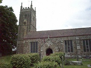
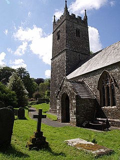
Ruby Country is the name given to the rural inland hinterland of north-west Devon, UK. It covers 45 parishes around the market towns of Holsworthy and Hatherleigh. These two towns were at the centre of the 2001 Foot and Mouth Disease outbreak, and although agriculture was directly affected, most local businesses suffered considerable financial hardship.

Devon County of England

Devon, also known as Devonshire, which was formerly its common and official name, is a county of England, reaching from the Bristol Channel in the north to the English Channel in the south. It is part of South West England, bounded by Cornwall to the west, Somerset to the north east, and Dorset to the east. The city of Exeter is the county town. The county includes the districts of East Devon, Mid Devon, North Devon, South Hams, Teignbridge, Torridge, and West Devon. Plymouth and Torbay are each geographically part of Devon, but are administered as unitary authorities. Combined as a ceremonial county, Devon's area is 6,707 km2 and its population is about 1.1 million.

A parish is a territorial entity in many Christian denominations, constituting a division within a diocese. A parish is under the pastoral care and clerical jurisdiction of a parish priest, who might be assisted by one or more curates, and who operates from a parish church. Historically, a parish often covered the same geographical area as a manor. Its association with the parish church remains paramount.

As a result, the Ruby Country Initiative was established, a not for profit partnership, to help create a more robust and sustainable local economy, and to create an identity for the area. [1]

Partnership arrangement in which parties agree to cooperate to advance their mutual interests

A partnership is an arrangement where parties, known as partners, agree to cooperate to advance their mutual interests. The partners in a partnership may be individuals, businesses, interest-based organizations, schools, governments or combinations. Organizations may partner to increase the likelihood of each achieving their mission and to amplify their reach. A partnership may result in issuing and holding equity or may be only governed by a contract.

The project is supported by a number of organisations: Devon County Council, Devon Renaissance, Devon Wildlife Trust, Forestry Commission, Hatherleigh Area Project, Holsworthy Market and Coastal Town Initiative, North Devon's Biosphere Reserve, Torridge District Council and West Devon Borough Council.

Devon County Council British administrative authority

Devon County Council is the county council administering the English county of Devon. Based in the city of Exeter, the council covers the non-metropolitan county area of Devon. Members of the council (councillors) are elected every four years to represent the electorate of each county division, almost all being nominated by the major national political parties.

Devon Wildlife Trust member of The Wildlife Trusts partnership covering the county of Devon, England

The Devon Wildlife Trust is a member of The Wildlife Trusts partnership covering the county of Devon, England. It is a registered charity, established in 1962 as the Devon Naturalists Trust, and its aim is to safeguard the future of the county's urban, rural and marine wildlife and its environment.

The Forestry Commission is a non-ministerial government department responsible for forestry in England and Scotland. It was set up in 1919 to expand Britain's forests and woodland after depletion during the First World War. To do this, the commission bought large amounts of former agricultural land, eventually becoming the largest land owner in Britain. The Commission is divided into three divisions: Forestry Commission England, Forestry Commission Scotland and Forest Research. Forestry Commission Scotland reports to the Scottish Government.

Related Research Articles

North Devon Non-metropolitan district in England

North Devon is a local government district in Devon, England. Its council is based in Barnstaple. Other towns and villages in the North Devon District include Braunton, Fremington, Ilfracombe, Instow, South Molton, Lynton and Lynmouth. The district was formed on 1 April 1974 as a merger of the Barnstaple municipal borough, the Ilfracombe and Lynton urban districts, and the Barnstaple and South Molton rural districts.

Torridge District Non-metropolitan district in England

Torridge is a local government district in North Devon, England. Its council is based in Bideford. Other towns and villages in the district include Holsworthy, Great Torrington, Hartland and Westward Ho!. The island of Lundy is administratively part of the district. To the south of the district bordering Cornwall, near Welcombe, the rugged coastline has a wild untouched beauty, due to its inaccessibility, but the South West Coast Path is well defined. The district is named after the River Torridge.

Black Torrington village in United Kingdom

Black Torrington is a village and civil parish in mid Devon, England, situated between the towns of Holsworthy and Hatherleigh. It is located on and named after the River Torridge.

Hatherleigh town

Hatherleigh is a small market town in west Devon, England.

Thornbury, Devon village and civil parish in Torridge, Devon, England

Thornbury is a small village and civil parish in the local government district of Torridge, Devon, England. The parish, which lies about five miles north-east of the town of Holsworthy, comprises the five hamlets of Thornbury, Woodacott, Brendon, Lashbrook and South Wonford. These five hamlets are spread over an area of some 6 square miles, with a distance of 3 miles from Brendon to Thornbury Church. Hence, the community is quite widespread, with the only focal point being the Green at Woodacott Cross. The parish is surrounded clockwise from the north by the parishes of Milton Damerel, Bradford, Cookbury and Holsworthy Hamlets. In 2011 its population was 290, in 120 households, little changed from the 291 residents it had in 1901.

Cookbury village in Devon, England

Cookbury is a village and civil parish in the local government district of Torridge, Devon, England. The parish, which lies about five miles east of the town of Holsworthy, is surrounded clockwise from the north by the parishes of Thornbury, Bradford, Ashwater, Hollacombe, and Holsworthy Hamlets. In 2001 its population was 158, little changed from the 146 residents it had in 1901.

Landkey village in the United Kingdom

Landkey is a small village in the county of Devon in the south-west of England with a population of 2274, falling to 1,734 at the 2011 census. It is situated 3 miles (4.8 km) from the nearest town of Barnstaple. The village is a major part of the electoral ward called Landkey, Swimbridge and Taw. The total ward population at the above census was 4,957.

North Devon College

North Devon College was a further education college in Barnstaple, North Devon. It is now part of Petroc.

The Okehampton–Bude line was a railway line built to serve Holsworthy, in Devon, and then Bude, on the Cornish coast near the Devon border in the United Kingdom. It branched from a main route at Meldon Junction, a little to the west of Okehampton, on the northern margin of Dartmoor. It opened in 1879 to Holsworthy and 1898 to Bude; the line is now closed.

Bradford, Devon village in Devon, United Kingdom

Bradford is a village and civil parish in the local government district of Torridge, Devon, England. The parish, which lies about six miles east of the town of Holsworthy has part of its eastern boundary formed by the River Torridge, and it is surrounded clockwise from the north by the parishes of Milton Damerel, Shebbear, Black Torrington, Ashwater, Cookbury and Thornbury. In 2001 its population was 359, compared to 280 in 1901.

Halwill Junction railway station railway station

Halwill Junction Railway Station was a railway station in Halwill Junction, near the villages of Halwill and Beaworthy in Devon, England. It opened in 1879 and formed an important junction between the now-closed Bude Branch and North Cornwall line. It closed in 1966 along with the lines which it served, a casualty of the Beeching Report.

Holsworthy railway station

Holsworthy was a railway station in Devon, England, on the now-closed railway line from Okehampton to Bude. It opened in 1879 to serve the market town of Holsworthy and closed in 1966, a victim of the Beeching Axe.

Pyworthy village in United Kingdom

Pyworthy is a village and civil parish in the far west of Devon, England. It forms part of the local government district of Torridge. The parish lies to the west of the town of Holsworthy. It is surrounded clockwise from the north-west by the parishes of Bridgerule, a small part of Pancrasweek, Holsworthy Hamlets and Holsworthy, and Clawton. Its western border follows the River Tamar which forms the county boundary with Cornwall. In 2001 its population was 689, up from 429 in 1901.

Clawton village in United Kingdom

Clawton is a village and civil parish in the far west of Devon, England. It forms part of the local government district of Torridge. The village lies about three miles south of the town of Holsworthy on the A388 road. The parish is surrounded clockwise from the north-west by the parishes of Pyworthy, Holsworthy Hamlets, Ashwater, and Tetcott. Its western border follows the River Tamar which forms the county boundary with Cornwall. In 2001 its population was 326, slightly down from 389 in 1901.

Northcott, Devon

Northcott is a small settlement and civil parish in the far west of Devon, England. It lies about seven miles south of the town of Holsworthy and forms part of the local government district of Torridge. It is bordered on the north by the parish of Luffincott and on the east and south by the parish of St Giles on the Heath. Its western border follows the River Tamar which forms the county boundary with Cornwall. In 2001 its population was 26, down from 60 in 1901. Whilst it is administered as a separate parish in Devon, for ecclesiastical purposes it is linked with the parish of Boyton across the River Tamar in Cornwall, and it has been transferred from one county to the other several times.

Holsworthy Hamlets

Holsworthy Hamlets is a civil parish in the northwest of Devon, England. It forms part of the local government district of Torridge and came into being on 1 April 1900 when the ecclesiastical parish of Holsworthy was split into two.

Hollacombe a village located in Torridge, United Kingdom

Hollacombe is a village and small civil parish in the local government district of Torridge, Devon, England. It lies about five miles south east of the town of Holsworthy and is surrounded clockwise from the north by the parishes of Cookbury, Ashwater, and Holsworthy Hamlets. In 2001 its population was 59, compared to 69 in 1901.

Pancrasweek

Pancrasweek is a civil parish and hamlet in the far west of Devon, England forming part of the local government district of Torridge and lying about three miles north west of the town of Holsworthy.

Sutcombe farm village in the United Kingdom

Sutcombe is a village and civil parish in the local government district of Torridge, Devon, England. The parish, which lies about 5.5 miles north of the town of Holsworthy, is surrounded clockwise from the north by the parishes of West Putford, Abbots Bickington, Milton Damerel, Holsworthy Hamlets and Bradworthy. In 2001 its population was 299, compared to 351 in 1901.

References

  1. "Welcome to the Ruby Country". Ruby Country. Retrieved 5 July 2016.

Manning, S. et al."Land Between the Moors", Countryside Agency, Spring, 2004. Accessed May 25, 2008.

Countryside Agency

The Countryside Agency was a statutory body set up in England in 1999 with the task of improving the quality of the rural environment and the lives of those living in it. The Agency was formed by merging the Countryside Commission and the Rural Development Commission. Its powers were inherited from those bodies.