Dębołęka is a village in the administrative district of Gmina Wałcz, within Wałcz County, West Pomeranian Voivodeship, in north-western Poland. It lies approximately 15 kilometres (9 mi) north-west of Wałcz and 117 km (73 mi) east of the regional capital Szczecin. It is mainly surrounded by farm land.

Górnica is a village in the administrative district of Gmina Wałcz, within Wałcz County, West Pomeranian Voivodeship, in north-western Poland. It lies approximately 17 kilometres (11 mi) north-west of Wałcz and 113 km (70 mi) east of the regional capital Szczecin.

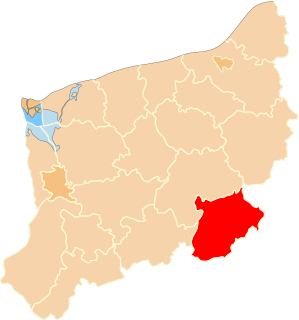
Kłębowiec is a village in the administrative district of Gmina Wałcz, within Wałcz County, West Pomeranian Voivodeship, in north-western Poland. It lies approximately 6 kilometres (4 mi) north of Wałcz and 124 km (77 mi) east of the regional capital Szczecin.
Kłosowo is a village in the administrative district of Gmina Wałcz, within Wałcz County, West Pomeranian Voivodeship, in north-western Poland. It lies approximately 18 kilometres (11 mi) north-west of Wałcz and 113 km (70 mi) east of the regional capital Szczecin.
Lubno is a village in the administrative district of Gmina Wałcz, within Wałcz County, West Pomeranian Voivodeship, in north-western Poland. It lies approximately 11 kilometres (7 mi) north-west of Wałcz and 118 km (73 mi) east of the regional capital Szczecin.
Głębockie Drugie is a village in the administrative district of Gmina Ślesin, within Konin County, Greater Poland Voivodeship, in west-central Poland. It lies approximately 6 kilometres (4 mi) north-east of Ślesin, 22 km (14 mi) north of Konin, and 99 km (62 mi) east of the regional capital Poznań.
Załuski is a village in the administrative district of Gmina Nidzica, within Nidzica County, Warmian-Masurian Voivodeship, in northern Poland. It lies approximately 7 kilometres (4 mi) north-west of Nidzica and 44 km (27 mi) south of the regional capital Olsztyn.
Bukowo is a village in the administrative district of Gmina Człopa, within Wałcz County, West Pomeranian Voivodeship, in north-western Poland. It lies approximately 5 kilometres (3 mi) north-east of Człopa, 26 km (16 mi) south-west of Wałcz, and 114 km (71 mi) east of the regional capital Szczecin.
Golin is a village in the administrative district of Gmina Człopa, within Wałcz County, West Pomeranian Voivodeship, in north-western Poland. It lies approximately 7 kilometres (4 mi) north-west of Człopa, 30 km (19 mi) south-west of Wałcz, and 105 km (65 mi) east of the regional capital Szczecin.
Jaglice is a village in the administrative district of Gmina Człopa, within Wałcz County, West Pomeranian Voivodeship, in north-western Poland. It lies approximately 6 kilometres (4 mi) east of Człopa, 28 km (17 mi) south-west of Wałcz, and 116 km (72 mi) east of the regional capital Szczecin.
Mielęcin is a village in the administrative district of Gmina Człopa, within Wałcz County, West Pomeranian Voivodeship, in north-western Poland. It lies approximately 10 kilometres (6 mi) north-east of Człopa, 21 km (13 mi) south-west of Wałcz, and 116 km (72 mi) east of the regional capital Szczecin.
Przelewice is a village in the administrative district of Gmina Człopa, within Wałcz County, West Pomeranian Voivodeship, in north-western Poland. It lies approximately 6 kilometres (4 mi) south of Człopa, 35 km (22 mi) south-west of Wałcz, and 111 km (69 mi) south-east of the regional capital Szczecin.
Trzebin is a village in the administrative district of Gmina Człopa, within Wałcz County, West Pomeranian Voivodeship, in north-western Poland. It lies approximately 2 kilometres (1 mi) south of Człopa, 32 km (20 mi) south-west of Wałcz, and 111 km (69 mi) east of the regional capital Szczecin.
Załom is a village in the administrative district of Gmina Człopa, within Wałcz County, West Pomeranian Voivodeship, in north-western Poland. It lies approximately 5 kilometres (3 mi) west of Człopa, 34 km (21 mi) south-west of Wałcz, and 106 km (66 mi) east of the regional capital Szczecin.
Jadwiżyn is a village in the administrative district of Gmina Mirosławiec, within Wałcz County, West Pomeranian Voivodeship, in north-western Poland. It lies approximately 8 kilometres (5 mi) south-east of Mirosławiec, 22 km (14 mi) west of Wałcz, and 106 km (66 mi) east of the regional capital Szczecin.
Toporzyk is a village in the administrative district of Gmina Mirosławiec, within Wałcz County, West Pomeranian Voivodeship, in north-western Poland. It lies approximately 9 kilometres (6 mi) east of Mirosławiec, 20 km (12 mi) north-west of Wałcz, and 109 km (68 mi) east of the regional capital Szczecin.
Jamienko is a village in the administrative district of Gmina Tuczno, within Wałcz County, West Pomeranian Voivodeship, in north-western Poland. It lies approximately 12 kilometres (7 mi) north of Tuczno, 18 km (11 mi) west of Wałcz, and 109 km (68 mi) east of the regional capital Szczecin.
Lubiesz is a village in the administrative district of Gmina Tuczno, within Wałcz County, West Pomeranian Voivodeship, in north-western Poland. It lies approximately 9 kilometres (6 mi) north-east of Tuczno, 19 km (12 mi) west of Wałcz, and 108 km (67 mi) east of the regional capital Szczecin.
Martew is a village in the administrative district of Gmina Tuczno, within Wałcz County, West Pomeranian Voivodeship, in north-western Poland. It lies approximately 3 kilometres (2 mi) south-west of Tuczno, 27 km (17 mi) south-west of Wałcz, and 105 km (65 mi) east of the regional capital Szczecin.
Miłogoszcz is a village in the administrative district of Gmina Tuczno, within Wałcz County, West Pomeranian Voivodeship, in north-western Poland. It lies approximately 6 kilometres (4 mi) south-east of Tuczno, 22 km (14 mi) south-west of Wałcz, and 112 km (70 mi) east of the regional capital Szczecin.