
Lusatia is a historical region in Central Europe, territorially split between Germany and modern-day Poland. Lusatia stretches from the Bóbr and Kwisa rivers in the east to the Pulsnitz and Black Elster rivers in the west, and is located within the German states of Saxony and Brandenburg as well as in the Polish voivodeships of Lower Silesia and Lubusz. Major rivers of Lusatia are the Spree and the Lusatian Neisse, which defines the border between Germany and Poland. The Lusatian Mountains of the Western Sudetes separate Lusatia from Bohemia in the south. Lusatia is traditionally divided into Upper Lusatia, the hilly southern part, and Lower Lusatia, the flat northern part.
Elbe-Elster is a Kreis (district) in the southern part of Brandenburg, Germany. Neighboring districts are Teltow-Fläming, Dahme-Spreewald, Oberspreewald-Lausitz, Meißen, Nordsachsen and Wittenberg. The district has a partnership with the Märkischer Kreis.

Torgau-Oschatz is a former district (Kreis) in Saxony, Germany. It was bounded by the district Wittenberg in Saxony-Anhalt, the district Elbe-Elster in Brandenburg, and the districts Riesa-Großenhain, Döbeln, Muldentalkreis and Delitzsch.

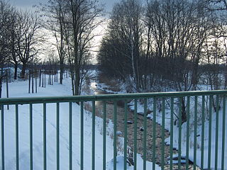
The Black Elster or Schwarze Elster is a 179-kilometre (111 mi) long river in eastern Germany, in the states of Saxony, Brandenburg and Saxony-Anhalt. It is a right tributary of the Elbe. Its source is in the Upper Lusatia region, near Elstra.

The Böhme is a right-bank, northeastern tributary of the Aller in the district of Soltau-Fallingbostel in the north German state of Lower Saxony. The river is 72 kilometres (45 mi) long.

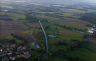
is a town in the Oberspreewald-Lausitz district, in Upper Lusatia, Brandenburg, in eastern Germany. It is situated on the river Schwarze Elster, 12 kilometres (7.5 mi) southwest of Senftenberg.
Schwarzheide or Carny Gózd is a town in the Oberspreewald-Lausitz district, in Lower Lusatia, Brandenburg, Germany. It is situated on the river Schwarze Elster, 11 km southwest of Senftenberg, 110 km south of Berlin and 40 km north of Dresden. The little river Pössnitz runs through the eastern part of Schwarzheide.
Schwarzwasser is German for "black water" and may refer to:

The Black Pockau is a river of Saxony, Germany, in the Ore Mountains. It is a left tributary of the Flöha. This virtually unspoilt wild stream with a length of 33 km (21 mi) is known for the picturesque gorge in its middle reaches.

The Western Ore Mountains is a natural region that forms the westernmost part of the Ore Mountains in the German state of Saxony. It is also part of the major landscape unit known as the Saxon Highlands and Uplands. It extends eastwards to include the valley of the Schwarzwasser, and, below its mouth, that of the Zwickauer Mulde, and incorporates the western parts of the former major units known as the Lower and Upper Western Ore Mountains, no. 423, as well as the Southern Slopes of the Ore Mountains, no. 420.
The Schwarzwasser or Černá is a river in Germany and the Czech Republic. The name means 'black'. It is a right tributary of the Zwickauer Mulde in the German state of Saxony. It flows through Schwarzenberg.
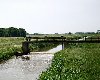
The Pößnitz is a river of Brandenburg, Germany. It flows into the Black Elster near Ruhland.
The Große Röder is a river of Saxony and Brandenburg, eastern Germany. It is a left tributary of the river Black Elster. It rises near Arnsdorf, about 20 km (12 mi) east of Dresden. It flows in a generally northwestern direction, through the towns Radeberg, Radeburg and Großenhain. It joins the Black Elster in the village Haida, west of Elsterwerda.
The Kleine Röder, also called the Schwarzgraben, is a river in Saxony and Brandenburg, Germany.

The term West Lusatia was coined in the 1950s for the old counties of Hoyerswerda, Kamenz and Bischofswerda – mainly in order to make the Museum of West Lusatia into a centrepoint. Culturally and historically, West Lusatia corresponds to western Upper Lusatia, including part of the Brandenburg county of Oberspreewald-Lausitz, between the rivers Pulsnitz and Black Elster.
The Königsbrück-Ruhland Heaths are a natural region in Saxony and in Brandenburg. They are located around the two towns that give the heathlands their name: Königsbrück and Ruhland, that, although in two different German states, are historically part of Upper Lusatia and represent border towns of that region. To the west is the Großenhainer Pflege, to the east the Upper Lusatian Heath and Pond Landscape. In the south they interleave with the West Lusatian Hill Country and Uplands.

The classification of natural regions of Saxony shown here was produced between 1994 and 2001 by a working group called "Ecosystem and Regional Character" at the Saxonian Academy of Sciences in Leipzig as part of the research and development project "Natural Regions and Natural Region Potential of the Free State of Saxony" at a scale of 1:50,000 as the basis for the rural development and regional planning. This was also supported by the Saxon State Ministry of the Environment and Agriculture and the Saxon Ministry of the Interior.

Prieschka is a district of the spa town of Bad Liebenwerda in Elbe-Elster in southern Brandenburg.

Zeischa is an Ortsteil of the spa town of Bad Liebenwerda in the district of Elbe-Elster in southern Brandenburg. The village is located about three kilometres from the town centre in the Lower Lusatian Heath Nature Park on the banks of the Black Elster River.

