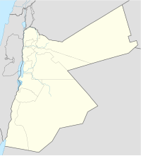
Coordinates | 31°57′28″N35°54′17″E / 31.95772°N 35.904613°E |
---|---|
Type | Ammonite tower |
History | |
Founded | 6th-5th century BCE (?); at least reused in the Roman period |
Site notes | |
Public access | Yes |
Rujm al-Malfouf or Rujm al-Malfouf North is an ancient structure consisting of a round stone tower and several adjacent storerooms, located in modern-day Amman, Jordan [1] (ancient Rabbath Ammon), on the northern side of Jabal Amman [2] and next to the Department of Antiquities. [3] Possibly built in the mid-first millennium BCE (Iron Age II period) during the Ammonite Kingdom, it was with certainty at least rebuilt and reused during the Roman period. [4] There are a number of tower-like structures on the plateaus of central Jordan, which were interpreted as "Ammonite towers" in the sense of border forts by Nelson Glueck in 1939, but are more recently considered to have fulfilled a variety of purposes across many historical periods, mainly of an agricultural and residential nature. [5] [6] This article deals with the entire category of such sites, primarily though with Rujm al-Malfouf North.
Rujm al-Malfouf South, now destroyed, was a smaller "Ammonite tower" on the southwestern side of Jabal Amman (13 m diametre, compared to the northern tower's 22 m diametre). [2] [7]
Rujm al-Malfouf can be translated as "heap of stones that are round". The translation "cabbage" for mafluf is rejected by P. M. Bikai. [6] The Arabic word rujm, used as part of toponyms, means pile of stones, cairn, sometimes tumulus.
Rujm el-Malfuf North was excavated in 1969 by Roger Boraas, who published his report in 1971. [4] The round part of the structure is 22 m in diametre. [2] It is the only round rujm-type building in this category known, as of 1991, to have had an entrance; the others might have been accessed by ladder. [5] The split-level entrance led to a ground floor or basement whose floor was directly on the bedrock, and to an upper floor above it, the two levels being separated by a Roman-style corbel ceiling/floor resting on partition walls. [4] The building was plastered on the outside, as was Rujm el-Malfuf South, possibly to make it harder to climb for attackers. [5] Partition walls present at every site indicate the existence of either a corbelled roof, or one held by wooden beams. [5]
Dating the stone structures in the area has proven to be very difficult, too few of them being excavated - some not at all, others just partially -, with pottery being the main means of establishing a relative date, and even that based on the assumption that the ceramic sequence east of the River Jordan would be the same as west of it. [7]
Kletter (1991) called the entire typological group "Rujm el-Malfuf buildings", although ironically Rujm al-Malfouf North is the only example of an "Ammonite tower", to use Glueck's term, which yielded only Roman-period findings at the 1969 excavation, leaving it isolated in this regard. [5] Roger Boraas excavated two areas down to bedrock, inside and outside the tower, and only found Roman-period pottery sherds. However, Yassine (1988) quotes Langer de Polacky, who did additional work at the site after Boraas but didn't publish it, and who claimed to have found 6th-5th-century BCE pottery in the lower levels of the tower. [4]
Based on the majority of the pottery findings across all known similar buildings, Kletter felt confident to date the entire category to the Assyrian period at the end of the Iron Age, i.e. to ca. 730-630/620 BCE, without ruling out that some might have been built or used during the next period, of Babylonian dominance. [5]
Younger, writing in 1989, offered a much more varied image, noting that 3 of the 29 "tower sites" were in use during the Late Bronze Age, 7 in Iron I, with the majority, 24, in Iron II, 9 in the Roman period, 19 in the Byzantine period, and 9 in the Umayyad period, adding that more sites than expected had been in use during the Persian and Hellenistic periods as well. [6]
There are buildings initially considered to be contemporary to Rujm al-Malfouf, of an either round plan, or a rectangular or square one, in Glueck's and Kletter's terms: rujms if round, qasr s (kasers) if rectangular/square. [5] They can occur isolated, in groups, next to each other and sometimes sharing walls, and even within each other, sometimes even as conglomerations of both types with a dominant massive "tower", round or rectangular, at their core. [5]
Kletter saw the round rujms as unique to the Amman area, in both plan and design. [5] The same couldn't be claimed of the rectangular and square buildings, even while he saw them as contemporary and sometimes intertwined with the round ones, because their plan is much more common. [5]
Kletter (1991) considered that there was no clarity about the purpose of the "Rujm el-Malfuf buildings". [5] He saw as possible that they served a defensive purpose, but noticed that their location and design speaks against a centralised (royal) project of creating military forts; he saw it as more likely that they could have offered shelter to local people. [5] Kletter also noticed the similarity with the noterot, "stone huts" from Cisjordan/the West Bank, which were used by farmers during harvest time, while also boasting thick walls and rising up to 8 metres high. [5] They date from the Hellenistic period through to modern times. [5] While several "Rujm el-Malfuf buildings" might have served the same agricultural purpose as the noterot, others are by far too large (up to 40x50 m) to be seen as mere "stone huts". [5]
Kletter saw large "Rujm el-Malfuf buildings" as settlements inhabited by an extended family or small clan, also offering some protection in times of danger. [5]
Younger, also writing in 1991, concludes that many structures had proven to be either lime kilns, field shelters, and agricultural complexes - smaller farmsteads or larger estates. [6]
In 1991, Kletter wrote of at least 34 round rujms known from 24 locations, and some 100 rectangular or square buildings from 70 sites. [5] While aware of the incompleteness of survey data, he ventured to place them all within a territory of similar climatic and topographic conditions (over 200 mm of rain per year, on the plateau above the Jordan Valley and west of the desert), and between what he saw as Ammon's boundaries toward Assyrian Gilead to the north and Moab to the south. [5] However, once his "Iron-Age-only" paradigm lost traction, much of his rationale lost its justification, too. [6] Additionally, a whole cluster of similar structures were discovered in the Madaba Plain, i.e. in Moab, if one were to apply the Iron Age terms to other periods as well. [6]
Ammon was an ancient Semitic-speaking kingdom occupying the east of the Jordan River, between the torrent valleys of Arnon and Jabbok, in present-day Jordan. The chief city of the country was Rabbah or Rabbat Ammon, site of the modern city of Amman, Jordan's capital. Milcom and Molech are named in the Hebrew Bible as the gods of Ammon. The people of this kingdom are called Children of Ammon or Ammonites.
Amman is the capital and the largest city of Jordan, and the country's economic, political, and cultural center. With a population of four million as of 2021, Amman is Jordan's primate city and is the largest city in the Levant region, the fifth-largest city in the Arab world, and the tenth-largest metropolitan area in the Middle East.
The history of Jordan refers to the history of the Hashemite Kingdom of Jordan and the background period of the Emirate of Transjordan under British protectorate as well as the general history of the region of Transjordan.
Tel Abel Beth Maacah is a large archaeological tell with a small upper northern section and a large lower southern one, connected by a saddle. It is located on the northern border of present-day Israel, about 2 km south of the town of Metula and about 6.5 km west of Tel Dan.
The architecture of Mesopotamia is ancient architecture of the region of the Tigris–Euphrates river system, encompassing several distinct cultures and spanning a period from the 10th millennium BC to the 6th century BC. Among the Mesopotamian architectural accomplishments are the development of urban planning, the courtyard house, and ziggurats. Scribes had the role of architects in drafting and managing construction for the government, nobility, or royalty.
Milcom or Milkom was the name of either the national god, or a popular god, of the Ammonites. He is attested in the Hebrew Bible and in archaeological finds from the former territory of Ammon. His connections to other deities with similar names attested in the Bible and archaeologically are debated, as well as his relationship to the Canaanite supreme deity El, or the putative deity Moloch.
Shanip was king of Ammon in the mid eighth century BCE. He is mentioned as a vassal of the Assyrian king Tiglath-Pilesar III.
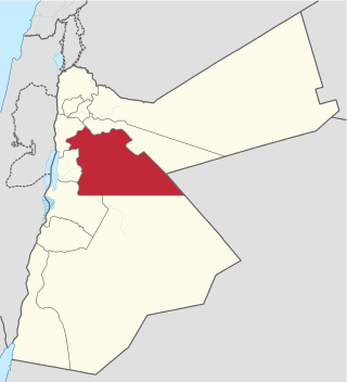
Amman Governorate, officially known as Muhafazat al-Asima, is one of the governorates in Jordan. The governorate's capital is the city of Amman, which is also the country's capital. The administrative center of the governorate as well as all government offices and parliament are located in the Abdali district.
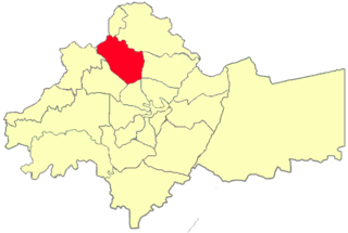
Al-Jubeiha (الجبيهة) is a city district and one of twenty-two Districts of the Greater Amman Municipality in Jordan. Al-Jubeiha has seven neighborhoods: Al-Jama'a, Al-Rasheed, Qurneh, Al-Sadiq, Al-Zaitounah, Al-Mahabah, and Al-Baladiyat.
Jordanian art has a very ancient history. Some of the earliest figurines, found at Aïn Ghazal, near Amman, have been dated to the Neolithic period. A distinct Jordanian aesthetic in art and architecture emerged as part of a broader Islamic art tradition which flourished from the 7th-century. Traditional art and craft is vested in material culture including mosaics, ceramics, weaving, silver work, music, glass-blowing and calligraphy. The rise of colonialism in North Africa and the Middle East, led to a dilution of traditional aesthetics. In the early 20th-century, following the creation of the independent nation of Jordan, a contemporary Jordanian art movement emerged and began to search for a distinctly Jordanian art aesthetic that combined both tradition and contemporary art forms.
'Iraq al-Amir or Araq el-Amir is the name shared by a town and nearby caves, within the municipality of Amman in the Jordan Valley. Located about 15 km southwest of the town of Wadi as-Seer, it has a population of about 6000 people, mostly members of the Abbadi tribe. It is located on hills with high and medium altitude, in an area with many springs and famous for its olive trees and other forest trees.
The Amman Citadel is an archeological site at the center of downtown Amman, the capital of Jordan. The L-shaped hill is one of the seven hills (jebal) that originally made up Amman.
Rujm is an Arabic word that appears as an element in numerous place names. It can be translated as 'mound, cairn, hill, spur', and also as 'stone heap' or 'tumulus'. The following is a list of place names that include Rujm as an element:
The following is a timeline of the history of the city of Amman, Kingdom of Jordan.
Tall Jawa is an archaeological and historical site in central Jordan.
Tall al-’Umayri is an archaeological dig site in western Jordan that dates from the Early Bronze Age to the Hellenistic period. It is located near the modern capital of Amman and is significant for its well-preserved evidence of a temple, as well as archaeological evidence of a network of small farms believed to have produced wine. Excavations were proceeding as of 2014.
Tell el-Hammam is an archaeological site in the Amman Governorate of Jordan, in the eastern part of the lower Jordan Valley 11.7 kilometers east of the Jordan River and not far from its mouth. It lies 12.6 kilometers northeast of the Dead Sea. The site has substantial remains from the Chalcolithic, Early, Intermediate and Middle Bronze Age, and from Iron Age II. There are different attempts at identifying the site with a biblical city. The Hammam Megalithic Field lies nearby. Other archaeological sites in the vicinity include Tall Nimrin, Tall Bleibel, Tall Mustah, Tall Iktanu, Tall Tahouna, Tall Barakat, Tall Kafrayn, and Tall Rama.
The architecture of Jordan has been subject to vast development, specifically in the final years of the twentieth century. Jordan is a semi-arid country located in the Middle East. Its location has great significance to Christians, Muslims and Jews as it is considered part of the Holy Land.
Khirbet es-Sar is an archaeological site in Jordan. It lies in the western suburb of modern Amman, on the edge of a plateau. In the MEGA Jordan database, which stores information about sites located in Jordan, Khirbet es-Sar can be found under numbers 11304 and 3007.