
The Ridgeway is a ridgeway or ancient trackway described as Britain's oldest road. The section clearly identified as an ancient trackway extends from Wiltshire along the chalk ridge of the Berkshire Downs to the River Thames at the Goring Gap, part of the Icknield Way which ran, not always on the ridge, from Salisbury Plain to East Anglia. The route was adapted and extended as a National Trail, created in 1972. The Ridgeway National Trail follows the ancient Ridgeway from Overton Hill, near Avebury, to Streatley, then follows footpaths and parts of the ancient Icknield Way through the Chiltern Hills to Ivinghoe Beacon in Buckinghamshire. The National Trail is 87 miles (140 km) long.

A trail, also known as a path or track, is an unpaved lane or a small paved road not intended for usage by motorized vehicles, usually passing through a natural area. In the United Kingdom and Ireland, a path or footpath is the preferred term for a pedestrian or hiking trail. The term is also applied in North America to accompanying routes along rivers, and sometimes to highways. In the US, the term was historically used for a route into or through wild territory used by explorers and migrants. In the United States, "trace" is a synonym for trail, as in Natchez Trace.

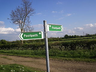
A footpath is a type of thoroughfare that is intended for use only by pedestrians and not other forms of traffic such as motorized vehicles, bicycles and horses. They can be found in a wide variety of places, from the centre of cities, to farmland, to mountain ridges. Urban footpaths are usually paved, may have steps, and can be called alleys, lanes, steps, etc.

The South Downs Way is a long distance footpath and bridleway running along the South Downs in southern England. It is one of 16 National Trails in England and Wales. The trail runs for 160 km (100 mi) from Winchester in Hampshire to Eastbourne in East Sussex, with about 4,150 m (13,620 ft) of ascent and descent.
In England and Wales, excluding the 12 Inner London boroughs and the City of London, the right of way is a legally protected right of the public to pass and re-pass on specific paths. The law in England and Wales differs from Scots law in that rights of way exist only where they are so designated, whereas in Scotland any route that meets certain conditions is defined as a right of way, and in addition, there is a general presumption of access to the countryside. Private rights of way or easements also exist.

Rushmere St Andrew is a village, civil parish and electoral ward adjacent to part of the eastern edge of the borough of Ipswich in the East Suffolk district of Suffolk, England. The parish includes most of Rushmere Heath and parts of the Ipswich suburb of Broke Hall as well as the village of Rushmere St. Andrew, from which it draws its name. The parish was formed in 1894 from the rural part of the parish of Rushmere.
Martlesham is a village in Suffolk, England about two miles (3 km) South-West of Woodbridge and 6 miles (9.7 km) East of Ipswich. It is often referred to as "old Martlesham" by locals in order to distinguish this old village from the much more recent Martlesham Heath development (1 km) to the south although both form a single administrative parish. Also at Martlesham Heath is BT's Research and Development Centre, now called Adastral Park.

Blaxhall is a village and civil parish in the East Suffolk district of the English county of Suffolk. Located around 8 miles (13 km) south-west of Leiston and Aldeburgh, in 2007 its population was estimated to be 220, measured at 194 in the 2011 Census.

The Icknield Way Path or Icknield Way Trail is a long distance footpath and riding route in East Anglia, England. The ancient Icknield Way itself is unique among long-distance trails because it can claim to be ‘the oldest road in Britain’. It consists of prehistoric pathways, ancient when the Romans came; the route is dotted with archaeological remains. It survives today in splendid tracks and green lanes along the ‘chalk spine’ of southern England.
The Sandlings Walk is a long-distance path in Suffolk, England. It runs 91.6km through the Suffolk Sandling that used to stretch from the outskirts of Ipswich to Southwold which is an area of lowland heath, Britain's rarest wildlife habitat, and the Suffolk Coast and Heaths Area of Outstanding Natural Beauty.
National Cycle Route 51 is an English long distance cycle route running broadly east-west connecting Colchester and the port of Harwich to Oxford via Ipswich, Bury St Edmunds, Cambridge, Bedford, Milton Keynes, Bicester, and Kidlington.

Ipswich is the county town of Suffolk, England. It is a medieval port and industrial town with a strong transport history; the urban area has a population of 122,000 and currently offers urban transport services for cars, cycles and buses. In addition there are 3 railway stations and regional coach services. London Stansted Airport is accessible by the airlink coach.

North Warren RSPB reserve is a nature reserve run by the Royal Society for the Protection of Birds (RSPB) in Suffolk, England. It lies on the Suffolk coast on the north edge of the town of Aldeburgh and to the south of Thorpeness and includes the Aldringham Walks area of heathland to the north. It is within the Suffolk Coast and Heaths Area of Outstanding Natural Beauty (AONB) and the Suffolk Heritage Coast area. Noted for its populations of Eurasian bittern, European nightjar and other bird species, it covers a range of coastal habitats and is protected with SSSI, SPA conservation status.

Purdis Farm is a civil parish, in the East Suffolk district, in the English county of Suffolk. It is located on the eastern edge of Ipswich and includes areas of suburban housing and industrial development along the A1156, including the area of Warren Heath. In 2001 the population of the area was 1743, the population increasing to 2,092 at the 2011 Census.

Blaxhall Common is a nature reserve in the parish of Blaxhall in the East Suffolk District of Suffolk. The reserve is owned by Blaxhall Parish Council and managed by Suffolk Wildlife Trust. It is designated a 45.9-hectare (113-acre) biological Site of Special Scientific Interest as Blaxhall Heath. It is part of the Sandlings Special Protection Area under the European Union Directive on the Conservation of Wild Birds, and of the Suffolk Coast and Heaths Area of Outstanding Natural Beauty. A Bronze Age bowl barrow is a Scheduled Monument.

Bixley Heath is a 5.1-hectare (13-acre) biological Site of Special Scientific Interest on the eastern outskirts of Ipswich in Suffolk. It is also a Local Nature Reserve owned and managed by Ipswich Borough Council.

A shared-use path, mixed-use path or multi-use pathway is a path which is "designed to accommodate the movement of pedestrians and cyclists". Examples of shared-use paths include sidewalks designated as shared-use, bridleways and rail trails. A shared-use path typically has a surface that is asphalt, concrete or firmly packed crushed aggregate. Shared-use paths differ from cycle tracks and cycle paths in that shared-use paths are designed to include pedestrians even if the primary anticipated users are cyclists.

Snape Warren is a 48 hectare biological Site of Special Scientific Interest east of Snape in Suffolk. It is part of the Sandlings Special Protection Area under the European Union Directive on the Conservation of Wild Birds, and in the Suffolk Coast and Heaths Area of Outstanding Natural Beauty.

Tunstall Common is a 36.6 hectares biological Site of Special Scientific Interest east of Tunstall in Suffolk. It is part of the Sandlings Special Protection Area under the European Union Directive on the Conservation of Wild Birds, and the Suffolk Coast and Heaths Area of Outstanding Natural Beauty.

Ipswich Golf Club is a members club based in Ipswich, Suffolk. It maintains the Purdis Heath course.


