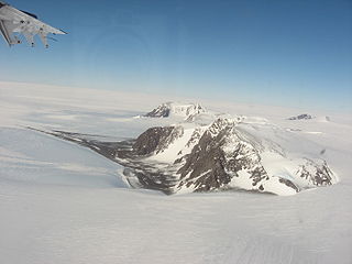
The Thiel Mountains are isolated, mainly snow-capped mountains of the Transantarctic Mountains System, located in the Ellsworth Land region of Antarctica. The mountain range is 45 nautical miles long, is located roughly between the Horlick Mountains and the Pensacola Mountains, and extends from Moulton Escarpment on the west to Nolan Pillar on the east. Major components include Ford Massif, Bermel Escarpment and a group of eastern peaks near Nolan Pillar.
The Commonwealth Range is a north-south trending range of rugged mountains, 60 nautical miles long, located within the Queen Maud Mountains on the Dufek Coast of the continent of Antarctica. The range borders the eastern side of Beardmore Glacier from Keltie Glacier to the Ross Ice Shelf. The range is southeast of the Queen Alexandra Range, which is to the west of the Beardmore Glacier. It is west of the Hughes Range and north of the Supporters Range and the Barton Mountains.
The Cook Mountains is a group of mountains bounded by the Mulock and Darwin glaciers in Antarctica. They are south of the Worcester Range and north of the Darwin Mountains and the Britannia Range.

The Darwin Glacier is a large glacier in Antarctica. It flows from the polar plateau eastward between the Darwin Mountains and the Cook Mountains to the Ross Ice Shelf. The Darwin and its major tributary the Hatherton are often treated as one system, the Darwin–Hatherton.

Shackleton Glacier is a major Antarctic glacier, over 60 nautical miles long and from 5 to 10 nautical miles wide, descending from the Antarctic Plateau from the vicinity of Roberts Massif and flowing north through the Queen Maud Mountains to enter the Ross Ice Shelf between Mount Speed and Waldron Spurs. Discovered by the United States Antarctic Service (USAS) (1939–41) and named by the Advisory Committee on Antarctic Names (US-ACAN) for Sir Ernest Shackleton, British Antarctic explorer.
Tucker Glacier is a major valley glacier of Victoria Land, Antarctica, about 90 nautical miles long, flowing southeast between the Admiralty Mountains and the Victory Mountains to the Ross Sea. There is a snow saddle at the glacier's head, just west of Homerun Range, from which the Ebbe Glacier flows northwestward.
The Victory Mountains is a major group of mountains in Victoria Land, Antarctica, about 100 nautical miles long and 50 nautical miles wide, which is bounded primarily by Mariner and Tucker glaciers and the Ross Sea. They are north of the Mountaineer Range, east of the Freyberg Mountains and south of the Concord Mountains and the Admiralty Mountains. The division between the Victory Mountains and the Concord Mountains is not precise but apparently lies in the vicinity of Thomson Peak.

The Ford Ranges are a collection of mountain groups and ranges standing east of Sulzberger Ice Shelf and Block Bay in the northwest part of Marie Byrd Land, Antarctica.
Lennox-King Glacier is a large valley glacier, about 40 nautical miles (70 km) long that flows east into the Ross Ice Shelf.
The Rockefeller Mountains are a group of low-lying, scattered granite peaks and ridges, almost entirely snow-covered, standing 30 nautical miles south-southwest of the Alexandra Mountains on the Edward VII Peninsula of Antarctica.
The Mariner Glacier is a major glacier over 60 nautical miles long, descending southeast from the plateau of Victoria Land, Antarctica, between Mountaineer Range and Malta Plateau, and terminating at Lady Newnes Bay, Ross Sea, where it forms the floating Mariner Glacier Tongue.
Mount Yakovlev is a somewhat isolated mountain about 11 miles (18 km) north of Sarkofagen Mountain in the Russkiye Mountains, Queen Maud Land. Mapped by Norsk Polarinstitutt from air photos taken by Norwegian Antarctic Expedition in 1958–59. Also observed in 1959 by the Soviet Antarctic Expedition and named for noted Soviet paleontologist N.N. Yakovlev.
Zhelannaya Mountain is a relatively isolated mountain about 9 miles (14 km) north of Mount Karpinskiy in the Russkiye Mountains, Queen Maud Land. Mapped by the Soviet Antarctic Expedition of 1959 and named "Gora Zhelannaya".
Pryor Glacier is a glacier flowing northeastward, to the north of Mount Shields and Yermak Point, into Rennick Bay. The feature is about 30 nautical miles long and forms a physical separation between Wilson Hills and Usarp Mountains.
Pennell Coast is that portion of the coast of Antarctica between Cape Williams and Cape Adare. To the west of Cape Williams lies Oates Coast, and to the east and south of Cape Adare lies Borchgrevink Coast. Named by New Zealand Antarctic Place-Names Committee (NZ-APC) in 1961 after Lieutenant Harry Pennell, Royal Navy, commander of the Terra Nova, the expedition ship of the British Antarctic Expedition, 1910–13. Pennell engaged in oceanographic work in the Ross Sea during this period. In February 1911 he sailed along this coast in exploration and an endeavor to land the Northern Party led by Lieutenant Victor Campbell.
The Monument Nunataks are a group of nunataks in Antarctica that have numerous pinnacles and odd-shaped projections resembling monuments, situated north of Sculpture Mountain in the upper part of Rennick Glacier. The group was named by the Northern Party of the New Zealand Geological Survey Antarctic Expedition (NZGSAE) of 1962–63.

Sarnoff Mountains is a range of mountains, 251 nautical miles long and 4 to 8 nautical miles wide separating the west-flowing Boyd Glacier and Arthur Glacier in the Ford Ranges of Marie Byrd Land, Antarctica.
Mount Karpinskiy is an isolated mountain about 9 nautical miles (17 km) south of Zhelannaya Mountain in the Russkiye Mountains of Queen Maud Land, Antarctica. It was observed and mapped by the Soviet Antarctic Expedition in 1959, and named for geologist A.P. Karpinskiy, President of the Academy of Sciences of the U.S.S.R.
Mount Rusanov is an isolated mountain lying north of the Russkiye Mountains, about 35 nautical miles (60 km) northeast of Zhelannaya Mountain, in Queen Maud Land. Mapped by Norsk Polarinstitutt from air photos by Norwegian Antarctic Expedition, 1958–59. Also mapped in 1959 by the Soviet Antarctic Expedition, and named for Russian geologist and polar explorer V.A. Rusanov.
