Related Research Articles

The Orange River is a river in Southern Africa. It is the longest river within the borders of South Africa and the Orange River Basin extends extensively from Lesotho into South Africa and Namibia to the north. It rises in the Drakensberg mountains in Lesotho, flowing westwards through South Africa to the Atlantic Ocean. The river forms part of the international borders between South Africa and Lesotho and between South Africa and Namibia, as well as several provincial borders within South Africa. Except for Upington, it does not pass through any major cities. The Orange River plays an important role in the South African economy by providing water for irrigation and hydroelectric power. The river was named the Orange River in honour of the Dutch ruling family, the House of Orange, by the Dutch explorer Robert Jacob Gordon. Other names include simply the word for river, in Khoekhoegowab orthography written as !Garib, which is rendered in Afrikaans as Gariep River with the intrusion of a velar fricative in place of the alveolar click, Groote River or Senqu River, derived from ǂNū "Black".

Hartbeespoort Dam is an arch type dam situated in the North West Province of South Africa. It lies in a valley to the south of the Magaliesberg mountain range and north of the Witwatersberg mountain range, about 35 kilometres north west of Johannesburg and 20 kilometres west of Pretoria. The name of the dam means "gorge of the hartebeest" in Afrikaans. This "poort" in the Magaliesberg was a popular spot for hunters, where they cornered and shot the hartebeest. The dam was originally designed for irrigation, which is currently its primary use, as well as for domestic and industrial use. The dam has suffered from a hypertrophic state since the early 1970s. Mismanagement of waste water treatment from urban zones within the Hartbeespoort Dam catchment area is largely to blame, having distorted the food web with over 280 tons of phosphate and nitrate deposits.

The Gariep Dam is located in South Africa, near the town of Norvalspont, bordering the Free State and Eastern Cape provinces. Its primary purpose is for irrigation, domestic and industrial use as well as for power generation.

The Vanderkloof Dam is situated approximately 130 km (81 mi) downstream from Gariep Dam and is fed by the Orange River, South Africa's largest river. Vanderkloof Dam is the second-largest dam in South Africa, having the highest dam wall in the country at 108 metres (354 ft). The dam was commissioned in 1977; it has a capacity of 3,187.557 million cubic metres (2,584,195 acre⋅ft) and a surface area of 133.43 square kilometres (51.52 sq mi) when full. Other rivers flowing into this dam are the Berg River, two unnamed streams coming in from the direction of Reebokrand, the Knapsak River, Paaiskloofspruit, Seekoei River, Kattegatspruit and the Hondeblaf River, in a clockwise direction.
Nandoni Dam, previously known as the Mutoti Dam, is an earth-fill/concrete type dam in Limpopo province, South Africa. It is located on the Luvuvhu River near the villages of ha-Mutoti and ha-Budeli and ha-Mphego just a few kilometres from Thohoyandou in the district of Vhembe. The dam serves primarily for water supply and its hazard potential has been ranked high (3).

The Western Cape Water Supply System (WCWSS) is a complex water supply system in the Western Cape region of South Africa, comprising an inter-linked system of six main dams, pipelines, tunnels and distribution networks, and a number of minor dams, some owned and operated by the Department of Water and Sanitation and some by the City of Cape Town.

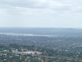
The Berg River Dam is a 68-metre (223 ft) high dam on the Berg River in South Africa. It is the centerpiece of the Berg Water Project (BWP) which is designed to capture the winter rainfall and store it for supply to Cape Town during the dry summer months. The project in turn forms an important part of the Western Cape Water Supply System (WCWSS), an intricate system of dams and bulk water infrastructure that provides water to more than 3 million people. At the inauguration of the dam in 2009, then President of South Africa Kgalema Motlanthe called the project "a good example of how public infrastructure projects can be used to contribute meaningfully to poverty eradication and to foster social empowerment of the people." The Berg River Dam was the first dam in South Africa to be designed and constructed, and is due to be operated, in accordance with the guidelines of the World Commission on Dams. It has been completed on time and within budget. The Berg River basin and the adjacent metropolitan area of Cape Town are of particular importance to the Western Cape region because, although the basin generates only about 3% of the country's water resources, it is home to about 8% of South Africa's population, and produces about 12% of GDP.
Beervlei Dam is a dam in the Groot River, Eastern Cape, South Africa. It was established in 1957, has a capacity of 85,800,000 cubic metres (3.03×10⁹ cu ft), and a surface area of 23.145 square kilometres (8.936 sq mi), and the dam wall is 31 m high. The main purpose of the dam is to provide flood absorption. The Karoo sediments in the area contain a lot of salts and it has been found that lengthy storage of water results in high water salinity. Any flood water is used as quickly as possible by the downstream irrigators and the reservoir is kept empty for extended periods.

Blyderivierpoort Dam is a gravity-arch dam on the Blyde River, in the lower Blyde River Canyon, near Hoedspruit in Mpumalanga, South Africa. It also floods the lower reaches of the Blyde's Ohrigstad River tributary. The dam was completed in 1974. The 71 m high dam wall and 22 m deep is situated 3 km from Swadini resort by road.
Loskop Dam is a combined gravity and arch type dam located on the Olifants River, near Groblersdal, Mpumalanga, South Africa. It was established in 1939 and has been renovated in 1979. The dam is situated in the Loskop Dam Nature Reserve and it serves mainly for irrigation purposes. The hazard potential of the dam has been ranked high (3).

Roode Elsberg Dam is located on the Sanddrift River, some 10 km north west of the town of De
Welbedacht Dam is a concrete-gravity type dam situated in South Africa, and was established in 1973. Bloemfontein is the sixth-largest city in South Africa, with a population around 300 000. It is situated in the Modder River catchment, which has insufficient water resources to meet the growing water requirements. The water supply to Bloemfontein is, therefore, augmented from the adjacent Caledon River by means of the Caledon - Modder River Government Water Scheme (CMRGWS).

Wemmershoek Dam is an earth-fill type dam located on the Wemmershoek River near Franschhoek and Paarl in South Africa. The dam was established in 1957 with a capacity of 58 644 000 m3 behind a 55 m high wall. The dam serves mainly for municipal and industrial use as part of the Western Cape Water Supply System which supplies the city of Cape Town and surrounding areas. Its hazard potential has been ranked high (3).

Woodhead Dam is a dam on Table Mountain, Western Cape, South Africa. It was built in 1897 and supplies water to Cape Town. The dam, which was the first large masonry dam in South Africa, was designated as an International Historic Civil Engineering Landmark by the American Society of Civil Engineers in 2008.

The Eerste River, located in the Western Cape, South Africa, rises on Dwarsberg 60 km east of Cape Town at the head of Jonkershoek. The Eerste River catchment covers the eastern part of the Cape Flats lying to the west of the Hottentots Holland Mountains and south of the Tygerberg where the Kuils River tributary rises east of Kanonkop. The Eerste River is a short river; its length has been given as 40 km. The major tributary, Kuils River, is approximately 30 km long to its point of confluence with the Eerste River.
Kammanassie Dam is a gravity type dam located on the Kammanassie River, near De Rust, Western Cape, South Africa. It was established in 1923. The primary purpose of the dam is to provide water for irrigation, and its hazard potential has been ranked high (3).
Stompdrift Dam is a combined multi-arch and gravity type dam located on the Olifants River near De Rust, Western Cape, South Africa.

Wolwedans Dam is a concrete dam in South Africa located on the Great Brak River near Mossel Bay, Western Cape, South Africa. The dam is the main source of water for the municipality of Mossel Bay as well as the gas-to-liquids refinery PetroSA. The dam serves mainly for municipal and industrial water supply purposes.
References
- 1 2 Erasmus, B.P.J. (2014). On Route in South Africa: Explore South Africa region by region. Jonathan Ball Publishers. p. 401. ISBN 9781920289805.