
The Santa Monica Mountains is a coastal mountain range in Southern California, paralleling the Pacific Ocean. It is part of the Transverse Ranges. Because of its proximity to densely populated regions, it is one of the most visited natural areas in California. Santa Monica Mountains National Recreation Area is located in this mountain range.

Cascade Mountain is in Essex County of New York. It is one of the 46 Adirondack High Peaks (36th) and is located in the Adirondack Park. Its name comes from a series of waterfalls on a brook near the mountain's base. The lake it flows into and the pass between Cascade and Pitchoff mountains are also named Cascade.

The South Mountains, known locally as simply South Mountain, is a mountain range in central Arizona in south Phoenix, Arizona. It is on public land managed by the city of Phoenix as South Mountain Park.
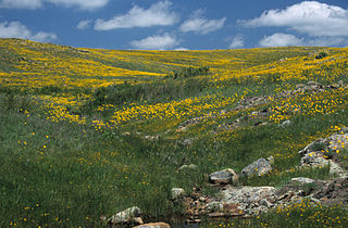
Wichita Mountains Wildlife Refuge, located in southwestern Oklahoma near Lawton, has protected unique wildlife habitats since 1901 and is the oldest managed wildlife facility in the United States Fish and Wildlife Service system. Measuring about 59,020 acres (238.8 km2), the refuge hosts a great diversity of species: 806 plant species, 240 species of birds, 36 fish, and 64 reptiles and amphibians are present. The refuge's location in the geologically unique Wichita Mountains and its areas of undisturbed mixed grass prairie make it an important conservation area. The Wichitas are approximately 500 million years old.
Johnny Lang was an American cattle driver who discovered Lost Horse Mine in Joshua Tree National Park. He claimed that he had moved to the area because his brother had been gunned down in New Mexico with six other cowboys. In 1890, in the process of herding their cattle, they lost their horses in what is now known as Lost Horse Valley. He tracked them to what is now known as Keys Desert Queen Ranch, which at that time was believed to be occupied by cattle rustlers from what known as the McHaney Gang, but did not find the horses. He then claimed he then met "Dutch" Frank, who claimed he discovered a rich gold claim but was afraid to develop it because he had been threatened by the purported rustlers. Lang and his father bought the rights to the mine, purportedly for $1,000.00, and named it "Lost Horse". He claimed to have taken on three partners as back-up, out of fear of the gang of purported rustlers or having his claim jumped. The four men filed their claim, set up a two-stamp mill and began to produce substantial amounts of gold. Lang's claim and mill were then sold to a Montana rancher named J.D. Ryan. Much of this history was provided by longtime Joshua Tree area resident long-time resident William F. Keys, a long-time resident, for whom Keys Ranch was named.

Fern Canyon is a canyon in the Prairie Creek Redwoods State Park in Humboldt County, California, western United States. The park is managed in cooperation with other nearby redwoods state parks and Redwood National Park. It is named for the ferns growing on the 50-foot high walls, through which runs Home Creek. Fern Canyon is recognized as a World Heritage site and an International Biosphere Reserve.

The Coxcomb Mountains are a mountain range located in eastern Riverside County, Southern California.
The Sheep Hole Mountains are a mountain range in the Mojave Desert, to the north of Joshua Tree National Park, in San Bernardino County, California. The mountains were once Chemehuevi hunting grounds.

Black Butte is a stratovolcano 5.5 miles (8.9 km) west of Sisters, Oregon in Deschutes National Forest.

Mount Langley is located on the crest of the Sierra Nevada, on the boundary between Inyo and Tulare counties, in eastern California in the southwestern United States. To the east is Owens Valley, and to the west is the Kern River Valley. It is the ninth-highest peak in the state and the seventh-highest in the Sierra. Mount Whitney, the highest peak in the contiguous United States, lies 4.8 miles (7.7 km) to the northwest. Mt. Langley also has the distinction of being the southernmost fourteener in the United States.

Saddle Mountain is the tallest mountain in Clatsop County in the U.S. state of Oregon. Part of the Oregon Coast Range, Saddle Mountain is in Saddle Mountain State Natural Area in the northwest corner of Oregon. The peak is listed on Oregon’s Register of Natural Heritage Resources.

Elijah Bristow State Park is a state park in the U.S. state of Oregon, administered by the Oregon Parks and Recreation Department. It has more than 10 miles (16 km) of well-maintained trails along ponds, wetlands, meadows, and the Middle Fork Willamette River, and through forests of broadleaf and evergreen trees. The trails are open to horses, hikers, and mountain bikers, and there is a separate equestrian staging area popular with riding clubs.
The Yellow River is a 76-mile-long (122 km) tributary of the Ocmulgee River in the U.S. state of Georgia.

Dog Mountain rises above the north side of the Columbia River Gorge in the U.S. state of Washington. The base of the mountain is in Skamania County along Washington State Route 14, about 9 miles (14 km) east of Stevenson and 53 miles (85 km) east of Vancouver. From its base at 150 feet (46 m), it climbs steeply to an elevation of 2,948 feet (899 m).

Lost Palms Oasis Trail is a 7.2 mile day-hike trail located in the southernmost part of Joshua Tree National Park. The trail is generally completed in a loop. Known for the beautiful palm trees from which the trail gets its name, this hike is also known for its great bouldering, pools of water, and the ever-elusive "Victory Palms". Deemed by the National Park Service as a "Day-Use-Only" area, this trail is also home to bighorn sheep who use the pools as their main source of water.

Hidden Valley is a self-guiding, one-mile loop trail that winds among massive boulders through what was believed to be a legendary cattle rustlers' hideout. It is one of the most popular and scenic hiking trails in Joshua Tree National Park. The area is also a popular rock-climbing area. Many visitors enjoy just watching the climbers in action.

Fortynine Palms Oasis is a three-mile, out and back trail located in Joshua Tree National Park in California, with a 300 foot elevation gain in both directions. The trail starts at Fortynine Palms Parking Area, goes up and over a ridge dotted with barrel cacti, and descends to a palm oasis in a rocky canyon.


