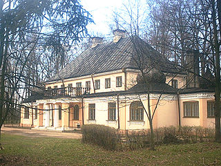
Khotont is a sum (district) of Arkhangai Province in central Mongolia.

Diên Khánh is a rural district (huyện) of Khánh Hòa Province in the South Central Coast region of Vietnam. Diên Khánh is one of the oldest citadels in the south of Vietnam and it is one of the precious vestiges for studying ancient citadels. As of 2003 the district had a population of 134,118. The district covers an area of 513 km². The district capital lies at Diên Khánh.

Artsvaberd is a town in the Tavush province of Armenia.

Mərcanlı is a village in the Jabrayil Rayon of Azerbaijan.

Jasionna is a village in the administrative district of Gmina Błaszki, within Sieradz County, Łódź Voivodeship, in central Poland. It lies approximately 9 kilometres (6 mi) south of Błaszki, 20 km (12 mi) west of Sieradz, and 73 km (45 mi) west of the regional capital Łódź.

Hipolity is a village in the administrative district of Gmina Lututów, within Wieruszów County, Łódź Voivodeship, in central Poland. It lies approximately 3 kilometres (2 mi) south-east of Lututów, 24 km (15 mi) east of Wieruszów, and 84 km (52 mi) south-west of the regional capital Łódź.

Rynek is a settlement in the administrative district of Gmina Szczucin, within Dąbrowa County, Lesser Poland Voivodeship, in southern Poland. It lies approximately 6 kilometres (4 mi) south-east of Szczucin, 13 km (8 mi) north-east of Dąbrowa Tarnowska, and 86 km (53 mi) east of the regional capital Kraków.

Grzegorzowice Wielkie is a village in the administrative district of Gmina Iwanowice, within Kraków County, Lesser Poland Voivodeship, in southern Poland. It lies approximately 4 kilometres (2 mi) north of Iwanowice and 22 km (14 mi) north of the regional capital Kraków.
Pardasówka is part of Sabaudia village in the administrative district of Gmina Tomaszów Lubelski, within Tomaszów Lubelski County, Lublin Voivodeship, in eastern Poland.

Głupiów is a village in the administrative district of Gmina Końskie, within Końskie County, Świętokrzyskie Voivodeship, in south-central Poland. It lies approximately 12 kilometres (7 mi) west of Końskie and 42 km (26 mi) north-west of the regional capital Kielce.

Koniec is a settlement in the administrative district of Gmina Wadowice Górne, within Mielec County, Subcarpathian Voivodeship, in south-eastern Poland. It lies approximately 4 kilometres (2 mi) west of Wadowice Górne, 15 km (9 mi) west of Mielec, and 61 km (38 mi) north-west of the regional capital Rzeszów.

Worowice is a village in the administrative district of Gmina Waśniów, within Ostrowiec County, Mazowieckie Voivodeship, in south-central Poland. It lies approximately 6 kilometres (4 mi) south-east of Waśniów, 14 km (9 mi) south-west of Ostrowiec Świętokrzyski, and 45 km (28 mi) east of the regional capital Kielce.
Kocewia Duża is a village in the administrative district of Gmina Chodów, within Koło County, Greater Poland Voivodeship, in west-central Poland.

Biskupice is a village in the administrative district of Gmina Pilica, within Zawiercie County, Silesian Voivodeship, in southern Poland. It lies approximately 2 kilometres (1 mi) north-west of Pilica, 17 km (11 mi) east of Zawiercie, and 52 km (32 mi) north-east of the regional capital Katowice.

Kwiatków is a village in the administrative district of Gmina Otmuchów, within Nysa County, Opole Voivodeship, in south-western Poland, close to the Czech border. It lies approximately 8 kilometres (5 mi) south-east of Otmuchów, 8 km (5 mi) south-west of Nysa, and 55 km (34 mi) south-west of the regional capital Opole.

Domanice is a settlement in the administrative district of Gmina Damnica, within Słupsk County, Pomeranian Voivodeship, in northern Poland. It lies approximately 7 kilometres (4 mi) south-east of Damnica, 21 km (13 mi) east of Słupsk, and 85 km (53 mi) west of the regional capital Gdańsk.

Obłęże is a village in the administrative district of Gmina Kępice, within Słupsk County, Pomeranian Voivodeship, in northern Poland. It lies approximately 4 kilometres (2 mi) north-east of Kępice, 25 km (16 mi) south of Słupsk, and 111 km (69 mi) west of the regional capital Gdańsk.

Huta is a settlement in the administrative district of Gmina Potęgowo, within Słupsk County, Pomeranian Voivodeship, in northern Poland. It lies approximately 5 kilometres (3 mi) west of Potęgowo, 26 km (16 mi) east of Słupsk, and 80 km (50 mi) west of the regional capital Gdańsk.
Płutniki is a village in the administrative district of Gmina Korsze, within Kętrzyn County, Warmian-Masurian Voivodeship, in northern Poland.

Chłopówko is a settlement in the administrative district of Gmina Barwice, within Szczecinek County, West Pomeranian Voivodeship, in north-western Poland. It lies approximately 9 kilometres (6 mi) south-west of Barwice, 29 km (18 mi) west of Szczecinek, and 115 km (71 mi) east of the regional capital Szczecin.


