Sadra, Gandhinagar

Last updated

Sadra is a village, on the banks of Sabarmati river, in Gandhinagar Taluka in Gandhinagar district of Gujarat state, India.

Gandhinagar district district in Gujarat, India

Gandhinagar district is an administrative division of Gujarat, India, whose headquarters are at Gandhinagar, the state capital. It was organized in 1964.

Gujarat State in India

Gujarat is a state in Western India and Northwest India, a coastline of 1,600 km (990 mi) – most of which lies on the Kathiawar peninsula – and a population in excess of 60 million. It is the sixth largest Indian state by area and the ninth largest state by population. Gujarat is bordered by Rajasthan to the northeast, Daman and Diu to the south, Dadra and Nagar Haveli and Maharashtra to the southeast, Madhya Pradesh to the east, and the Arabian Sea and the Pakistani province of Sindh to the west. Its capital city is Gandhinagar, while its largest city is Ahmedabad. The Gujarati-speaking people of India are indigenous to the state. The economy of Gujarat is the third-largest state economy in India with 14.96 lakh crore (US$210 billion) in gross domestic product and a per capita GDP of 157,000 (US$2,200).

Contents

History

Sadra was a military post during Mughal period and was known as Islamabad. The village was under Vasna State during British period and served as the headquarters of the Mahi Kantha Agency. When, in 1821, the Mahi Kantha Agency was established, a piece of land near the village was rented from the Vasna Thakor for a station. In the ground was a small fort said to have been built by Ahmed Shah I (1411-1443), when he built the fort of Ahmednagar in 1426. [1]

Mahi Kantha Agency

Mahi Kantha was a political agency or collection of princely states in British India, within the Gujarat Division of Bombay Presidency. In 1933, the states of the Mahi Kantha Agency, except for Danta, were included in the Western India States Agency. The total area of the agency was 8,094 km2 (3,125 sq mi); the population in 1901 was 361,545.

Himatnagar City in Gujarat, India

Himatnagar or Himmatnagar is a municipality in Sabarkantha district in the Indian state of Gujarat. It is the administrative headquarters of the district. The town is on the bank of the river Hathmati.

Sadra village is located in Gandhinagar Tehsil of Gandhinagar district in Gujarat, India. It is situated 25km away from Gandhinagar, which is both district & sub-district headquarter of Sadra village. As per 2009 stats, Sadra village is also a gram panchayat.According to Census 2011 information the location code or village code of Sadra village is 511242 The total geographical area of village is 1214.71 hectares. Sadra has a total population of 5,989 peoples. There are about 1,205 houses in Sadra village. Gandhinagar is nearest town to Sadra which is approximately 25km away. The total population of village is 5989 with gender distribution for males is 3115 and for female is 2874.

Related Research Articles

Limbhoi is a village in Modasa Taluka in Aravalli district of Gujarat state, India. It is located to the north of Aravalli Range. It is reached by a detour of about 8 kilometres (5.0 mi) from the Modasa.

Vav is town and the headquarter of Vav Taluka of Banaskantha district in Gujarat state of India. Vav is the largest taluka of district.

22.81954°N 72.748444°E

Magodi is a village in Malpur Taluka in Aravalli district of Gujarat state, India.

Prantvel is a village in Bayad Taluka in Aravalli district of Gujarat state, India.

Punadra is a town and former Kshatriya Koli princely state in Gujarat, western India.

Ramas is a town and former princely state in Mahi Kantha.

History of Radhanpur

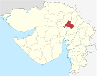
Radhanpur is a town and a municipality in Patan district in the Indian state of Gujarat. Radhanpur belonged to the Vaghelas in early years and later it was held as a fief under the Gujarat Sultanate by Fateh Khan Baloch. During Mughal period, the descendants of Babi dynasty were appointed as the governor of Radhanpur and other villages of North Gujarat. After decline of Mughal, they became free and established themselves as independent rulers. In 1743, Babi descendant Jawan Mard Khan II took over viceroyalty of Ahmedabad and controlled several villages in North Gujarat. He was defeated by Maratha Gaekwads in 1753 at Ahmedabad and Gaekwads agreed to his demand of control of villages in North Gujarat headquartered at Radhanpur State. His descendants lost some of these villages to Gaekwads subsequently. In 1813, Sher Khan made a treaty with the Gaekwar and British and became British protectorate. His descendants ruled the state until independence of India in 1947.

Santalpur is a village in Santalpur Taluka of Patan district of Gujarat state, India.

Varahi is a village in Santalpur taluka of Patan district of Gujarat state of India.

Diyodar, also spelled Diodar or Deodar, is a town and former princely state in Diyodar Taluka of Banaskantha district in Gujarat, western India.

Suigam Is Town And The Headquarter Of Suigam Taluka Of Banaskantha District In Gujarat State Of India

Tervada is a village in Kankrej Taluka of Banaskantha district in Gujarat, India.

Morvada is a village in Vav Taluka of Banaskantha district in Gujarat, India.

Dhima is a village in tharad Taluka of Banaskantha district in Gujarat, India.

Kakar is a village in Kankrej Taluka of Banaskantha district in Gujarat, India.

Panchasar is a village in Sami Taluka of Patan district of Gujarat, India.

Sami, Gujarat town in Gujarat, India

Sami is a town in Sami Taluka of Patan district of Gujarat, India.

Vaghel is a village in Harij Taluka of Patan district in Gujarat, India.

Jagana village in Gujarat, India

Jagana is a village in the Palanpur taluka of Banaskantha district in northern Gujarat, India. The villages Vasna, Bhagal, Sedrasana are located near to Jagana and it is just 6 km away from the district headquarters, Palanpur.

References

Bibliography

PD-icon.svg This article incorporates text from a publication now in the public domain: Gazetteer of the Bombay Presidency: Cutch, Palanpur, and Mahi Kantha. Government Central Press. 1880. p. 439.

The public domain consists of all the creative works to which no exclusive intellectual property rights apply. Those rights may have expired, been forfeited, expressly waived, or may be inapplicable.

Coordinates: 72°47′00″N23°21′00″E / 72.7833°N 23.3500°E / 72.7833; 23.3500

Geographic coordinate system Coordinate system

A geographic coordinate system is a coordinate system that enables every location on Earth to be specified by a set of numbers, letters or symbols. The coordinates are often chosen such that one of the numbers represents a vertical position and two or three of the numbers represent a horizontal position; alternatively, a geographic position may be expressed in a combined three-dimensional Cartesian vector. A common choice of coordinates is latitude, longitude and elevation. To specify a location on a plane requires a map projection.