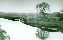
Lower Saxony is a German state in northwestern Germany. It is the second-largest state by land area, with 47,614 km2 (18,384 sq mi), and fourth-largest in population among the 16 Länder federated as the Federal Republic of Germany. In rural areas, Northern Low Saxon and Saterland Frisian are still spoken, albeit in declining numbers.

Frisia is a cross-border cultural region in Northwestern Europe. Stretching along the Wadden Sea, it encompasses the north of the Netherlands and parts of northwestern Germany. Wider definitions of ‘Frisia’ may include the island of Rem and the other Danish Wadden Sea Islands. The region is traditionally inhabited by the Frisians, a West Germanic ethnic group.
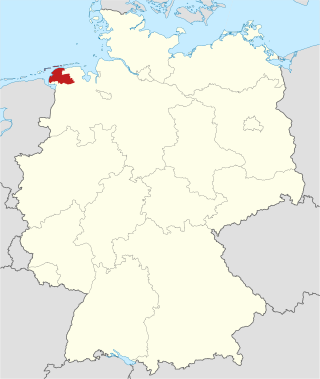
Aurich is a district (Landkreis) in Lower Saxony, Germany. It is bounded by the North Sea, the districts of Wittmund and Leer, and the city of Emden.

The East Frisian Islands are a chain of islands in the North Sea, off the coast of East Frisia in Lower Saxony, Germany. The islands extend for some 90 kilometres (56 mi) from west to east between the mouths of the Ems and Jade / Weser rivers and lie about 3.5 to 10 km offshore. Between the islands and the mainland are extensive mudflats, known locally as Watten, which form part of the Wadden Sea. In front of the islands are Germany's territorial waters, which occupy a much larger area than the islands themselves. The islands, the surrounding mudflats and the territorial waters form a close ecological relationship. The island group makes up about 5% of the Lower Saxony Wadden Sea National Park.

The Ems is a river in northwestern Germany. It runs through the states of North Rhine-Westphalia and Lower Saxony, and discharges into the Dollart Bay which is part of the Wadden Sea. Its total length is 362.4 kilometres (225.2 mi). The state border between the Lower Saxon area of East Friesland (Germany) and the province of Groningen (Netherlands), whose exact course was the subject of a border dispute between Germany and the Netherlands, runs through the Ems estuary.
Leer is a district (Landkreis) in Lower Saxony, Germany. It is bounded by the city of Emden, the districts of Aurich, Wittmund, Friesland, Ammerland, Cloppenburg and Emsland, and by the Netherlands.
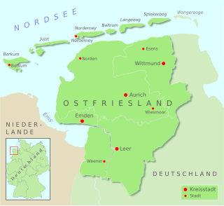
East Frisia or East Friesland is a historic region in the northwest of Lower Saxony, Germany. It is primarily located on the western half of the East Frisian peninsula, to the east of West Frisia and to the west of Landkreis Friesland.
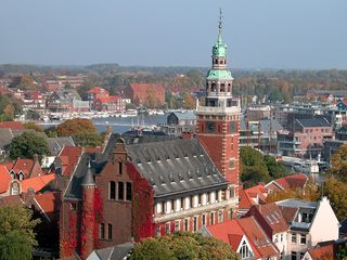
Leer is a town in the district of Leer, in the northwestern part of Lower Saxony, Germany. It is situated on the river Leda, a tributary of the river Ems, near the border with the Netherlands. With 34,958 inhabitants (2021), it is the third-largest city in East Frisia after Emden and Aurich.

Aurich is a town in the East Frisian region of Lower Saxony, Germany. It is the capital of the district of Aurich and is the second largest City in East Frisia, both in population, after Emden, and in area, after Wittmund.
Ems-Oriental was a department of the First French Empire in present-day Germany. It was formed in 1810, when the Kingdom of Holland was annexed by France. Its territory is part of the present-day German region of East Frisia in Lower Saxony. Its capital was Aurich. The department was subdivided into the following arrondissements and cantons :
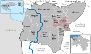
Jümme is a collective municipality (Samtgemeinde) in the district of Leer in the German state of Lower Saxony. It is named after the River Jümme which flows through all three constituent communities. It has an area of 82.34 km2 and a population of 6,421. It is situated in the region of East Frisia. Along with the Samtgemeinde of Hesel, it is one of two in the district. It was formed in the wake of local government reform in 1973. Filsum serves as the administrative centre.

Leda is a river in north-western Germany in the state of Lower Saxony.

Soeste is a river in the Cloppenburg district in Lower Saxony, Germany, a tributary of the Ems.
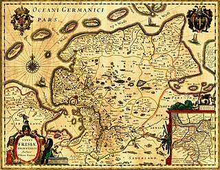
The County of East-Frisia was a county in the region of East Frisia in the northwest of the present-day German state of Lower Saxony.

Jümme is a river of Lower Saxony, Germany. It is a tributary of the Leda.

The Hümmling is a ground moraine landscape, up to 73 m above sea level (NN), in the Emsland region on the North German Plain in the western part of the German state of Lower Saxony.
Marka is a 28.7 km (17.8 mi) long river in Lower Saxony, Germany. At its confluence with the Ohe west of Friesoythe, the river Sagter Ems is formed.

Fehntjer Tief is a river in East Frisia, Lower Saxony, Germany. It discharges into the Ems through the Oldersumer Sieltief near Emden.

Ohe is a river of Lower Saxony, Germany. At its confluence with the Marka west of Friesoythe, the river Sagter Ems is formed.

A pünte is the German term for a type of non-motorised river boat and thus a special type of flat-bottomed boat. It is propelled manually using a crank or hauled by horses on the shore. Today pünten are used almost exclusively as ferries.
