
Sai Kung District is one of the 18 districts of Hong Kong. The district comprises the southern half of the Sai Kung Peninsula, the Clear Water Bay Peninsula in the New Territories and a strip of land to the east of Kowloon. Areas in the district include Sai Kung Town, Hong Kong UNESCO Global Geopark, Tseung Kwan O and over 70 islands of different sizes. The administrative centre had been located in Sai Kung Town until the Sai Kung District Office was relocated to Tseung Kwan O recently. The district's population is concentrated in Tseung Kwan O, as of 2011. In 2011, the district was the third youngest district, with a median age of 39.3. Known as the "back garden of Hong Kong", Sai Kung has been able to retain its natural scenery. Many traditional customs and cultures are still retained in the rural villages.

Ma On Shan Country Park is a park located in the central neck of the Sai Kung Peninsula in the eastern New Territories of Hong Kong. The park covers an area of 28.8 square kilometres (11.1 sq mi) and links Sai Kung Country Park and Lion Rock Country Park to form an extensive recreation area on the Ma On Shan massif.

The Sai Kung Peninsula is a peninsula in the easternmost part of the New Territories in Hong Kong. Its name comes from Sai Kung Town in the central southern area of the peninsula. The southern part of the peninsula is administered by Sai Kung District, the north by Tai Po District and the northwest by Sha Tin District.

The High Island Reservoir, located in the far south eastern part of the Sai Kung Peninsula, was opened in 1978, helping to alleviate water shortage problems in Hong Kong. Its water capacity is approximately 273 million cubic metres. The area it occupies was originally the Kwun Mun Channel (官門海峽), which separated High Island from the Sai Kung Peninsula.

Wong Shek, or Wong Ma Tei, is an area in the northern part of the Sai Kung Peninsula in Hong Kong. It is under the administration of Tai Po District. In the area, there are picnic facilities with views of the sea. However, to protect the natural environment of Wong Shek, the Government controls the number of vehicle entering the area; a gate is set up at Pak Tam Chung on the way towards Wong Shek, which only allows permitted vehicles to enter. There is also a public pier called "Wong Shek Pier".

Pak Tam Chung is an area in the southern part of the Sai Kung Peninsula in the New Territories of Hong Kong. It is administratively under the Sai Kung District.

High Island or Leung Shuen Wan Chau is a former island located in the southeast of Sai Kung Peninsula in Hong Kong, within Sai Kung District. Two sets of dams constructed between 1969 and 1979 and crossing the former Kwun Mun Channel (官門海峽), connect the island to the peninsula, thereby forming the High Island Reservoir. Before being connected to the mainland, the island had an area of 8.511 km² (3.29 square miles) and was the 4th largest island of Hong Kong in 1960.

Wan Tsai is a peninsula at the northern extremity of the north-western Sai Kung Peninsula, Hong Kong, with Hoi Ha Wan to its west and Long Harbour on its east. Grass Island lies east of the peninsula.

Tai Mun Shan lies to the west of Tai Long Wan near Chek King on the Sai Kung Peninsula in Hong Kong. The hill comprises a rounded peak, which rises to a height 370 metres (1,210 feet).
Sai Kung West Country Park (Wan Tsai Extension) (Chinese: 西貢西郊野公園 (灣仔擴建部份)) is a 1.23 square kilometres (0.47 sq mi) country park on the Sai Kung Peninsula in northeast Hong Kong. Opened in 1996, the park's sights include:

Sai Kung East Country Park is a country park on the Sai Kung Peninsula in Hong Kong, measuring 44.77 square kilometres (17.29 sq mi). It opened in 1978 and has features including:
Sai Kung West Country Park is a 30 square kilometres (12 sq mi) country park on the Sai Kung Peninsula in northeast Hong Kong.

Sharp Island or Kiu Tsui Chau is the largest island in the Kiu Tsui Country Park located at Port Shelter of Sai Kung, Hong Kong. The area is most known for fishing, swimming as well as diving. Sharp Island is under the administration of Sai Kung District.
Cyclists in Hong Kong have the same rights and responsibilities as all other road users, except for prohibitions from expressways and some other designated locations, such as all tunnel areas, the Tsing Ma and Tsing Sha control areas, many elevated roads and many underpasses. At least one hand must be kept on the handlebars at all times. Cyclists must use a cycle track wherever one is present.

Buffalo Hill is a hill located in Ma On Shan Country Park west of Sai Kung, in the eastern half of Hong Kong. It is particularly well known for its peak resembling the head of a Buffalo when viewed from Sha Tin. MacLehose Trail passes within 225 metres from the peak of the hill, while smaller trails cut off the main MacLehose trail up to the peak of Buffalo Hill. It is the sixteenth tallest peak in Hong Kong, with an altitude of 606 metres (1,988 ft), bordering Sha Tin and Sai Kung.

Kai Kung Leng is a mountain range in Lam Tsuen Country Park, New Territories, Hong Kong.

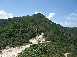
Kai Kung Shan is a mountain which lies within the western part of Sai Kung Peninsula in northeastern Hong Kong. Its summit is 399 metres (1,309 ft) above sea level. Stage 3 of the MacLehose Trail traverses this mountain.
Sai Wan Shan is a hill that lies within Sai Kung East Country Park, south of Tai Long Wan, on the Sai Kung Peninsula in Hong Kong. It has a height of 314 metres (1,030 ft) above sea level. The hill is reasonably easy for hikers and is a popular site for hiking in Hong Kong. A portion of MacLehose Trail Stage 2 is built along the ridge of this hill.
Tai Mong Tsai is a village and an area in Sai Kung District, Hong Kong.
This page is based on this
Wikipedia article Text is available under the
CC BY-SA 4.0 license; additional terms may apply.
Images, videos and audio are available under their respective licenses.
