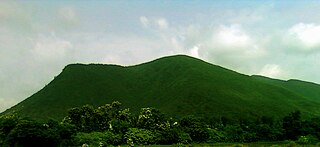
Nongpoh is the administrative centre of Ri-Bhoi district in the Indian state of Meghalaya in the Republic of India. Nongpoh is located on National Highway 40, fifty-two kilometers from the state capital Shillong and forty-eight kilometers from Guwahati in the state of Assam.
Gothra is a census town in Jhunjhunu district in the Indian state of Rajasthan.
Jala Kendua is a census town in Panchla CD Block of Howrah Sadar subdivision in Howrah district in the Indian state of West Bengal.
Jangipur or Zangipur is a town and a nagar panchayat in Ghazipur district in the Indian state of Uttar Pradesh.
Kerakat or Kirakat is a town and nagar panchayat in Jaunpur district of the Indian state of Uttar Pradesh with a population of approximately 13,500. It is situated near the Gomati River, which helps the land around the town stay very fertile. Kerakat or Kirakat forms a part of Varanasi Division. It is located 30 km east of the city of Jaunpur and 279 km from Lucknow, the capital of Uttar Pradesh.

Koilwar or Koelwar is a nagar panchayat (town) and one of the 14 community development block in Bhojpur district in the Indian state of Bihar. As of 2011, the population of Koilwar town was 17,725, in 2,893 households. Koilwar lies on the Arrah-Patna highway (NH-922).

Kothavalasa is a town in Vizianagaram district of the Indian state of Andhra Pradesh. It is located in Kothavalasa mandal of Vizianagaram revenue division. It is located 30 km from the city of Visakhapatanam
Mehnagar is a town and a nagar panchayat in Azamgarh district in the Indian state of Uttar Pradesh.
Parasia is a census town in the Jamuria CD block in Asansol Sadar subdivision of Paschim Bardhaman district in the Indian state of West Bengal.
Saidpur is a town and a nagar panchayat in the Badaun district of the Indian state of Uttar Pradesh.
Zamania is a town in the Indian state of Uttar Pradesh. Its municipal council is subordinate to the Ghazipur District.

Nelli-marla is a census town in Vizianagaram district of the Indian state of Andhra Pradesh. It is in Nellimarla mandal of Vizianagaram revenue division.

Piro is a nagar parishad town and corresponding community development block in Bhojpur District, in the Indian state of Bihar. Piro is 39 KM from the Ara Railway Station. Jitaura is 6 KM from Piro.

Shahpur is a town and a notified area in Bhojpur district in the Indian state of Bihar.
Sadat is a town and a nagar panchayat in Ghazipur district in the Indian state of Uttar Pradesh.
Aunrihar is a town in Ghazipur district of Varanasi division of Uttar Pradesh. Aunrihar is situated in lat. 25° 32' N and long. 83° 11' E on the main road leading from Varanasi to Kushinagar on NH 29, about 42 Km. west from Ghazipur city and about 3.2 km. from Saidpur. This place is archaeologically interesting. One of the oldest and the most important sites in the district is the belt having collection of mounds stretching from Saidpur to Aunrihar. The whole surface of the ground of Aunrihar is strewn with fragments, large carved stones & fine pieces of sculpture which are being utilized as common building stone. Every few yards traces of masonry wall appears
Zabran Pur, also Zabranpur or Zabaranpur, otherwise Jabaranpur, Jabranpur or Jabran Pur, is a small village in Saidpur block, Ghazipur district, Varanasi division, Uttar Pradesh, India.
Aurangabad is a nagar panchayat, a town that has rapidly transitioned from rural to urban. It is located in the Bulandshahr district of the Indian state of Uttar Pradesh. Aurangabad is inherited by sayeds of aurangabad. Sayeds of aurangabad win it undern mughal empire, During Aurangzeb Alamgir. pir Abdul Aziz Sahab (R.A) he was the pir of Aurangzeb. Aurangzeb's grave is near his grave which is situated in Maharashtra Chhatrapati Sambhaji Nagar district, Maharashtra. Aurangabad sayeds was the great pirs. Aurangabad sayeds have nearly 400 villages and also Delhi in it.
Bhimapar is a village and a Gram panchayat in Ghazipur district of Uttar Pradesh, India. Bhimapar is a developing and new face town. It is 57 km from Varanasi and 57 km from Ghazipur.
Aunrihar Junction is a railway station located in the city of Aunrihar in the Indian state of Uttar Pradesh. It is an important railway station in Ghazipur district. It falls on Varanasi–Chhapra line and Aunrihar–Jaunpur line. It is well connected to major cities including New Delhi, Mumbai, Surat, Ahmedabad, Kolkata, Pune, Faizabad, Ayodhya, Lucknow, Kanpur, Allahabad, Jaunpur and Varanasi.


