| Sainthal | |
|---|---|
| town area | |
 Sainthal Location in Rajasthan, India  Sainthal Sainthal (India) | |
| Coordinates: 27°02′N76°18′E / 27.033°N 76.300°E Coordinates: 27°02′N76°18′E / 27.033°N 76.300°E | |
| Country | |
| State | Rajasthan |
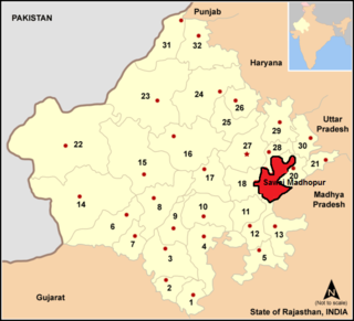
| District | Dausa |
| Population (2001) | |
| • Total | 11,000 |
| Languages | |
| • Official | Hindi |
| Time zone | IST (UTC+5:30) |
| Telephone code | 01427 |
Sainthal is a town and a nagar panchayat in Dausa district in the Indian state of Rajasthan. Sainthal is 24 kilometres from Dausa city.
A Nagar Panchayat or Notified Area Council (NAC) or City Council in India is a settlement in transition from rural to urban.

Dausa District is a district of Rajasthan state in India within Jaipur division. The city of Dausa is the district headquarters. It has a population of 1,634,409, an area of 3034 km², and a population density of 384 persons per km² with 62.75% literacy rate. It is bounded on the north by Alwar District, on the northeast by Bharatpur District, on the southeast by Karauli District, on the south by Sawai Madhopur District, and on the west by Jaipur District. The district is divided into Eight tehsils, Baswa, Dausa, Lalsot, Mahwa, Sikrai, Lawan, Nangal Rajawatan and Ramgarh Panchwara. The Sawa and Ban Ganga rivers run through the district. It is situated on National Highway no.11 From Jaipur to Agra. It is 55 km to the east of Jaipur and 103 km from SawaiMmadhpur. In Tehsil Mahwa there is a Gram Panchayat, Kherla Bujurg, it is famous for a record which was made during an election of member for legislative assembly Mahwa seat for Rajasthan Vidhan Sabha. All three candidates from National parties were resident this village, all of these three were from same cast (badgujar), all were advocates by their profession. Eventually Hari Singh Gurjar was elected. BBC news services broadcast a special programme about it. Current time Dausa MP is Harish Meena, A former DGP of Rajasthan Police.

India, also known as the Republic of India, is a country in South Asia. It is the seventh largest country by area and with more than 1.3 billion people, it is the second most populous country and the most populous democracy in the world. Bounded by the Indian Ocean on the south, the Arabian Sea on the southwest, and the Bay of Bengal on the southeast, it shares land borders with Pakistan to the west; China, Nepal, and Bhutan to the northeast; and Bangladesh and Myanmar to the east. In the Indian Ocean, India is in the vicinity of Sri Lanka and the Maldives, while its Andaman and Nicobar Islands share a maritime border with Thailand and Indonesia.