San Antonio | |
|---|---|
Municipality and village | |
| Country | |
| Province | La Rioja Province |
| Department | Arauco |
| Time zone | UTC−3 (ART) |
| Climate | BSh |
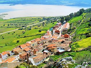
San Antonio is a municipality and village in La Rioja Province in northwestern Argentina. [1]
San Antonio | |
|---|---|
Municipality and village | |
| Country | |
| Province | La Rioja Province |
| Department | Arauco |
| Time zone | UTC−3 (ART) |
| Climate | BSh |
San Antonio is a municipality and village in La Rioja Province in northwestern Argentina. [1]

The Motorola DSP56000 is a family of digital signal processor (DSP) chips produced by Motorola Semiconductor starting in 1986 with later models are still being produced in the 2020s. The 56k series was intended mainly for embedded systems doing signal processing, but was also quite popular for a time in a number of computers, including the NeXT, Atari Falcon030 and SGI Indigo workstations all using the 56001. Upgraded 56k versions are still used today in audio equipment, radar systems, communications devices and various other embedded DSP applications. The 56000 was also used as the basis for the updated 96000, which was not commercially successful.

Rianxo is a port town and municipality in the autonomous community of Galicia in northwestern Spain in the province of A Coruña. It has a population of a little over 10,000 and its two main industries are fishing and tourism. The town's yearly celebration of Our Lady of Guadalupe is popular with tourists. Rianxo was the birthplace of several influential Galician writers, including Paio Gómez Chariño gl, Manuel Antonio, Alfonso R. Castelao and Rafael Dieste.

Armañanzas is a town and municipality located in the province and autonomous community of Navarre, northern Spain.

Canim Beach Provincial Park is a provincial park in British Columbia, Canada, located at the southwest end of Canim Lake in the Interlakes District of the South Cariboo region, adjacent to the Secwepemc Indian reserve community of Canim Lake, British Columbia just northeast of 100 Mile House. The park was established by Order-in-Council in 1956 and expanded by later legislation in 2000 and 2004 to total a current approximate of 8.2 hectares, 3.6 hectares of upland and 4.6 hectares of foreshore.

Quatsino Provincial Park is a provincial park in British Columbia, Canada, located on Quatsino Sound on northern Vancouver Island.
Drewry Point Provincial Park is a provincial park in British Columbia, Canada, on the west side of Kootenay Lake, southeast of the city of Nelson.

The Sechura Province is the largest of eight provinces of the Piura Region in Peru.

Calvas is a canton of the Province of Loja, Ecuador, located in the south of the province, bordering Paltas and Gonzanamá in the north, Quilanga and Espíndola in the east, Peru in the south, and Sozoranga in the west. It covers 851.2 km2 at an altitude of about 1,932 m. The total population is 26,042, and the capital city of the canton is Cariamanga.
KRIL was a radio station that served the Midland–Odessa metropolitan area with classic country music. In its final days, it was under ownership of Townsquare Media and branded as "Real Country 1410 KRIL".
Victor Graeff is a municipality in the state of Rio Grande do Sul, Brazil. As of 2020, the estimated population was 2,860.

Villa La Tapera is a Chilean hamlet in Coihaique Province, Aisén Region. It is the administrative center of the commune of Lago Verde.
Capilla is a Spanish municipality in the province of Badajoz, Extremadura. It has a population of 189 (2007) and an area of 147 km2.
The Compton Névé is a névé in the Pacific Ranges of the Coast Mountains in southwestern British Columbia, Canada, located southeast of the Homathko Icefield and Mount Gilbert and to the south of the Bishop River. It lies west of the Lillooet Icecap and is connected to it by the Ring Glacier, which sits astride Ring Pass, the divide between the Lillooet and Bishop Rivers, and has an area of 714 km2 (276 sq mi).
Carleton Corner is a community in the Canadian province of Nova Scotia, located in Annapolis County adjacent to Bridgetown. It is a designated place with a population of 99 in 2021. It is on Nova Scotia Route 201.

Salémata Department is one of the 45 departments of Senegal, located in the Kédougou Region. It was created as part of the new region in 2008.
Zael is a municipality in the province of Burgos, Castile and León, Spain.

Stotonic is a census-designated place (CDP) in Pinal County, Arizona, United States, located in the Gila River Indian Community. The population was 659 at the 2010 census. Stotonic Village has a median household income of $2,499 – the lowest of any CDP in Arizona
Jolimont and West Richmond was an electoral district of the Legislative Assembly in the Australian state of Victoria from 1889 to 1904. It was located in the inner eastern suburbs of Melbourne and included parts of Richmond and Jolimont.

Osikovo Ridge is the ice-covered ridge extending 12 km in south-southeast to north-northwest direction and 3 km wide, with a northern height rising to 1644 and southern one to 2009 m at the head of Darbel Bay on Loubet Coast in Graham Land, Antarctica. It surmounts McCance Glacier to the west and Widdowson Glacier to the east.

Quaker Harbour is the irregularly shaped bay indenting for 3.7 km the north coast of Weddell Island in the Falkland Islands. It is centred at 51°49′00″S61°04′35″W, and has its head fed by Pitt Creek. The bay takes its name from nearby Quaker Island.
28°33′36″S66°49′00″W / 28.56000°S 66.81667°W
| | This article about a place in La Rioja Province, Argentina is a stub. You can help Wikipedia by expanding it. |