Related Research Articles

Interstate 5 (I-5) is the main north–south Interstate Highway on the West Coast of the United States, running largely parallel to the Pacific Coast of the contiguous U.S. from Mexico to Canada. It travels through the states of California, Oregon, and Washington, serving several large cities on the West Coast, including San Diego, Los Angeles, Sacramento, Portland, and Seattle. It is the only continuous Interstate highway to touch both the Mexican and Canadian borders. Upon crossing the Mexican border at its southern terminus, I-5 continues to Tijuana, Baja California, as Mexican Federal Highway 1 (Fed. 1). Upon crossing the Canadian border at its northern terminus, it continues to Vancouver as British Columbia Highway 99 (BC 99).
Interstate 8 (I-8) is an Interstate Highway in the southwestern United States. It runs from the southern edge of Mission Bay at Sunset Cliffs Boulevard in San Diego, California, almost at the Pacific Ocean, to the junction with I-10, just southeast of Casa Grande, Arizona. In California, the freeway travels through the San Diego metropolitan area as the Ocean Beach Freeway and the Mission Valley Freeway before traversing the Cuyamaca Mountains and providing access through the Imperial Valley, including the city of El Centro. Crossing the Colorado River into Arizona, I-8 continues through the city of Yuma across the Sonoran Desert to Casa Grande, in between the cities of Phoenix and Tucson.
Interstate 605 is a 27-mile-long (43 km) major north–south auxiliary Interstate Highway in the Greater Los Angeles urban area of Southern California. It runs from I-405 and State Route 22 (SR 22) in Seal Beach to I-210 in Duarte. The San Gabriel River Freeway closely parallels the San Gabriel River for most of its alignment, hence its name, which is one of the few Southern California freeways not named after a city along its route.

Interstate 805 (I-805) is a major north–south auxiliary Interstate Highway in Southern California. It is a bypass auxiliary route of I-5, running roughly through the center of the Greater San Diego region from San Ysidro near the Mexico–U.S. border to near Del Mar. The southern terminus of I-805 at I-5 in San Ysidro is less than 1 mi (1.6 km) north of the Mexican border. I-805 then traverses the cities of Chula Vista and National City before reentering San Diego. The freeway passes through the San Diego neighborhoods of North Park, Mission Valley, Clairemont, and University City before terminating at I-5 in the Sorrento Valley neighborhood near the Del Mar city limit.
State Route 22 is an east–west state highway in the U.S. state of California that serves southern Los Angeles County and northern Orange County. It runs between Pacific Coast Highway in Long Beach and the Costa Mesa Freeway in Orange by way of Garden Grove. The westernmost part of SR 22 runs along Long Beach's 7th Street. From West Garden Grove to its eastern terminus in Orange, it is known as the Garden Grove Freeway. It is one of the two principal east–west routes in Orange County.
State Route 133 (SR 133) is a state highway in the U.S. state of California, serving as an urban route in Orange County. It connects SR 1 in Laguna Beach through the San Joaquin Hills with several freeways in Irvine, ending at the SR 241, a toll road in the latter city. It is built as an expressway from SR 73 to Laguna Canyon Road, and past this, SR 133 is a freeway to I-5, and a tollway to SR 241 near the Santa Ana Mountains.

The Santa Ana Freeway is one of the principal freeways in Southern California, connecting Los Angeles and its southeastern suburbs including the freeway's namesake, the city of Santa Ana. The freeway begins at its junction with the San Diego Freeway, called the El Toro Y, in Irvine, signed as I-5. From there, it generally goes southeast to northwest to the East Los Angeles Interchange, where it takes the designation of U.S. Route 101 (US 101). It then proceeds 2.95 miles (4.75 km) northwest to the Four Level Interchange in downtown Los Angeles. Formerly, the entirety of the route was marked as US 101 until the 1964 highway renumbering, which truncated US 101 to the East Los Angeles Interchange and designated the rest of the freeway as I-5.
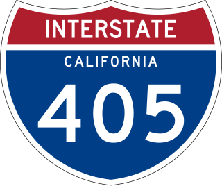
Interstate 405 (I-405) is a major north–south auxiliary Interstate Highway in Southern California. The entire route is known as the northern segment of the San Diego Freeway. I-405 is a bypass auxiliary route of I-5, running along the southern and western parts of the Greater Los Angeles urban area from Irvine in the south to near San Fernando in the north.
The Escondido Freeway is one of the named principal Southern California freeways. It consists of the following segments:

The El Toro "Y" is a freeway interchange in Irvine, California where the Santa Ana Freeway, Interstate 5 (I-5), and the San Diego Freeway merge. South of the El Toro Y, the highway is named the "San Diego Freeway" with the highway designation "I-5." Located in south Orange County im, the interchange was named after the nearby city El Toro, and the now-closed Marine Corps Air Station El Toro, located northeast of the interchange.

State Route 163 (SR 163), or the Cabrillo Freeway, is a state highway in San Diego, California. The 11.088-mile (17.844 km) stretch of the former US 395 freeway runs from Downtown San Diego just south of an interchange with Interstate 5 (I-5), extending north through historic Balboa Park and various neighborhoods of San Diego to an interchange with I-15 in the neighborhood of Miramar. The freeway is named after Juan Rodríguez Cabrillo, the first European to navigate the coast of present-day California.

The Southern California freeways are a vast network of interconnected freeways in the megaregion of Southern California, serving a population of 23 million people. The Master Plan of Metropolitan Los Angeles Freeways was adopted by the Regional Planning Commission in 1947 and construction began in the early 1950s. The plan hit opposition and funding limitations in the 1970s, and by 2004, only some 61% of the original planned network had been completed.

State Route 73 (SR 73) is an approximately 17.76-mile (28.58 km) state highway in Orange County, California. The southernmost 12 miles (19.31 km) of the highway is a toll road operated by the San Joaquin Hills Transportation Corridor Agency named the San Joaquin Hills Transportation Corridor, which opened in November 1996. The northernmost 5.76 miles (9.27 km) of the highway, which opened in 1978, is part of the Corona del Mar Freeway. SR 73's southern terminus is at Interstate 5 (I-5) in San Juan Capistrano and its northern terminus is at Interstate 405 (I-405) in Costa Mesa. The highway's alignment through the San Joaquin Hills follows an approximately parallel path between the Pacific Coast Highway and I-405. Currently, there are no HOV lanes for the three-mile freeway segment, but the medians have been designed with sufficient clearance for their construction should the need arise in the future.
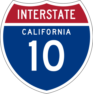
Interstate 10 (I-10) is a transcontinental Interstate Highway in the United States, stretching from Santa Monica, California to Jacksonville, Florida. The segment of I-10 in California runs east from Santa Monica through Los Angeles, San Bernardino, and Palm Springs before crossing into the state of Arizona. In the Greater Los Angeles area, it is known as the Santa Monica Freeway and the San Bernardino Freeway, linked by a short concurrency on I-5 at the East Los Angeles Interchange. I-10 also has parts designated as the Rosa Parks Freeway and the Sonny Bono Memorial Freeway. Some parts were also formerly designated as the Christopher Columbus Transcontinental Highway. However, the California State Legislature removed this designation following the passage of a bill on August 31, 2022. I-10 is also known colloquially as "the 10" to Southern California residents .

Route 15, consisting of the contiguous segments of State Route 15 (SR 15) and Interstate 15 (I-15), is a major north–south state highway and Interstate Highway in the U.S. state of California, connecting San Bernardino, Riverside, and San Diego Counties. The route consists of the southernmost 289.24 miles (465.49 km) of I-15, which extends north through Nevada, Arizona, Utah, Idaho, and Montana to the Canada–US border. It is a major thoroughfare for traffic between San Diego and the Inland Empire, as well as between Southern California, Las Vegas, Nevada, and the Intermountain West.

California's transportation system is complex and dynamic. Although known for its car culture and extensive network of freeways and roads, the state also has a vast array of rail, sea, and air transport. Several subway, light rail, and commuter rail networks are found in many of the state's largest population centers. In addition, with the state's location on the West Coast of the United States, several important ports in California handle freight shipments from the Pacific Rim and beyond. A number of airports are also spread out across the state, ranging from small general aviation airports to large international hubs like Los Angeles International Airport and San Francisco International Airport.
Interstate 5 (I-5) is a major north–south route of the Interstate Highway System in the United States, stretching from the Mexican border at the San Ysidro crossing to the Canadian border near Blaine, Washington. The segment of I-5 in California runs 796.77 miles (1,282.28 km) across the length of the state from San Ysidro to the Oregon state line south of the Medford-Ashland metropolitan area. It is the longest interstate in California, and accounts for more than half of I-5's total length.

Greater Los Angeles has a complex multimodal transportation infrastructure, which serves as a regional, national and international hub for passenger and freight traffic. The transportation system of Greater Los Angeles includes the United States' largest port complex, seven commuter rail lines, Amtrak service, a subway system within the city of Los Angeles, and numerous highways. Los Angeles is integrated into the Interstate Highway System by Interstate 5, Interstate 10, and Interstate 15, along with numerous auxiliary highways and state routes. Bus service is also included locally within the area by numerous local government agencies. Subways and light commuter rail lines are present within Los Angeles proper, allowing mass transportation within the city. Commuter railroads are run by Metrolink. Amtrak has numerous railroad lines that connect Los Angeles to the rest of the country.
Transportation in San Diego–Tijuana occurs by various means. Though, in the four cities of San Diego, Tijuana, Tecate, and Rosarito Beach, the automobile serves as most important means of transportation. The international metropolitan region maintains an intricate highway infrastructure. As a large metropolitan area in Western North America, many roadways, including Interstates, State Routes, and Mexican Federal Highways, hold a terminus in the area. These roads have grown accustomed to support the masses of the commuting populace within the international region and are constantly being expanded and/or renovated. Transportation is a crucial issue in the metropolitan area. The streets and highways of the region affect environmental health and have influence over the degree of regional connectivity. Binational discussions about coordinating public transportation across the border are currently underway. San Diego–Tijuana is the site of two major international airports and numerous regional airports. It is also the site of the Port of San Diego and miles from the nearby Port of Ensenada.
References
- ↑ "2012 Named Freeways, Highways, Structures and Other Appurtenances in California" (PDF). California Department of Transportation. Retrieved 28 April 2013.
If an internal link led you here, you may wish to change the link to point directly to the intended article.