Related Research Articles
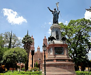
Dolores Hidalgo is the name of a city and the surrounding municipality in the north-central part of the Mexican state of Guanajuato.
Coatepec Harinas is one of 125 municipalities in the State of Mexico, Mexico. The municipal seat is the town of Coatepec Harinas. The original name is "Coauhtepetl" which means 'serpent hill' in Náhuatl. Around 1825 because of a boom in flour production, the name "Harinas" was added.

Atoyac Municipality is a municipality in the Mexican state of Jalisco. The administrative centre for the municipality is located in the town of Atoyac, Jalisco.
Acámbaro is a city and municipality in the southeastern corner of the Mexican state of Guanajuato, on the banks of the Lerma River, and the oldest of the 46 municipalities of Guanajuato. Acámbaro was originally a Purépecha settlement which was invaded by the Spanish, and their Otomi allies, in 1526. Acámbaro is noted as a major railway junction, a local transport hub, and the origin of the nationally famous Acámbaro bread. The 2005 census population of the municipality was 101,762, and that of the city proper 55,082. The municipality covers an area of 877.8 km2 and includes many small outlying communities, the largest of which are Iramuco and Parácuaro.

Magdalena de Kino is a city, part of the surrounding municipality of the same name, located in the Mexican state of Sonora covering approximately 560 square miles. According to the 2005 census, the city's population was 23,101, and the municipality's was 25,500. Magdalena de Kino is in the northern section of Sonora 50 miles from the Mexico-U.S. border. To the north the municipality abuts Nogales; to the south, the municipality of Santa Ana; to the east, Ímuris and Cucurpe; and to the west, the municipalities of Tubutama and Sáric. Its main sectors include San Ignacio, San Isidro, Tacicuri, and Sásabe. The city was named after the pioneer Roman Catholic missionary and explorer, Father Eusebio Francisco Kino, who worked in the area, as well as in the present-day US state of Arizona.
Imuris is the municipal seat of Imuris Municipality in the north of the Mexican state of Sonora.
Tarimoro is the municipal seat of the municipality of Tarimoro in the Mexican state of Guanajuato.

San Luis de la Paz is a city, and the surrounding municipality of the same name, located in the northeastern part of the state of Guanajuato in Mexico. San Luis de la Paz was founded on August 25, 1552, as a defensive town on the Spanish Silver Road, which linked the Zacatecas mines with Mexico City during the Spanish domination. It owes its name to the peace treaty between Otomi Indians, who were Spaniard allies, and the native Chichimecas, on the day of Saint Louis of France, August 25. San Luis de la Paz is also known as the Chichimeca Nation.

Tarandacuao is a Mexican city located in the lowlands of the state of Guanajuato. The municipality has an area of 117.39 square kilometres, and is bordered to the north and east by Jerécuaro, to the south by the state of Michoacán, and to the west by Acámbaro. The municipality had 11,583 inhabitants according to the 2005 census. Outlying communities found in Tarandacuao include La Purísima, San Juan De Dios, San José de Hidalgo, San Antonio, El Tocuz, San felipe and La Virgen.
Ocampo is a city located in the northwest region of the Mexican state of Guanajuato. The municipality has an area of 1,019.49 square kilometres and is bordered and to the south and east by San Felipe, to the north by the state of San Luis Potosí, to the west by the state of Jalisco. The municipality had a population of 23,500 inhabitants according to the 2010 census.
San José Iturbide is a Mexican city located in the Northeast region of the state of Guanajuato, within the Sierra Gorda range. It is named in honor of Saint Joseph and the first Emperor of Mexico, Agustín de Iturbide. The municipality has an area of 534.11 square kilometres and is bordered to the north by San Luis de la Paz and Doctor Mora, to the east by Tierra Blanca, to the south by the state of Querétaro, and to the west by San Miguel de Allende. The municipality had a population of 54,661 inhabitants according to the 2005 census.

Carbó is the municipal seat of Carbó Municipality of the state of Sonora, Mexico.
Granados is the municipal seat of Granados Municipality in the northeast of the Mexican state of Sonora. The municipal area is 361.27 km2, and the population was 1,228 according to the 2000 census. By 2005 the population had decreased to 938 due to emigration due to insufficient educational infrastructure and the lack of job opportunities.

Atlacomulco is one of 125 municipalities in the State of Mexico located in the northwest of the State of Mexico in central Mexico, 63 kilometres (39 mi) from the state capital of Toluca. The municipal seat is the city of Atlacomulco de Fabela. The name is derived from the Nahuatl phrase "atlacomulli" which means "where there are wells." The city, with a population of 109,384 is surrounded by rural area in which 75% of the rest of the municipality lives. The municipality has a sizable percentage of indigenous language speakers, mostly Mazahua. The Mazahua name for the area is Embaró, which means "colored rock." Agriculture is still the main economic activity, but the development of a number of industrial parks, such as Atlacomulco 2000, which allowed the seat to reach city statues by 1987. Atlacomulco is also the origin of a political organization called the "Atlacomulco Group" made up of powerful political figures who deny its existence.
Aculco is a municipality located in the Atlacomulco Region of the State of Mexico in Mexico. The name comes from Nahuatl. The municipal seat is the town of Aculco de Espinoza, although both the town and municipality are commonly referred to as simply "San Jerónimo Aculco".
Temascaltepec de González is a city and seat of the municipality of Temascaltepec located in south of the State of Mexico in Mexico. It is 66 km (41 mi) southeast of Toluca and 140 km (87 mi), from Mexico City. Temascaltepec comes from the Náhuatl "temazcalli," which means "steam bath," and "tepetl," which means "hill." The Matlatzincas named the area "Cocalostoc," which means 'cave of crows'.

Atotonilco El Alto is a town and municipality, in Jalisco in Los Altos (Jalisco) region in central-western Mexico. The municipality covers an area of 510.9 km2.

Chiconquiaco is a municipality in the Mexican state of Veracruz. It is located in the Sierra de Chiconquiaco in the middle of the State of Veracruz. It has a surface of 68.27 km2. It is located at 19°45′N96°49′W.
Quimixtlán Municipality is a municipality in the Mexican state of Puebla in south-eastern Mexico.
Zongozotla Municipality is a municipality in the Mexican state of Puebla in south-eastern Mexico.
References
- ↑ San Francisco Oxtotilpan at GEOnet Names Server
- ↑ "NORMAL CLIMATOLÓGICA 1991-2020" (TXT). Servicio Meteorológico Nacional. Archived from the original on 1 January 2025. Retrieved 1 January 2025.
- ↑ "VALORES EXTREMOS" (TXT). Servicio Meteorológico Nacional. Archived from the original on 1 January 2025. Retrieved 1 January 2025.
19°10′07″N99°54′09″W / 19.16861°N 99.90250°W
| | This article about a location in the state of Mexico is a stub. You can help Wikipedia by expanding it. |