San Juan Opico

Last updated
San Juan Opico
Municipality
Iglesia Parroquial San Juan Evangelista, San Juan Opico, El Salvador. Fachada.jpg
San Juan Evangelista Parochial Church
El Salvador location map.svg
Red pog.svg
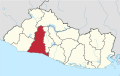
San Juan Opico
Location in El Salvador
Coordinates: 13°53′N89°21′W / 13.883°N 89.350°W / 13.883; -89.350
Country El Salvador
Department La Libertad
Area
  Total84 sq mi (218 km2)
Elevation
1,614 ft (492 m)
Population
 (2007)
  Total74,280

San Juan Opico (or Opico) is a municipality in the La Libertad department of El Salvador.

Contents

It is located 42 kilometers from San Salvador, capital of the republic. The municipality has an area of 218 km² and a population of 74,280 inhabitants; according to the 2007 census it is ranked No. 13 in population.

Within its territory are pre-Columbian archaeological sites like Joya de Cerén and San Andrés and a church built in the colonial era.

History

Opico was established as an Indian village in 1572 and received the title of town in 1881.

Administrative divisions

It has 27 cantons: San Jose la Cueva, Talcualuya, El Castillo, Buena Vista, Nombre de Dios, San Antonio, San Pedro Martir, Tehuicho, Barranca Honda, Los Amates, Pitichorro, Nueva Encarnación, Chantusnene, San Nicolás Encarnación, Minas de Plomo, San Pedro Oriente, San Felipe, Los Encuentros, Agua Escondida, Lomas de Santiago, Joya de Ceren, Sitio del Niño, Chanmico, Matazano, Sitio Grande, El Jabali, Las Delicias, and Las Granadillas.

Sports

The local football club is named Juventud Independiente and it played in the Salvadoran Premier Division after being promoted in Summer 2011. Now they play in the second division. They play their home games at the Complejo Municipal.

Related Research Articles

<span class="mw-page-title-main">Acajete Municipality, Veracruz</span> Municipality in Veracruz, Mexico

Acajete Municipality is a municipality located in the central zone in the Mexican state of Veracruz, about 20 km from state capital Xalapa. It has a surface of 90.48 km2. It is located at 19°58′N97°00′W. In the middle of 1586 this village was formed, on one of the adjoining old men of Tlacolulan's dominion. The decree N ° 64 of November 3, 1893, extinguished the municipality of La Hoya, annexing its territory to San Salvador Acajete. On November 5, 1932, the municipal head-board San Salvador Acajete changes the name to Acajete.

<span class="mw-page-title-main">La Libertad Department (El Salvador)</span> Department of El Salvador

La Libertad is one of the departments of El Salvador and is located in the southwest of the country. The capital is Santa Tecla. It has an area 1,653 km² and a population of more than 747,600 people.

<span class="mw-page-title-main">San Pedro del Pinatar</span> Municipality in Murcia, Spain

San Pedro del Pinatar is a small town and municipality in the Region of Murcia, southeastern Spain. The municipality is situated at the northern end of Murcia's Mediterranean coastline, the Costa Cálida, and borders the province of Alicante. It has an area of almost 22 km2, and a population of 25,167 as of 2018.

<span class="mw-page-title-main">Joya de Cerén</span>

Joya de Cerén is an archaeological site in La Libertad Department, El Salvador, featuring a pre-Columbian Maya farming village. The ancient Maya site of Joya de Cerén is located in the Zapotitán Valley, 36 kilometers northwest of San Salvador, El Salvador. It is often referred to as the "Pompeii of the Americas", in comparison to the famed Ancient Roman ruins.

<span class="mw-page-title-main">San Rafael Obrajuelo</span> Municipality of El Salvador in La Paz

San Rafael Obrajuelo is a municipality in the department of La Paz, El Salvador. As of 2017 it was estimated to have a population of 11,403.

<span class="mw-page-title-main">Nuevo Cuscatlán</span> Municipality in La Libertad, El Salvador

Nuevo Cuscatlán is a municipality of El Salvador, belonging to the department of La Libertad, it is located 13 kilometers from San Salvador. It borders to the north and east with Antiguo Cuscatlán, to the south with Huizúcar and San José Villanueva and to the west with Santa Tecla.

<span class="mw-page-title-main">Concepción de Ataco</span> Municipality in Ahuachapán Department, El Salvador

Concepción de Ataco is a municipality and city within the Ahuachapán Department, El Salvador. It has an area of 61.03 km ² and a population of 18,101 inhabitants.

<span class="mw-page-title-main">Santa Tecla, El Salvador</span> Place in La Libertad Department, El Salvador

Santa Tecla is a city in the La Libertad department of El Salvador. It is the capital of the department of La Libertad.

<span class="mw-page-title-main">Ciudad Nicolás Romero</span> City and municipality in State of Mexico, Mexico

Ciudad Nicolás Romero is the largest city and municipal seat of the municipality of Nicolás Romero in State of Mexico, Mexico. It is located 58 km from the city of Toluca, the state capital and lies in the north-central part of the state, just northwest of the Federal District. The seat/municipality's current name is to honor Nicolás Romero, who fought for Benito Juárez during the Reform War and the French intervention in Mexico. He was executed there by the French. The town adopted this name in 1898. The area was settled by the Otomi and named Azcapotzaltongo by the Aztecs after conquering it. During colonial times, it was known as San Pedro Azcapotzaltongo. It was then called Monte Bajo from 1821 to 1898, when the current name was adopted. Both the municipality and city are commonly referred to as Nicolás Romero.

<span class="mw-page-title-main">San Juan Bautista Tuxtepec</span> Municipality and city in Oaxaca, Mexico

San Juan Bautista Tuxtepec, or simply referred to as Tuxtepec, is the head of the municipality by the same name and is the second most populous city of the Mexican state of Oaxaca. It is part of the Tuxtepec District of the Papaloapan Region. As of the 2020 census, the city is home to a population of 103,609 and 159,452 in the municipality, though census data are often under reported for various reasons.

<span class="mw-page-title-main">Encarnación de Díaz</span> Municipality and town in Jalisco, Mexico

Encarnación de Díaz is a town and municipality located in the far northeast of the state of Jalisco in north-central Mexico. It is located in a natural pass that connects the Los Altos region of Jalisco to points north, and from pre-Hispanic times until the 20th century, it was a major thoroughfare for north-south travel. The town began as a way station along a road built through this pass in the 17th century, formally becoming a town in 1760. It began to function as a municipality in the latter 19th century, but this status was not confirmed until the early 20th. Transport, along with numerous prosperous haciendas supported the economy of the area until the early 20th century, when travel patterns and the Mexican Revolution spurred its decline. In the 1920s, it was a centre of rebellion during the Cristero War, and the town contains Mexico's only museum exclusively dedicated to this episode in history. It also contains a museum dedicated to various naturally occurring mummies which have been found in the municipal cemetery.

<span class="mw-page-title-main">Salvadorans</span> Citizens or residents of El Salvador

Salvadorans, also known as Salvadorians, are citizens of El Salvador, a country in Central America. Most Salvadorans live in El Salvador, although there is also a significant Salvadoran diaspora, particularly in the United States, with smaller communities in other countries around the world.

<span class="mw-page-title-main">Tlaxiaco</span> City in Oaxaca, Mexico

Tlaxiaco is a city, and its surrounding municipality of the same name, in the Mexican state of Oaxaca. It is located in the Tlaxiaco District in the south of the Mixteca Region, with a population of about 17,450.

El Carrizal is a municipality located in the department of Chalatenango in the North of El Salvador.

Club Deportivo Juventud Independiente, also commonly known as Juventud Independiente, is a professional Salvadoran football club, based in San Juan Opico, La Libertad, El Salvador. Founded on 7 September 1943, holding home matches at Complejo Municipal. The one time primera division side enjoyed its greatest successes in the 2010s, but following financial troubles and selling their spot to Luis Ángel Firpo, the club currently plays in the 4th division, Tercera División.

<span class="mw-page-title-main">Santiago Papasquiaro Municipality</span> Municipality in the Mexican state of Durango

Santiago Papasquiaro is a municipality in the Mexican state of Durango. The municipal seat lies at Santiago Papasquiaro. The municipality covers an area of 7,238.4 km². Santiago Papasquiaro municipality is at an average height of 1,730 m (5,675 ft) over the sea level. The municipality lies east of Sierra Madre Occidental Mountain Range. It neighbors with other municipalities: Canelas and Tepehuanes municipalities at the north; San Dimas and Otáez, south; Nuevo Ideal to the east, Tamazula to the west and El Oro located northeast.

<span class="mw-page-title-main">Tourism in El Salvador</span>

Tourism accounts for a large part of El Salvador's economy. El Salvador has many natural attractions including beaches with some of the best surfing breaks on the Pacific Coast. El Salvador offers many lush forests shrouded in cool temperatures with abundant wildlife and scenic mountain-top vistas. El Salvador also has great potential in the field of cultural tourism; with over 2,000 known archaeological sites, mostly of the Maya and Olmec cultures. These sites are of international interest for their easy access and well-preserved remains.

Brenda Damaris Cerén Delgado is a Salvadoran professional footballer who plays as a forward for Mexican Liga MX Femenil club Atlas and the El Salvador women's national team.

<span class="mw-page-title-main">Kanasín</span> City in Yucatán, Mexico

Kanasín is a city in the Mexican state of Yucatán and the municipal seat of the municipality of the same name. It is located in the northwestern region of the state, forming part of the Mérida metropolitan area. According to the 2020 census carried out by the National Institute of Statistics and Geography (INEGI), it had a population of 139,753, making it the second largest Yucatecan city after Mérida, the 8th most populous in southeastern Mexico and the 101st most populous in the country.